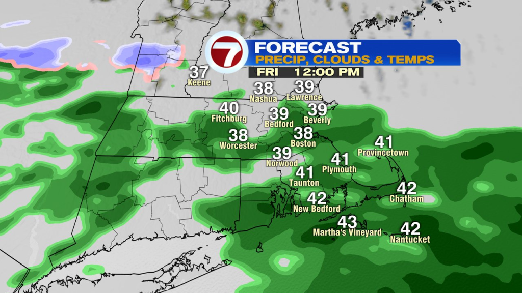
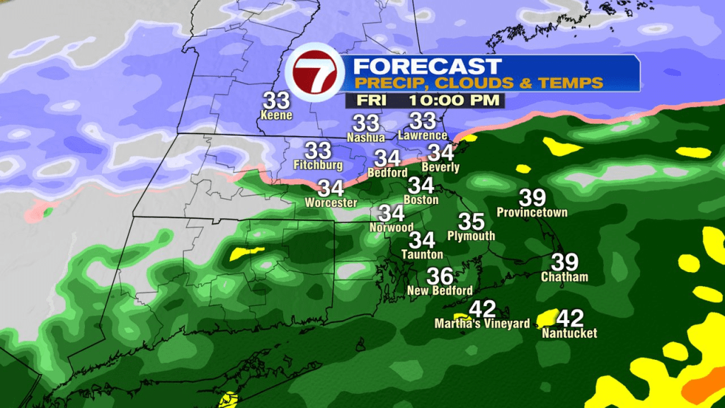
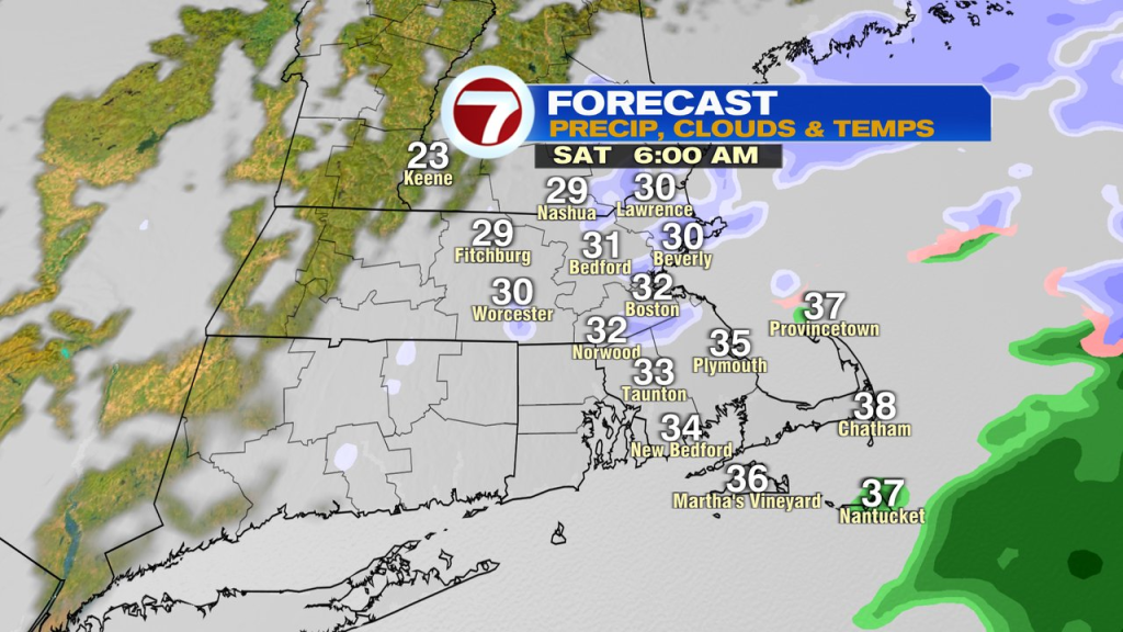
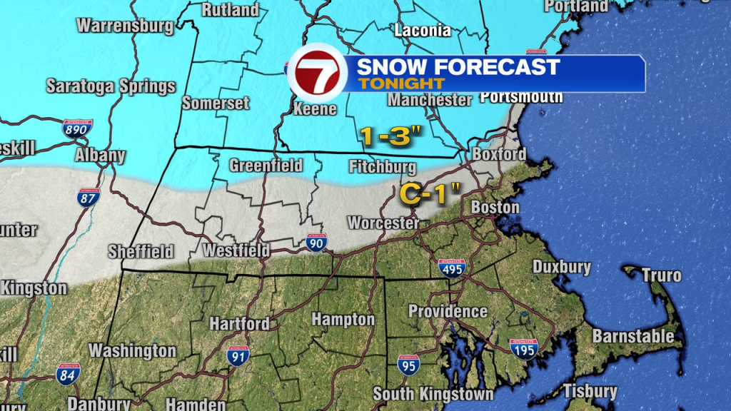
We’ll start today dry but by lunchtime, spotty showers start to break out as temps round into the upper 30s and low 40s. That rain will be a cold rain, and steady at times through the for the evening commute. As colder air works into the storm, it’ll change to some wet snow across northern Mass and southern NH this evening and likely snow for at least a few hours. That’s where the best shot of 1-3″ of snow is. Even closer to the Pike, some wet snow may throw down some slushy coatings predawn tomorrow, allowing for slick spots as residual moisture freezes with temps slipping below freezing.
Temps continue to slide during the day tomorrow as highs are in the low 30s early morning, slip into the 20s by the afternoon and quickly drop into the teens during the evening.

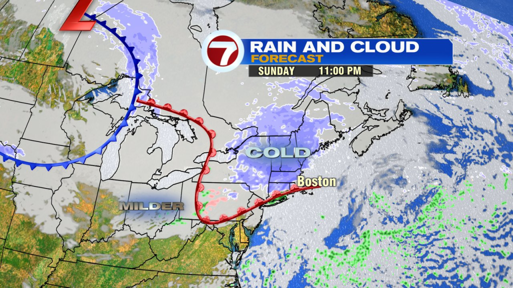
Overnight lows tomorrow night plunge into the single digits for many, allowing for a frigid Sunday start. Temps warm into the 20s Sunday afternoon and into the 30s during the evening. Snow breaks out in the evening too, with the best shot of another coating-2″ north of the Pike.
It’ll be milder on Monday, back into the 40s and dry.