

Editor Note: Tonight’s blog is written by 7Weather intern Owen Vetree ~JR
Good afternoon, welcome to today’s blog. It has been a mostly cloudy and relatively cool day. Some spots picked up rain early in the day, but most of the area is just starting to really see the rain as I write this.
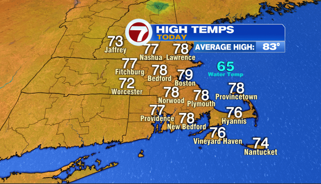
Everyone came in below 80 today, a few degrees below the average high of 83. Up to this point we have been seeing that average high tick upwards every couple of days but we have reached the peak. Next time we see that change, it will be going down rather than up.
Before we get there, we have got some rain that needs to be dealt with today and tomorrow.
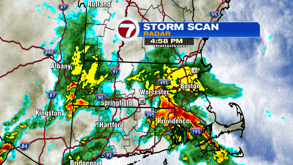
Here is how it looked around 5pm Tuesday. A very large portion of the area is experiencing rain with the heaviest being in Rhode Island and down toward the Buzzard’s bay area. Some spots in Northern Rhode Island have already seen over 2 inches of rain with this event.
This rain is expected to continue into the early part of the night as it becomes less and less widespread. The rain will exit from west to east.
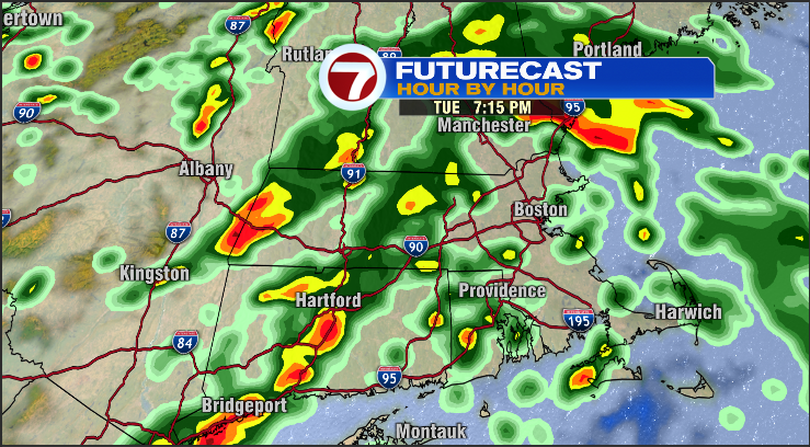
The area of widespread moderate to heavy rain that is currently encompassing our area will have lifted off to the north and east by around 7pm Tuesday. However, rain will continue although it may be more off and on rather than steady.
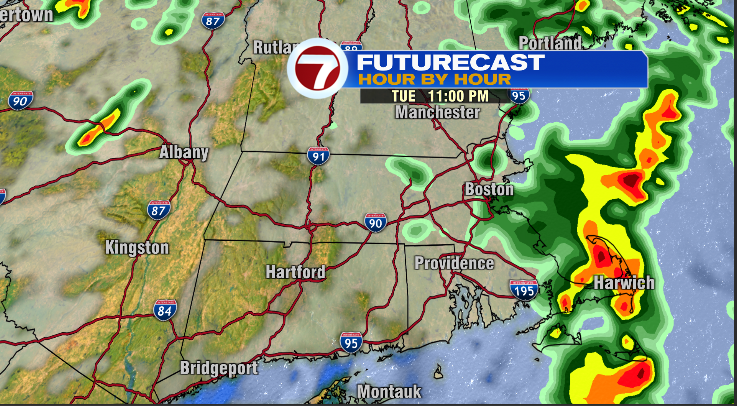
By 11pm the heavy rain will be confined to the Cape and Islands with lighter rain continuing near and east of I-95. Some patchy drizzle is possible west of this area as well but the bulk of the precipitation will have ended.
Any areas of steady rainfall are expected to exit the coast completely by midnight.
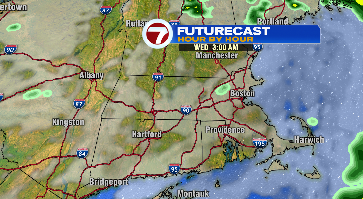
After midnight the skies will remain mostly cloudy to overcast with pockets of mist and fog possible. The clouds will start the break around sunrise tomorrow morning.
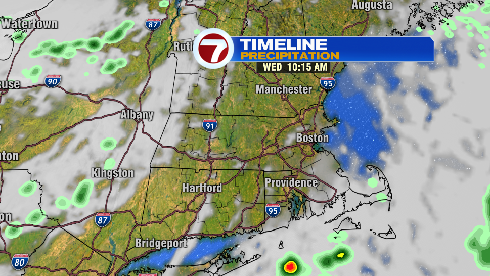
Clouds will give way to mostly sunny skies late tomorrow morning with the exception being the far southeastern locations. Isolated showers and clouds will persist until the early afternoon.
Tomorrow will be a nice summer day for most. There is a slight chance for a couple of isolated thunderstorms to move across the area between 3 and 7 in the afternoon. Most people won’t see them. Even if you do get one, you might get 20 minutes of hard rain before being able to resume any outdoor activities. It might be a good idea to keep an eye on the radar to see if anything might be heading your way.
The rest of the week is looking splendid.
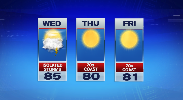
Highs around 80, low humidity, and a light sea breeze will make both Thursday and Friday near perfect summer days.
This beautiful weather will continue into the weekend!
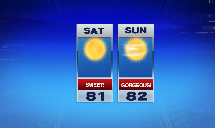
We may add a few clouds towards Sunday, regardless the next 5 days including the weekend are looking very nice.
Stay dry tonight, and I’ll see you tomorrow afternoon.
~Owen