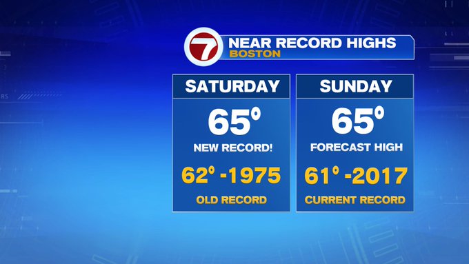
This morning, a much different feel than the past couple of days. By 10am, temperatures from Bedford to Norwood to Boston were already at 60°. As of 11am, we had broken the old record high of 62 in Boston.
Looking ahead to your Saturday afternoon, we’ll see highs into the upper 50s to mid 60s under some filtered sunshine.
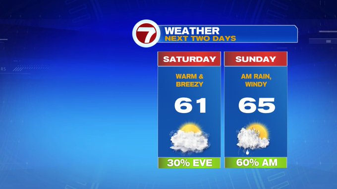
Tonight, we’re in for a mild night as lows only slip into the upper 40s to mid 50s! It will certainly feel like a spring-like pattern, today, tonight and tomorrow. It will be cloudy overnight with some patchy fog and a few showers.
The showers become more widespread early Sunday morning, with a few rumble of thunders and some gusty winds possible just ahead of daybreak. By midday – we’ll see emerging sunshine moving in from west to east, as the clouds swiftly exit. Highs Sunday afternoon will be slightly warmer than today, well into the upper 60s for most spots.


To kick off the next work week, highs will be in the 40s for highs Monday and Tuesday (which is still above average for this time of the year). Around 50 by Wednesday, before temperatures take a tumble by the end of the week.
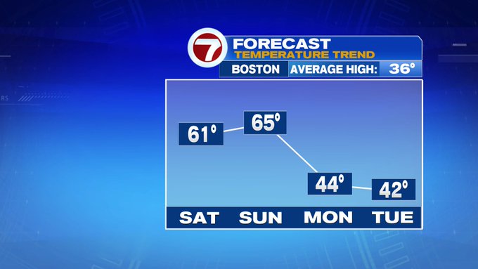
After the morning rumbles and showers Sunday, the next chance for showers will be Tuesday night, as well as Thursday morning, otherwise drier conditions prevail the rest of the week.
Highs on Friday will be around the freezing mark and it will be breezy under mostly sunny skies.
