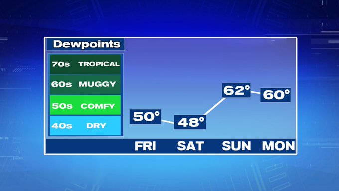
The tropical dewpoints we felt yesterday and earlier this morning are continuing to be pushed out by a cold front that will be ushering in much more comfortable conditions for the end of the week and into the weekend.
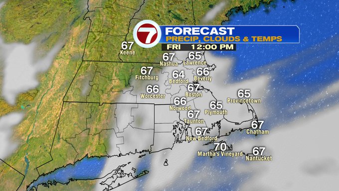
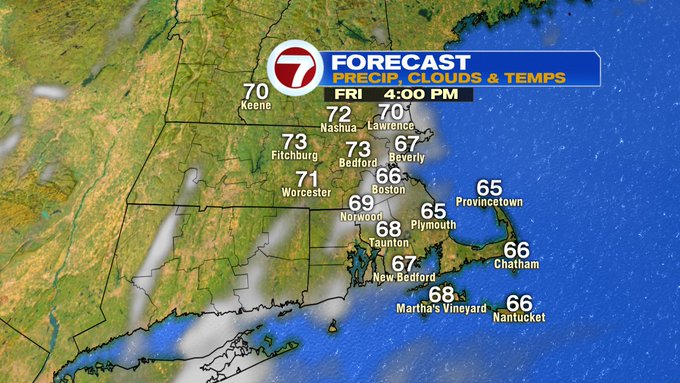
This afternoon, we’ll see a break in the cloud cover, with mainly sunny skies by mid-afternoon.
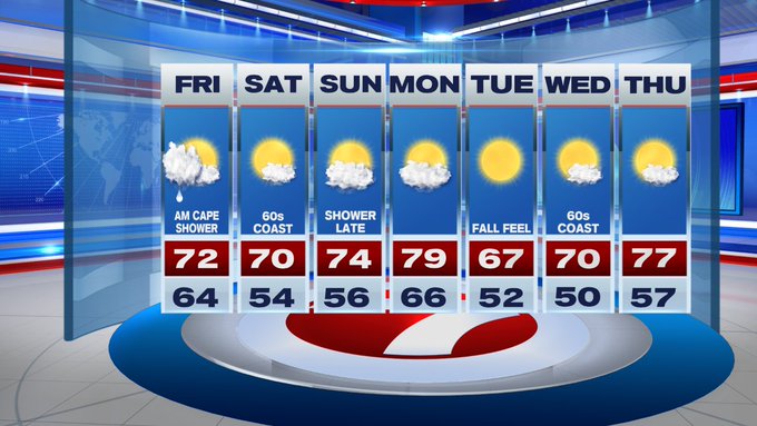
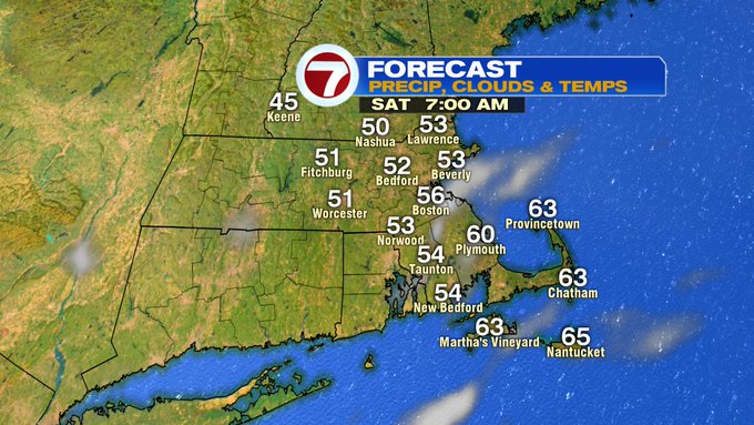
With that lower humidity and more sunshine, today will certainly have that fall feel by late day and especially tonight when low temperatures dive into the low to mid 50s under mainly clear skies. A few locations could even slip into the upper 40s in southern NH.
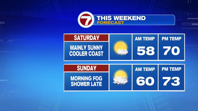
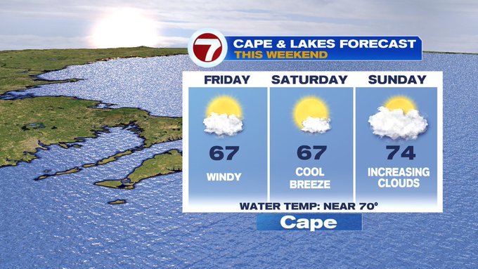
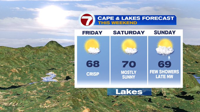
Saturday brings highs around 70 with slightly cooler conditions at the coast due to an easterly breeze.
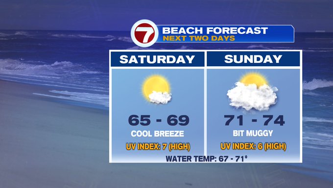
Planning on going to the beach this weekend? We’re tracking dry conditions both weekend days with more clouds and bit more muggy on Sunday.
Showers along a front to our west should hold off until late Sunday night.
Temperatures climb to near 80 Monday, then they fall back to a fall feel on Tuesday and Wednesday with highs in the upper 60s to around 70 midweek.