
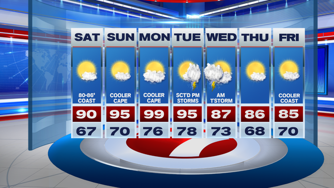
Today is one of the cooler days over the next several as the 90+ heat returns to southern New England through Tuesday.
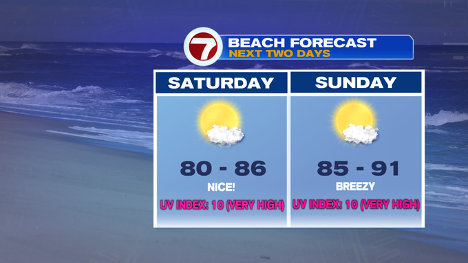
For your Saturday, we’re tracking highs around 90 inland, mid 80s at the coast due to an onshore breeze that develops by midday.

Sunday will likely be the 1st day of the heat wave for Boston, the 2nd for areas like Bedford and Norwood with highs stretching into the low to mid 90s. The exception will be for the South Coast and the Cape and Islands due to a southwesterly breeze off of the cooler ocean waters which will keep temperatures into the 80s.

Monday is the peak of the heat with near triple digit highs! The Cape will likely be in the mid to upper 80s on Monday, too.

Tuesday is yet another day in the 90s, likely making it an official heat wave for Boston, while quite a few spots will have reached into the 90s for the 4th day.
Relief is on the way as a cold front swings in Tuesday late afternoon/evening, which could produce some thunderstorms. Some of these storms could be on the strong side depending on the timing.
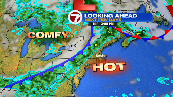
Also, dependent on the timing of the front, a few storms could linger into early Wednesday before clearing out and ushering in a much more comfortable airmass with highs on Wednesday into the mid to upper 80s.
We settle into the 80s through the rest of the week.
TROPICS UPDATE: You may have been hearing about three storms over the last few days catching some buzz. The first, being Tropical Storm Gonzalo, which is expected to skim the southern Windward Islands today and tonight with tropical storm conditions before it weakens to a tropical depression through the end of the weekend.

Hurricane Hanna, our first official hurricane of the 2020 Atlantic Hurricane Season, reached Category 1 status at the 8AM update on Saturday morning according to the NOAA Hurricane Hunter flyover through the storm. Hanna is expected to make landfall later today along the southern Gulf Coast of Texas, just south of Corpus Christi, bringing strong winds and flooding to the area.

Another hurricane to talk about is Hurricane Douglas in the central Pacific by the Hawaiian Islands. It is currently a Category 2 storm, but is expected to weaken to a Category 1 storm as it makes a near pass by the Islands, bringing with it damaging winds, flooding rain, and dangerous surf through the weekend.
