

We kick off this Friday morning with spotty light showers early, only to see some heavier showers zip through mid to late morning (8am-10am).
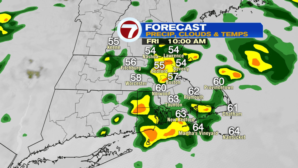
A few spotty showers linger into early this afternoon, then we’ll catch dry breaks mid to late afternoon, 2-6pm, as temps jump to near or just shy of 70 and humidity surges.
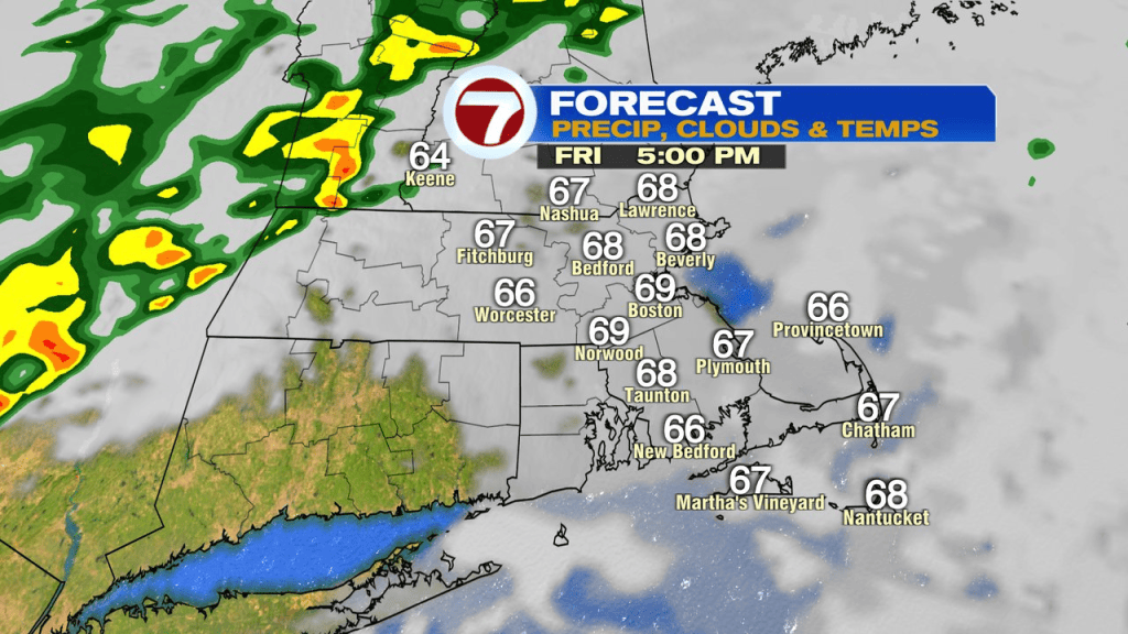
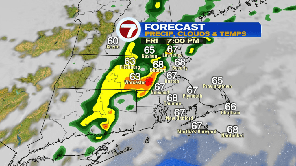
Gusty winds develop too, pushing 30-35mph. Early this evening (6-9pm), another round of showers and storms move through with localized strong winds and embedded downpours. Bottom line… we’re in and out of the wet weather, so keep the rain gear handy.
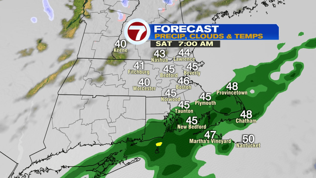
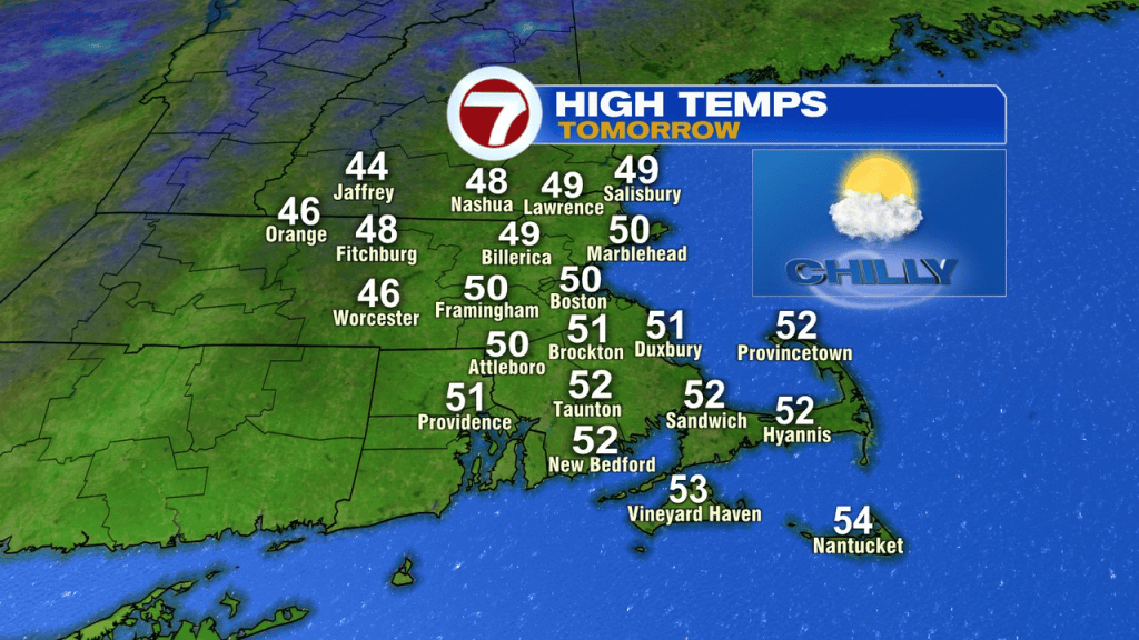
Showers linger through tonight across Southeast Mass, into tomorrow morning as chillier air comes back in. By midday, into the afternoon tomorrow, clouds decrease, allowing for brighter skies to prevail. It’ll take the longest to se the sun across Southeast Mass, while northwest of Boston, will see it pretty early in the day. A chilly breeze runs through the day, gusting 25-30mph with temps running in the mid 40s to low 50s.
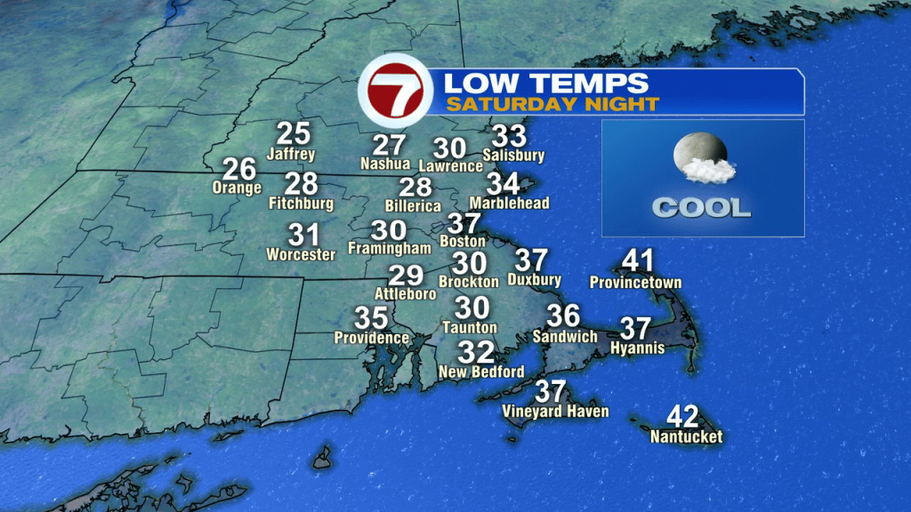
As skies remain clear and winds diminish tomorrow night, temps tumble. It’ll be quite chilly Sunday morning with many locations outside of Boston, near or below freezing.
Sunday afternoon looks good. Light winds, mid 50s and a decent deal of sunshine.