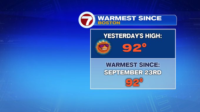
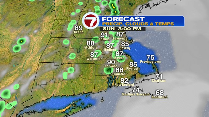
Yesterday, Boston reached over 90° making it the first 90-degree day of 2020, with Lawrence getting it’s first heat wave of 2020 after it’s 3rd day in a row of 90+ degree heat! Looks like a few locations today will stretch into the 90s again today.

For your outdoor plans for Father’s Day, don’t forget the sunglasses, the sunscreen and to stay hydrated as we’re tracking another day filled with heat and humidity.

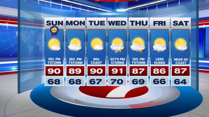
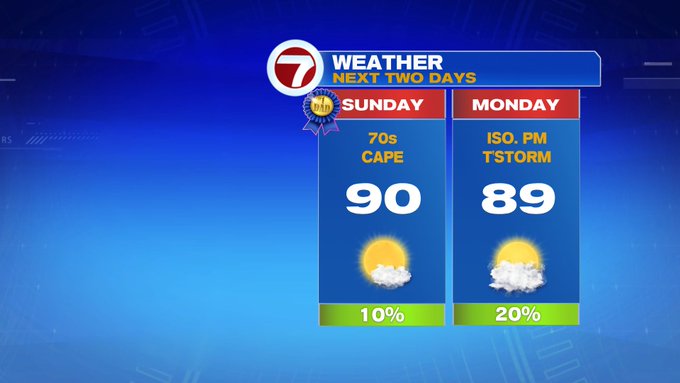
Highs today will be in the around 90° for the Merrimack Valley, upper 80s for Boston, mid to upper 80s along the immediate coastline, 70s for the Cape and Islands.
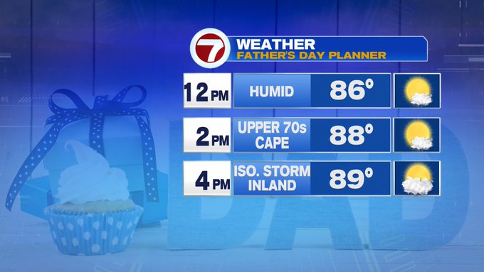
A spot thundershower is possible between 3pm and 6pm, mainly inland, so just be weather aware.

Tonight, another night with not much relief from the heat and humidity, with lows into the 60s.
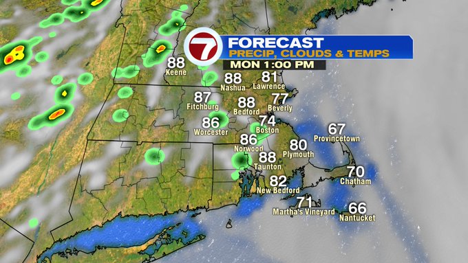
Tomorrow, a spot thundershower is possible in the afternoon, otherwise partly cloudy and still hot and humid with highs in the mid to upper 80s, 70s for the Cape/Islands.
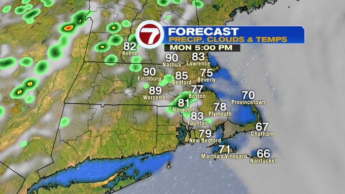
Tuesday and Wednesday surge into the low 90s especially for the Merrimack Valley, southern NH, and portions of central MA. A sweeping cold front Wednesday afternoon will bring scattered thunderstorms. A few lingering showers and storms expected Thursday, but the second half of the week brings relief from the heat and humidity. Highs on Thursday and Friday will be into the mid to upper 80s…still above normal, but at least we’re not talking about the heat AND humidity.
Drier conditions prevail for Friday and Saturday, and paired with less humid conditions, it looks like it will be a great start into the last weekend of June.