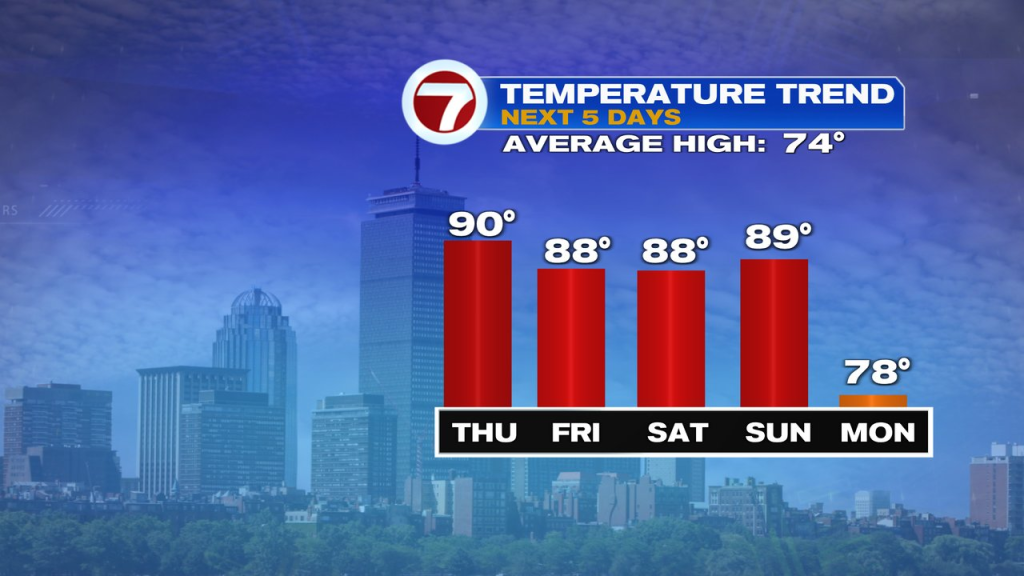
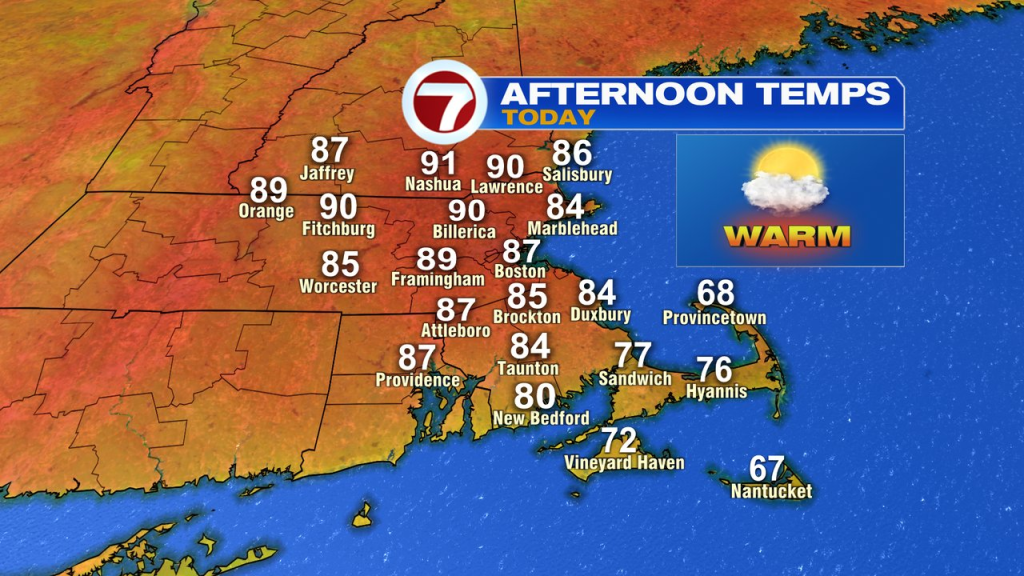
After another beauty of a day yesterday, we start today with a fantastic feel to the air as low humidity and comfortable temps kick off this Wednesday morning. As the day wears on, dew points do rise, so we’ll notice an increase in humidity. In addition, more clouds mix in with the sunshine this afternoon as a few isolated showers/storm are possible near day’s end into the evening. Activity, looks limited, so not all of us will see rain.
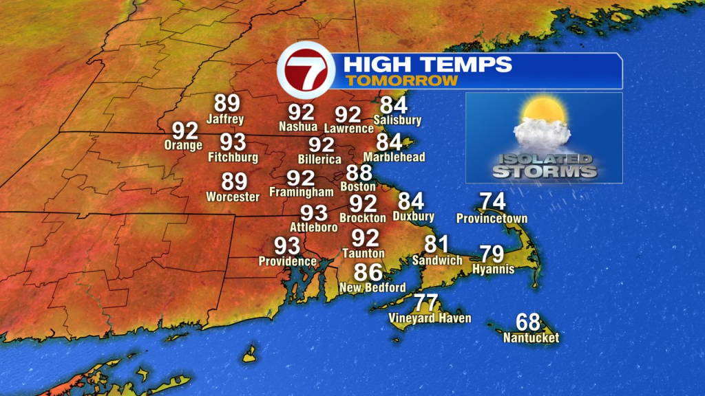
With humidity rising, it won’t be as cool tonight and some patches of fog and low clouds start early tomorrow. That’ll break for some sun by mid morning and as the sunshine gets to work, temps jump up into the low to mid 90s inland. At the coast, we’ll reach well into the 80s before the sea breeze kicks back temps a bit. A few isolated to scattered storms fire in the afternoon.
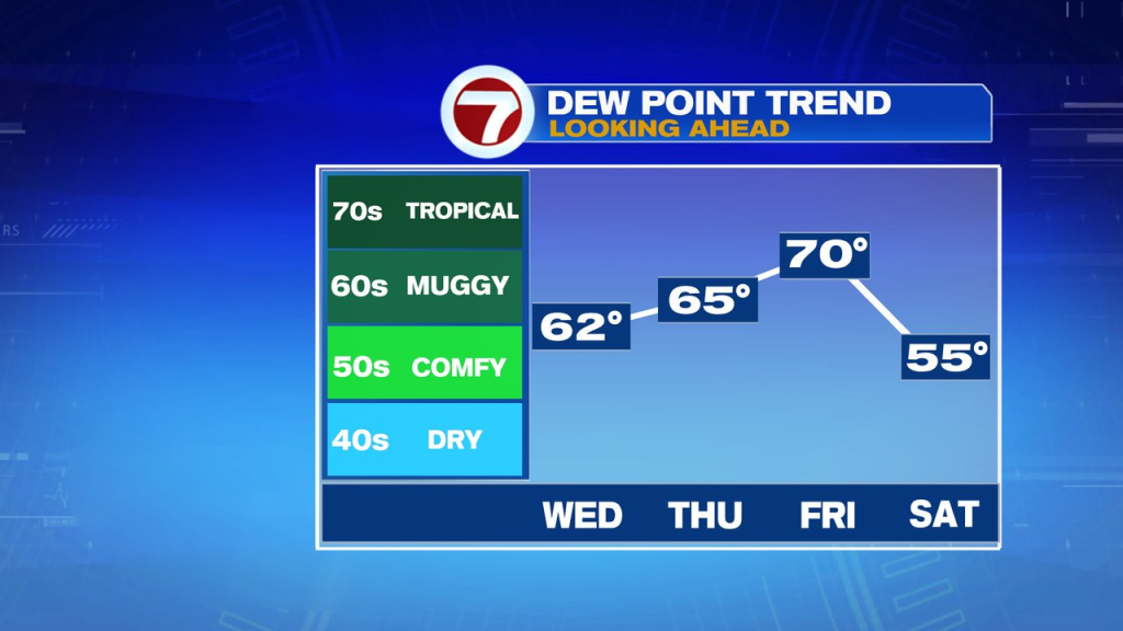
Friday is another hot one inland. At the coast, the east wind kicks in earlier and will be a bit stronger. That’ll push farther inland during the afternoon, cooling off many along the I-95 corridor. In addition, that sea breeze front will help kick off a few scattered storms. As dew points near 70, it’ll be quite humid.
Overall, the weekend looks good with just a few spotty showers early on Saturday morning across eastern Mass. Humidity won’t be as high Saturday across the interior and much of Saturday and Sunday turn out to be warm and rain free. Highs head for the mid 80s to low 90s. Sunday night will bring in a few more scattered showers and storms.