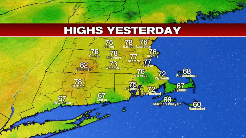
Better late than never, I guess. As sunshine finally broke out yesterday afternoon, temps jumped into the mid to upper 70s in the afternoon, allowing for a beauty of a finish to an otherwise cool and dreary long weekend. While the lawns and gardens would approve of the weekend weather, I think the rest of us wish we could work on the timing of the rain.
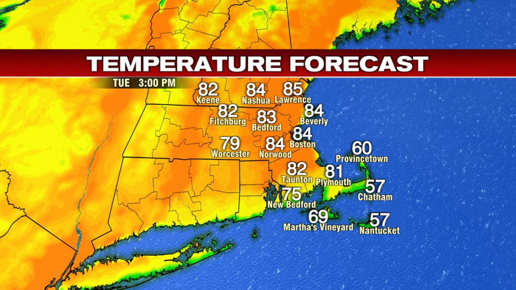
Figures, we’re back to school, back to work and now back to a beauty of a summery day. A cool and comfortable start features sunshine that’ll warm us up quickly. In fact, this afternoon, many of us away from the South Coast will reach the low to mid 80s. Dew points stay near 50, so it’ll be a dry warmth.
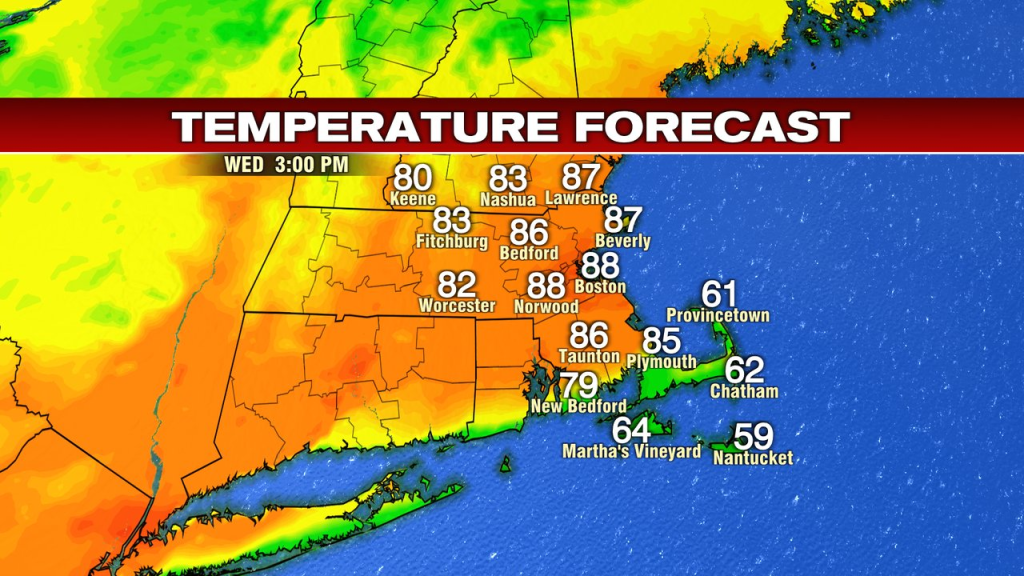
Tomorrow, it’ll be a bit warmer with a bit more humidity. Temps take a run into the mid to upper 80s. As a cold front drops in, a few isolated showers/storms are possible, but it looks limited in coverage area.
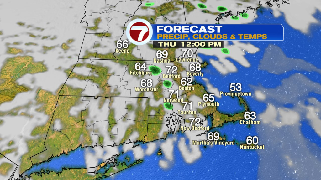
Behind the front, it’s cooler Thursday. Low 70s inland, 60s coast. With some very cold air aloft, a few spotty early to mid afternoon showers pop-up too, especially near and east of 495. They fade late afternoon/evening as the daytime heating is lost.
Friday is cool with sun to building clouds and just a spot shower.
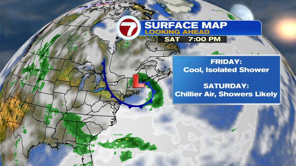
The weekend looks cool too and unsettled at times Saturday into Saturday night as an area of low pressure, with some very cold air aloft, drops in out of Canada. That’ll provide a couple batches of showers too during that time frame.