I hope everyone had a stress-free and enjoyable Thanksgiving with family and friends.
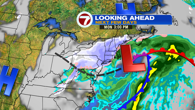
Now looking ahead to the end of the holiday weekend, it’s looking more and more likely for snow Sunday evening, with a messy wintry mix possible for Monday morning’s commute – which could make for some tricky travel in southern New England as everyone gets back into the swing of things.
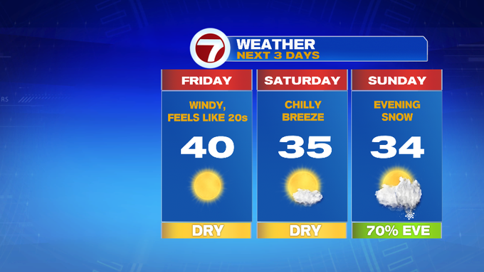
The good news is that we have two full days to prep ahead of this system. Today – sun-filled skies and a chilly northwest wind will make the feels like temperatures for most of the day in the 20s. While actual high temps will be near 40.
Saturday also features sunshine and a cold breeze. Wind chills in the morning will be i the teens before bouncing back into the upper 20s to low 30s. Actual high temperatures will reach the mid to upper 30s.

Sunday starts off dry as clouds thicken through late morning, then by mid-afternoon, the first snowflakes start falling in western MA, continuing to fill into Worcester Co. through the late afternoon / early evening.

As the system continues to evolve off south of the New England coastline, the rain/snow line will hover within the 495-corridor into Monday morning’s commute, making for a tricky drive for those heading back to work after an extended holiday weekend.

The snow will continue for the higher elevations and the interior, with plowable snow likely for Worcester Co. and interior southern NH.

There is still some uncertainty with this system so be sure to check back daily for updates on the air and on the weather blog.
