Temperatures on a bit of a roller coast ride as we ride to the end of 2020. Yesterday was a sunny, but cooler day (a great day to be outside I might add). Today is that upward climb of our roller coaster. A warm front has pushed through and already this morning temperatures are climbing before sunrise. Temperatures today will climb to the upper 40s for many — ten degrees above average!
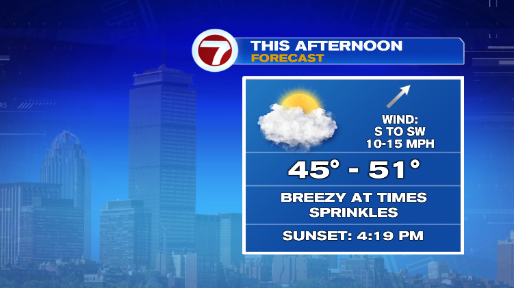
There will be a lot of clouds this morning and we’ll gradually add sunshine through the afternoon. It will be breezy at times with a few sprinkles possible so it’s not the prettiest of days, but it’s a good one to get out and enjoy the mild air.
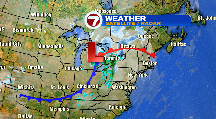
Tomorrow the cold front that’s trailing the warm front pushes through and you’ll most definitely feel the difference. The air that currently over Minnesota/Canada is headed here. Thankfully we’re not talking temperatures in the teens, but highs will fall back to the low 30s. Combine that with a gusty wind and it will feel like the teens and 20s for your Tuesday.
The cold and wind are only here for one day. By Wednesday we have a typical late-December day with above average numbers back by the end of the week.
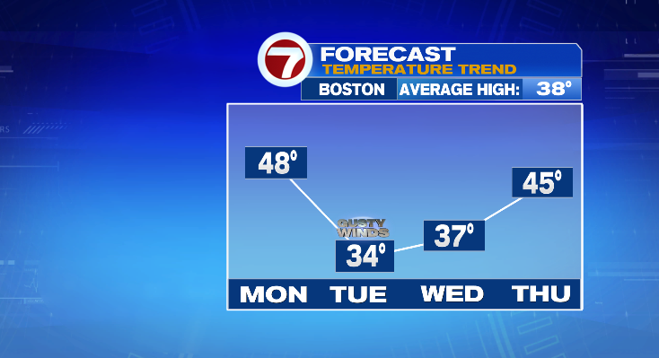
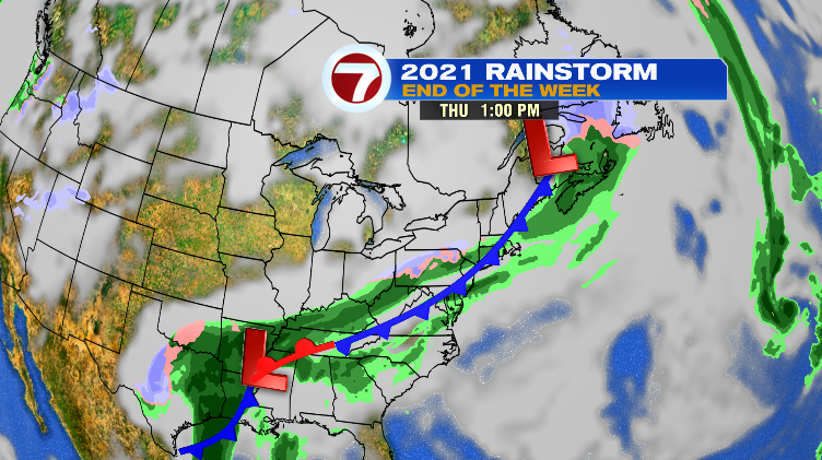
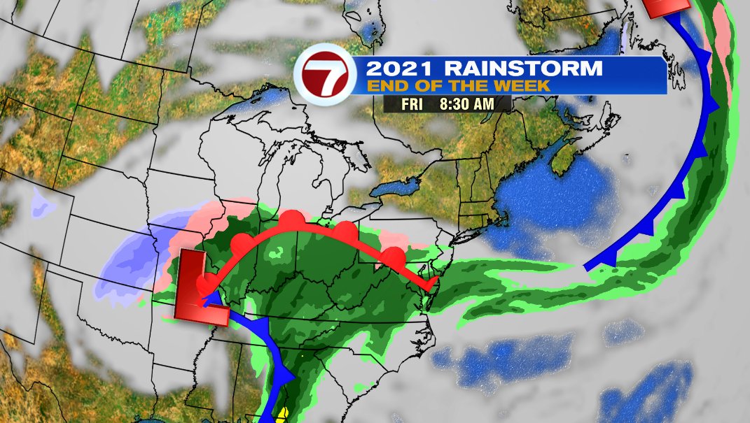
The catch is that late week warm up comes with some unsettled weather. Thursday, the last day of 2020, will have a few showers, but it’s far from a washout. Friday, the first day of 2021 is a much bigger system. Right now it looks like Friday will start dry with rain moving in for the afternoon and evening. It’s different from our Christmas storm in a few ways… first, there’s not a gusty wind to go along with it. Just a cold rain. Second, most of it is overnight so it won’t run an entire day. Friday morning looks good and outside of an early shower Saturday, the weekend does too. And finally, there’s a bit more cold air to work with this time so while most of us will just have a cool rain, it would mix with snow and/or sleet for our far northwestern spots. We’ll keep an eye on it this week.