Editor’s Note: Tonight’s blog is written by 7 Weather Intern Owen Vetree~JR
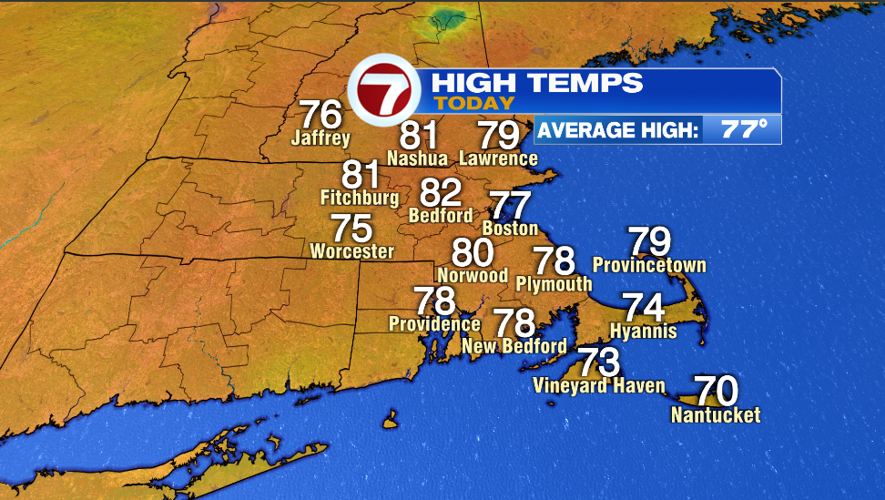
Hello, I hope everyone has enjoyed this beautiful Wednesday. Highs today were once again right around our averages. A few spots in the metro west made it into the 80s while most others stayed in the 70s.
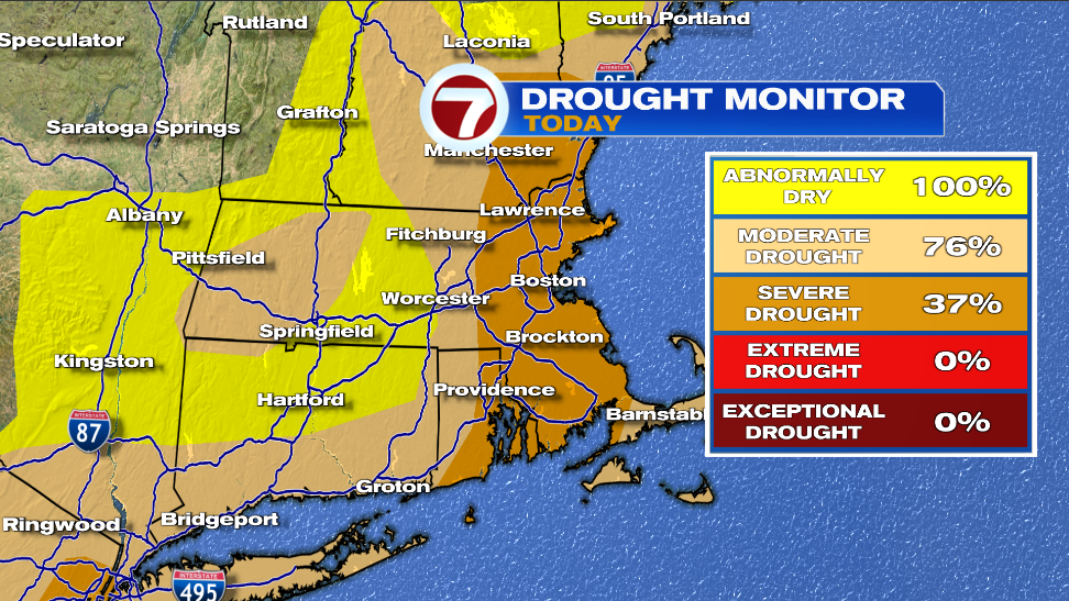
We are expecting rain tomorrow. Many of you are likely sad to hear this however, we are still in a drought and desperately need the rain. Below is the current drought monitor; a significant portion of the area is in a severe drought and many others are classified as moderate. The percentages represent the area of Massachusetts that falls under each drought level.
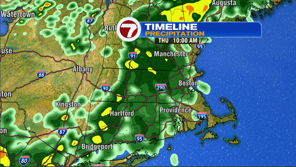
The rain is expected to move in the mid to late morning from west to east. It will likely arrive in Worcester around 9a and Boston around 10am. There may be some sprinkles and showers before this time north of the Mass pike. The map below is showing the simulated radar for 10am tomorrow.

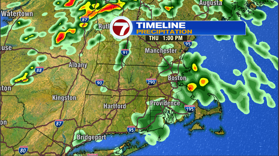
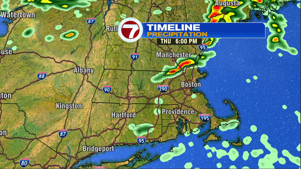
This will continue until about 1-2pm before more sporadic showers and storms continue through the remainder of the afternoon into the evening. The first map below is showing the simulated radar at 1pm and the second map is showing 6pm.
The highest amounts will be west and closer to the New Hampshire border with less towards the south coast. The Cape and the islands may only see a few sprinkles and should be dry most of the day. The highest amounts are unlikely to exceed half an inch with a large portion of the area seeing 0.1 to 0.3 inches of rain. Isolated higher amounts are possible where the storms track after the main batch of rain moves out. These amounts won’t help much with our drought but we will take anything we can get for now.
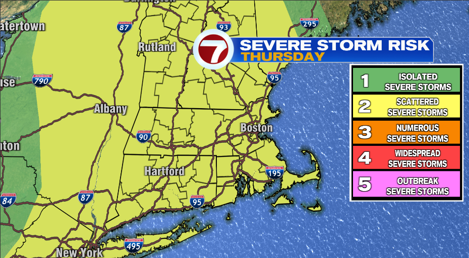
It is important to note that there is the possibility for some of these storms to be strong/severe. We are at a level 2 out 5 risk. The primary threat is damaging winds. There is a slight chance for a tornado or two to form. This chance is limited to areas north and west of I-495.
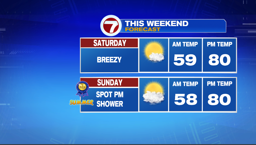
Enough of the doom and gloom, once we make it past Thursday the forecast is looking good through the weekend. Friday will be a partly cloudy to mostly sunny day with highs reaching into the mid 80s. Saturday and Sunday will be a bit cooler down around 80. Sunday might feature a spot pm shower, but it shouldn’t be enough to interrupt any of your father’s day plans. Humidity will be in the comfortable range for all 3 days.
~Owen