
Editor’s Note: tonight’s blog is written by 7Weather intern, Owen Vetree. Owen, take it away!!
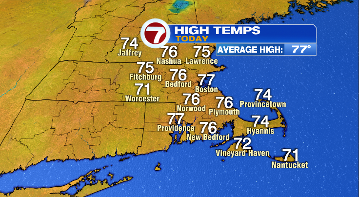
Good afternoon everyone, today was a beautiful June day. We observed a high temperature of 77 in Boston, exactly the average temperature for today’s date. The rest of the area saw highs in the 70s as well. Boston was actually the hot spot of the day. On the other hand our cool spots were Worcester and Nantucket both at 71. It’s not often that all of our area is within 6 degrees of each other.
Tomorrow will be a very similar day, except we may add a couple of degrees in most locations. Thursday unfortunately won’t be as nice. We will see some rain and increased humidity, although it might not be a hot day. It will be sticky and a little uncomfortable out there.
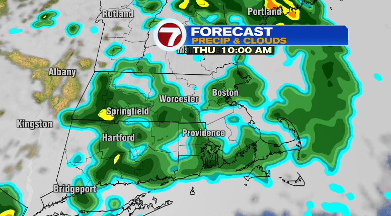
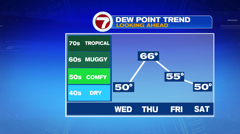
Thursday features showers and storms that will be with us throughout the daylight hours. The showers will be off and on. Amounts will be light generally 0.1 to 0.3 inches, with the highest amounts along the New Hampshire border. Temperatures will be around the 80 mark on Thursday as well. The dewpoint will also rise into the mid/upper 60s providing that sticky feeling before falling back into the 50s later this week.
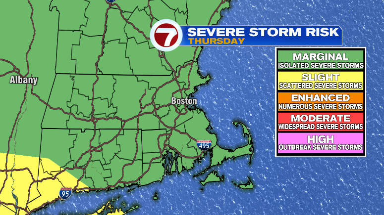
A cold front will be passing through late on Thursday, this may be able to spawn a few stronger storms. The best chance of this looks like it will be across our western areas. The timing of these potential storms will be in the afternoon.
Friday and Saturday are both shaping up to be nice days with highs in the 80s.
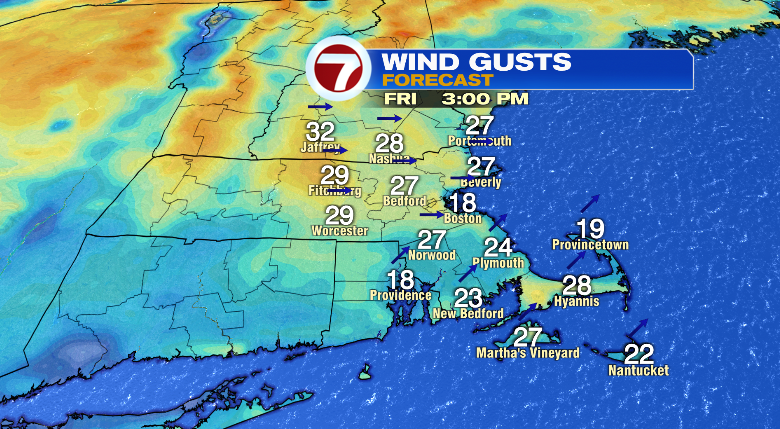
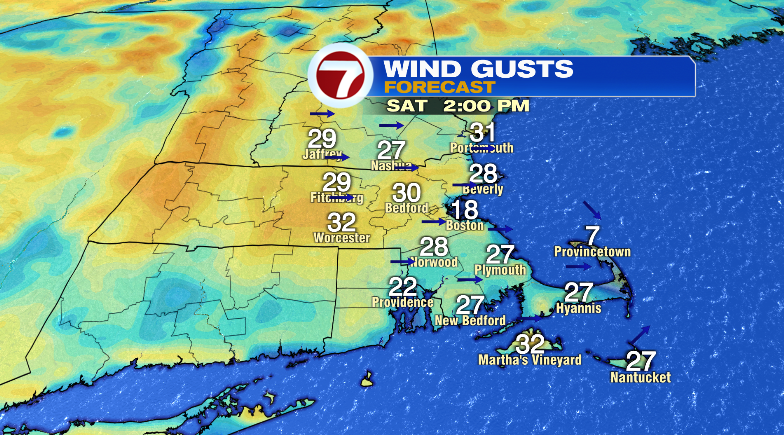
Both days are going to be a little on the breezy side but nothing too crazy with gusts up to 30 miles per hour.
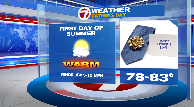
Father’s Day/First Day of Summer is looking good. Highs right around 80 once again. There is a slight chance of a brief PM shower.
~Owen