Well, that was quite the weekend we had for ourselves. From the soaking rain, with higher terrain flakes mixed in thanks to the cold air, to the damaging wind gusts, to even a meteor’s shockwave producing that sonic boom and rattling the house, it seemed like it was never a dull moment.
Fortunately, the weather looks to improve this week despite the chilly start to June.
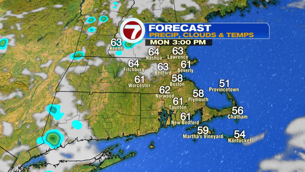
While we run a mostly cloudy mid to late morning with a spot shower today, much of the day turns out to be dry. More sunshine returns this afternoon too, allowing for a crisp, but brighter day overall. Temps run from the upper 50s at the coast to low to mid 60s inland.
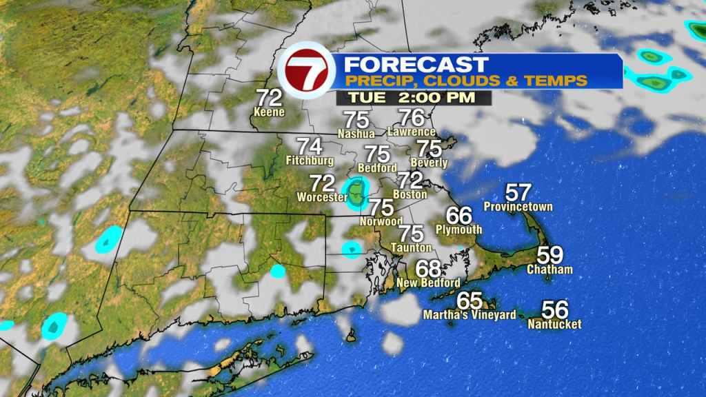
Tomorrow, we’ll add in another 10 degrees or so, pushing temps back into the low to mid 70s. It’ll start cool and bright with building cumulus clouds midday. Although an isolated shower can’t be ruled out, much of the day is once again rain-free.
Wednesday runs 75-80 and then we’ll be well into the 80s Thursday and Friday. It’ll be dry too.
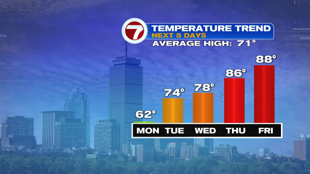
Can we keep it going into the weekend? Right now, Saturday still looks warm and dry with shower chances going up by Sunday. It’ll likely be much cooler by Sunday too if the wet weather with a front starts to kick in. Plenty of time to watch that though.