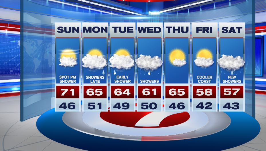
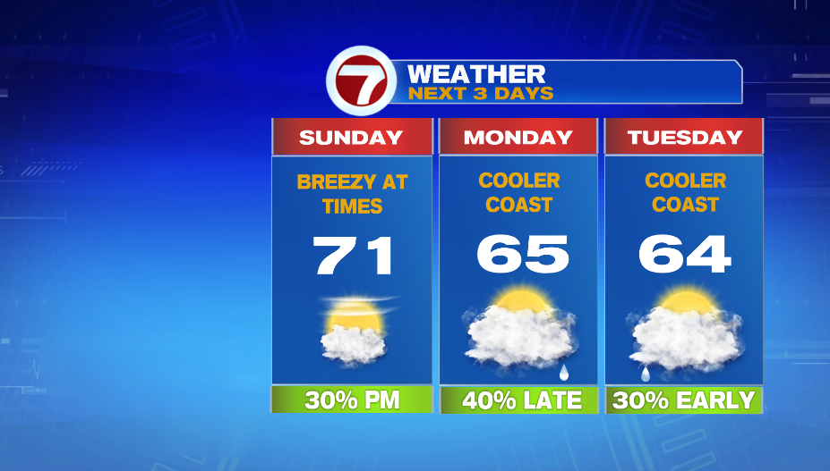
7Weather- We end the weekend with warmer temperatures on Sunday, and then the start of the week is a bit unsettled.
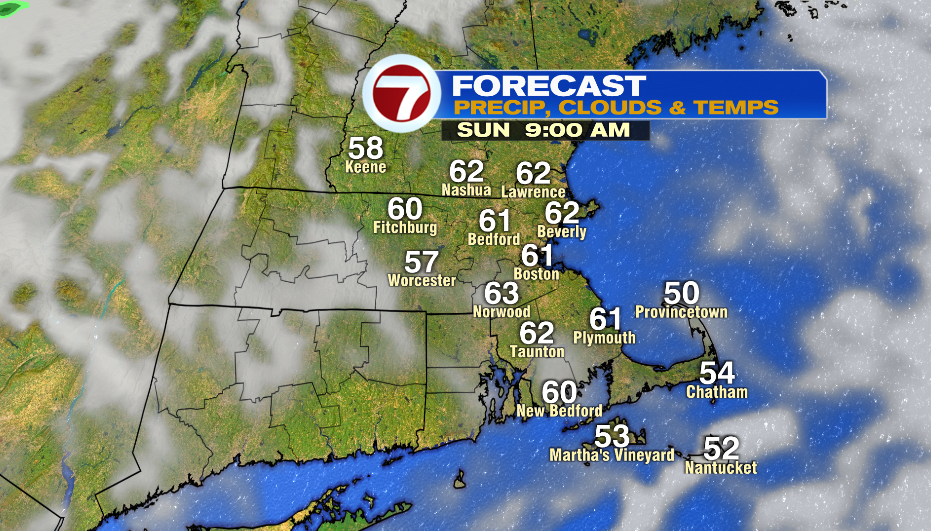
If your an early riser (sunrise 5:38 AM), you’ll see mainly cloudy skies Sunday morning. Those clouds start to move about 8-9 AM, and we jump into the low 60s.
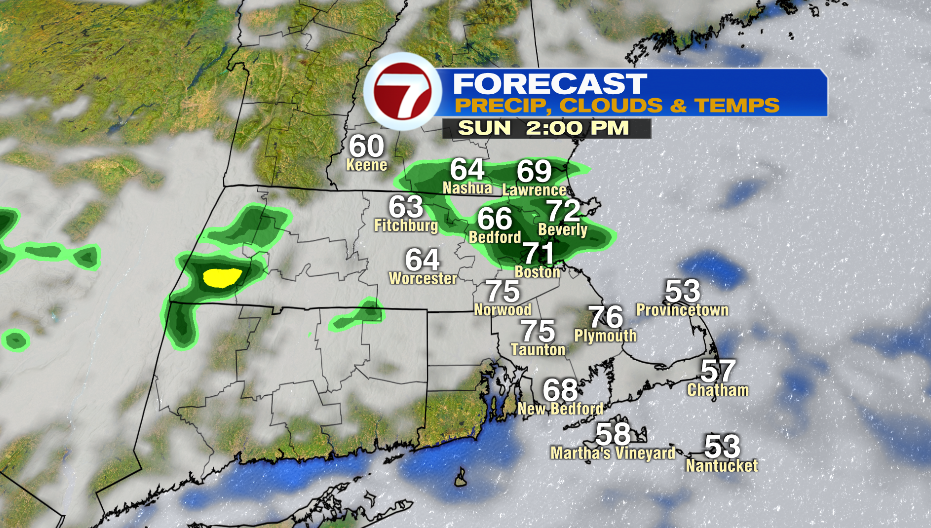
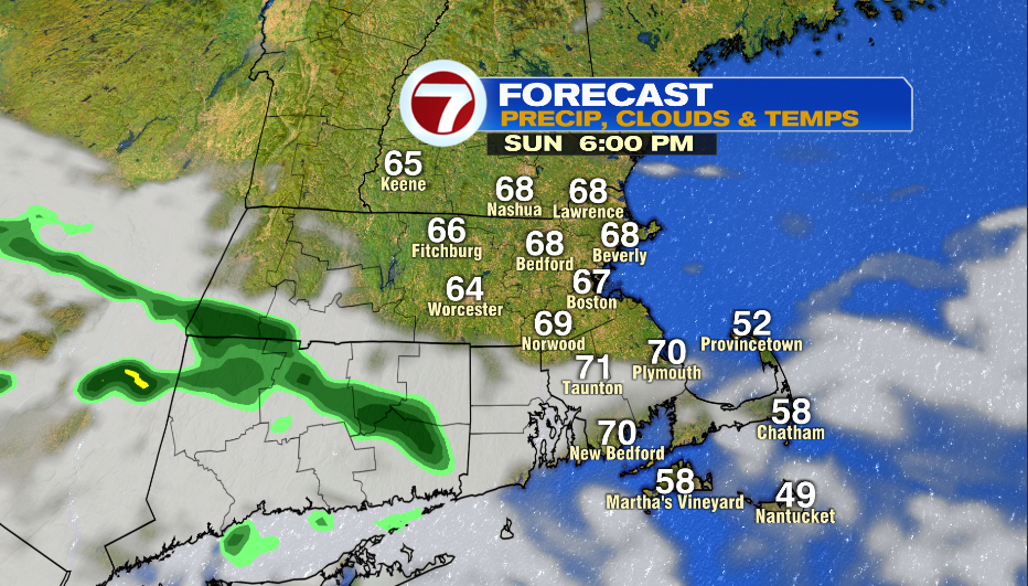
Clouds come right back throughout the early afternoon, and there could be spotty showers between 2-5 PM. It looks like we’ll see another window of clearing about 1-2 hours before sunset. Highs will be between 68-74º.
Monday will have lots of clouds around. Highs reach into the mid and upper 60s inland. An onshore wind will keep the coast near 60º. Showers move in late in the day likely after sunset. Showers will be on and off Monday night with a few raindrops lingering into early Tuesday morning. Most of Tuesday is mainly cloudy, and highs reach into the mid 60s. If we have more clearing than expected, temperatures will jump to about 70º.
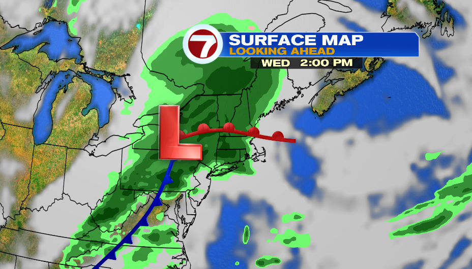
Wednesday has the best chance of rain this week. Expect scattered showers to arrive mid-day (11AM-1PM), and stick around throughout the afternoon.
Things clear up on Thursday. Skies are mainly sunny and highs reach into the mid 60s.