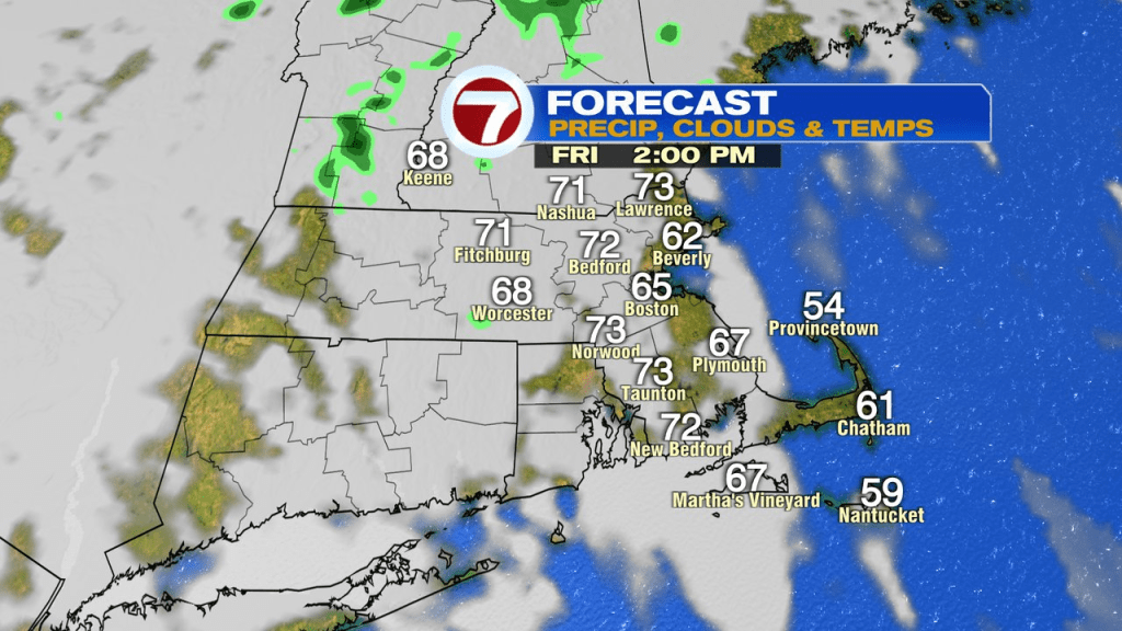
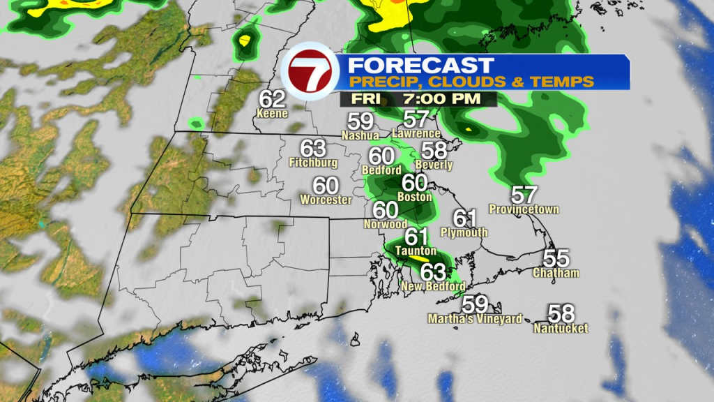
A comfy cool start to today leads to a seasonable afternoon with highs in the low to mid 70s inland, 60s at the coast. A few spotty showers develop later today with another round of showers tonight.
The big story over the weekend will be the Saturday storm. Although a couple of hours of dry weather are possible near sunrise tomorrow, it won’t take long for the rain to fill in from north to south as an area of low pressure drops in from our north. What’s impressive about this storm is the amount of very cold air it has aloft, especially for this time of year. As rain fills in mid to late morning tomorrow, temps drop back into the 40s. In fact, in the higher terrain of far northern Worcester County and southwest NH, if temps slip into the mid to upper 30s while there’s a burst of heavier precip, some wet snow flakes could mix in! May 30th or March 30th?
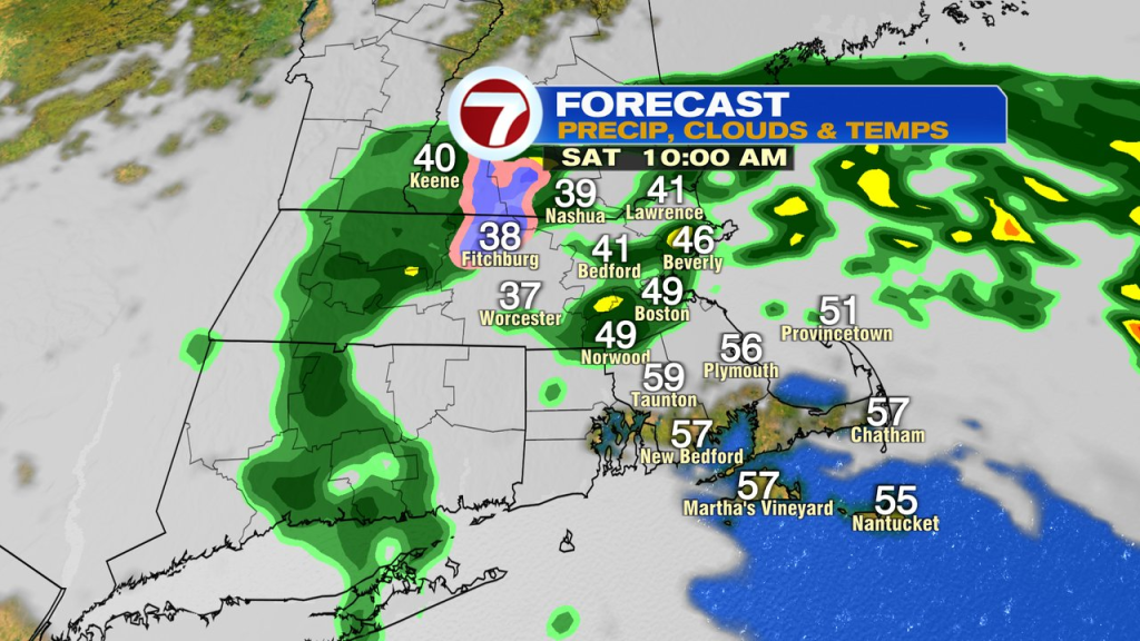
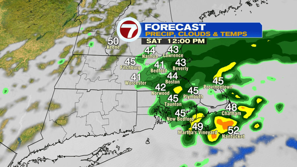
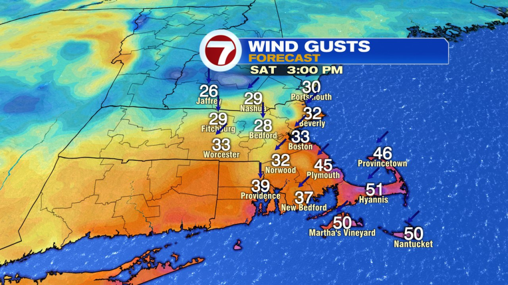
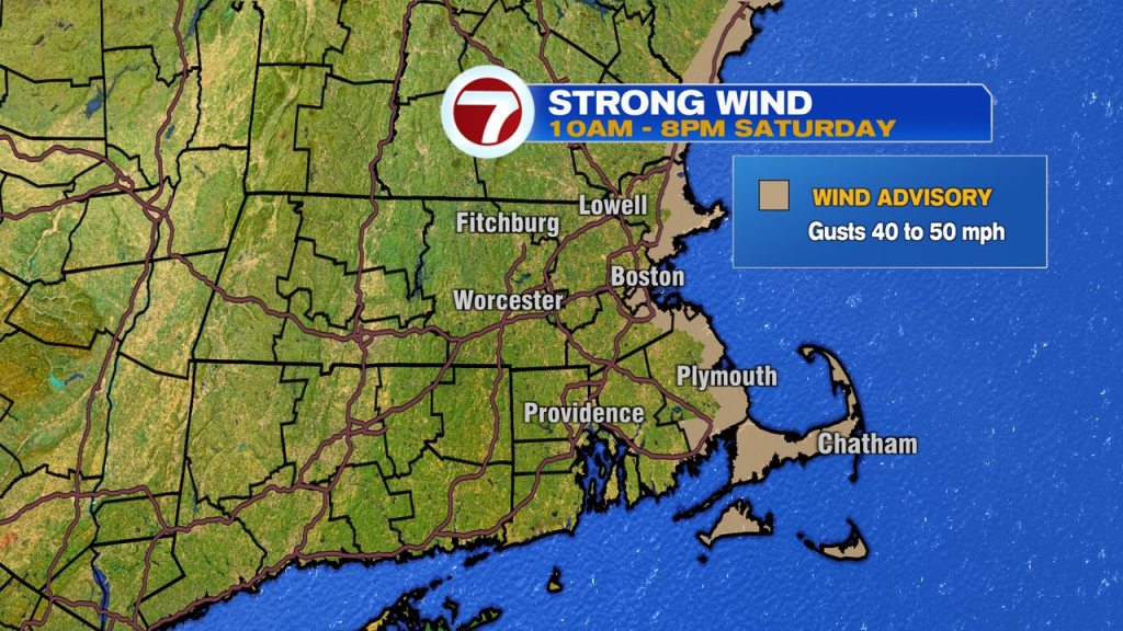
Early to mid afternoon, it’s just a cold rain for many of us. In addition, there will be a burst of strong winds with gusts 35-45mph, locally higher at the coast. The strong winds start across Northeast Mass and NH early in the morning and become more widespread farther south mid morning, through the afternoon. It’ll take until at least noon for the winds to ramp up across the Cape and Islands.
The storm exits stage east early Saturday evening and we’ll dry out quickly. Temps slip back into the upper 30s to low 40s for many by the start of Sunday. Sunday is the better half of the weekend with temps back to near 70. It’ll start sunny, end with more clouds with a few late-day scattered showers possible.
Early next week is a struggle with more scattered showers and temps below average.