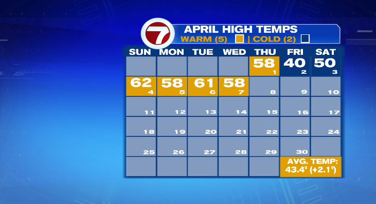
April is shaping up just like the second half of March… warm and dry. Today was another above average day with a mix of clouds and sunshine.
While this weather is nice, what we need is a day (or three) of a soaking rain. Aside from the rain we had on April 1st, we’ve been dry ever since. So yes, if we want those May flowers, we need to get some of those April showers.
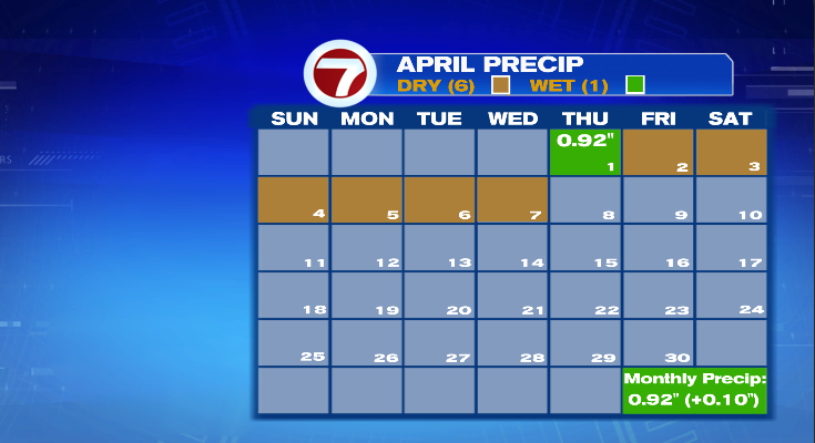
And while that rain was nice and is better than nothing, it can only last us so long. As of today, we’re technically still in a rain surplus for April. But once today is officially over and declared 0 for precipitation, we’ll be in a deficit once again. That means we’d not only be in a deficit for April, but a big deficit for March and same story in January.
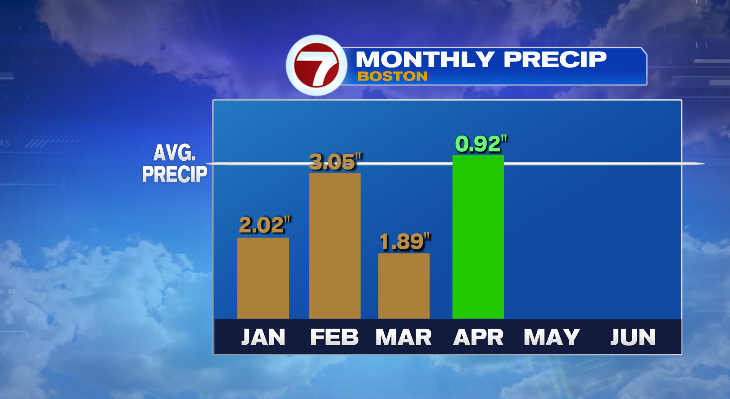
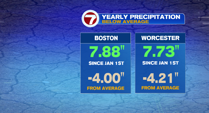
Year-to-date, both Boston and Worcester are 4″+ below average. That is only going to get worse as we head toward the weekend with no rain in the forecast.
But we’re getting rain on Sunday, right? Well…. not so fast. Good news for your weekend plans but not so much for the ground. So what happened to that rainy day we were advertising? A blocking area of high pressure.
Follow along with me as we break it down.
We are in a log jam of storms right now, none of which are in any hurry to move anywhere. The low that is in the middle of the Atlantic ocean is the same one that has been with us for several days. It caused the wind Monday, the coastal clouds Tuesday, and finally loosened its grip. But between all of these little lows are little (or in some cases big) highs.
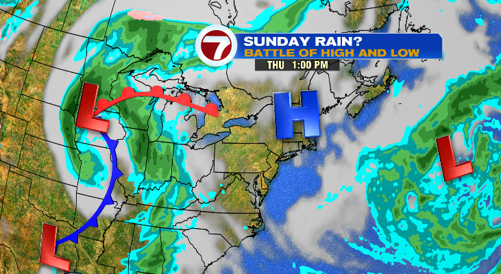
High pressure means nice weather for us. Light winds and sunshine generally. And that’s what we’ve been seeing lately and will see for the next several days. And that high will sit with us until the next system kicks it out. But it’s not always so black and white. The incoming system has to be stronger than the high it’s trying to move.
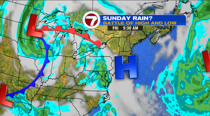
So Friday our high remains in control (above) and the sun will stick around. Temperatures will climb to the upper 60s inland, near 60 on the coast.
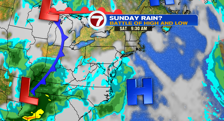
Saturday (above), more of the same, but warmer. Temperatures in the low 70s inland! 60s on the coast.
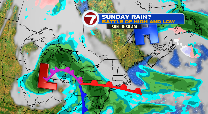
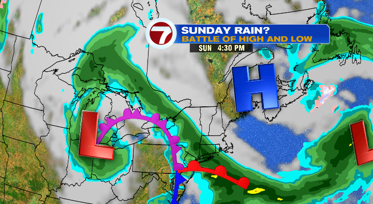
Then there’s Sunday (above). A reinforcing shot of high pressure is pushing in and it may just be enough reinforcement to hold low pressure (and thus, rain) off. Even if it doesn’t hold it off totally, it will be enough to keep most of Sunday dry with only a small potential of a shower late — that’s about it.
And as leaves continue to bud out, we need the rain to keep things greening up!
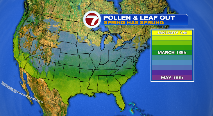
The leaf progression continues northward and since yesterday’s update things really blossoming across southern New England.
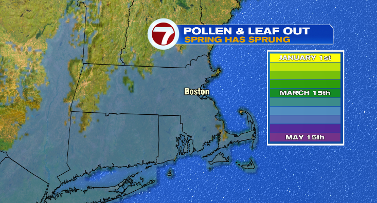
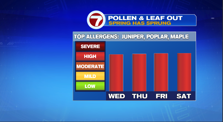
But of course that means allergies so tree pollen sufferers, stock up on those meds! Pollen counts remain high through the weekend.