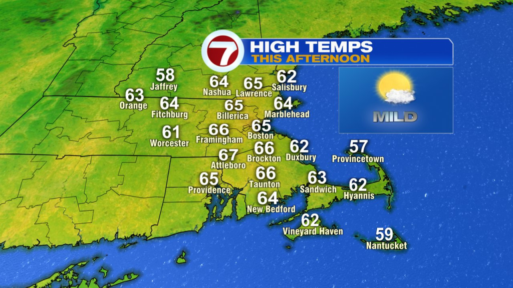
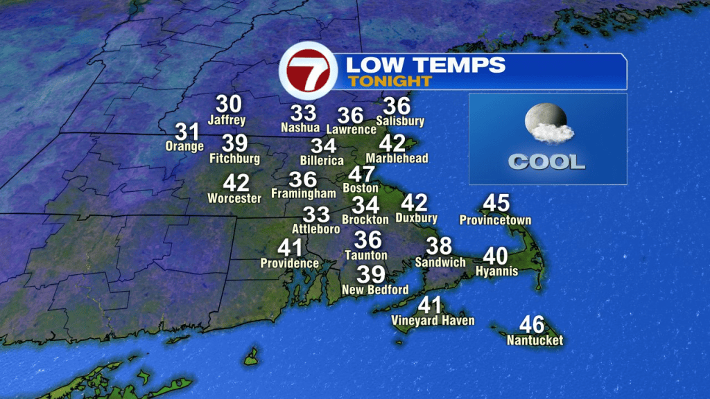
We’ll chalk up another beautiful day today as high temperatures run back into the 60s with mostly sunny skies. We’ll add in a little bit of a breeze, gusting 20-25mph. Tonight, we’ll drop back into the 30s and 40s.
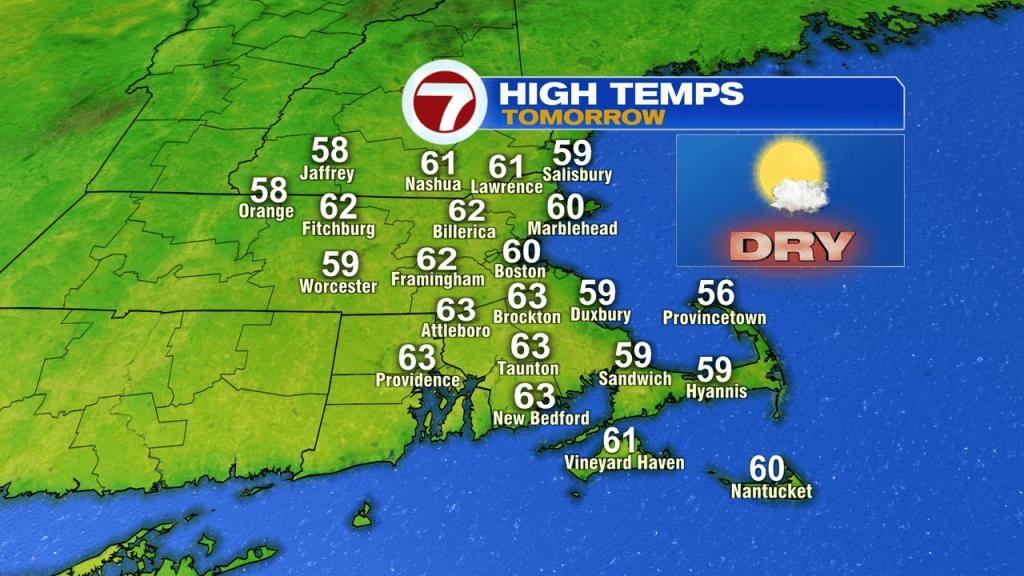
Tomorrow, we’ll start the weekend off nice with temps running into the lower 60s with a mostly sunny sky.
Sunday is dry most of the day, although the clouds increase and the chance of rain does go up near day’s end.
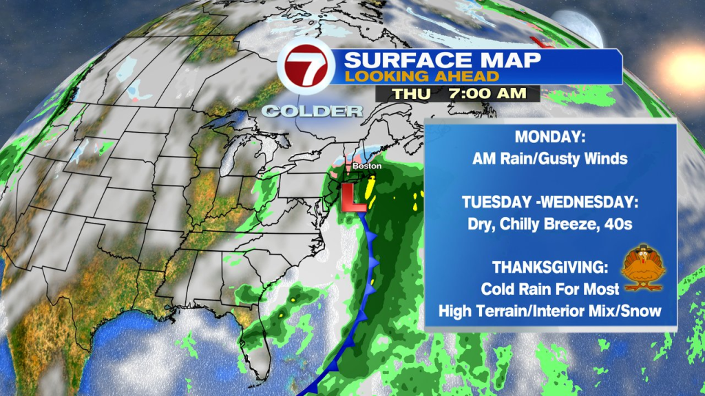
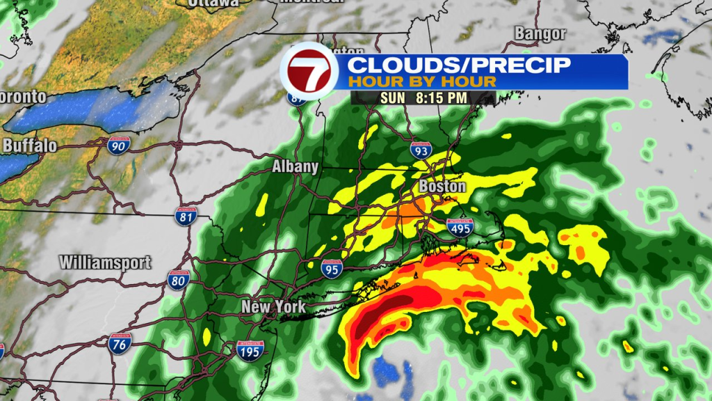
Sunday evening, into Monday morning, we’ll track a storm up the east coast and into or near Southern New England. That’ll spread in rain, localized downpours and some gusty breezes, especially at the coast. 1-3″ of rain is likely with the highest totals pending the exact track and where the localized heaviest bands set up. The storm is pretty progressive, so there’s a good shot this tapers off after Monday morning. Monday’s evening commute looks dry. Monday morning has a astronomical high tide, so we’ll watch for some minor coastal flooding/splashover.
Tuesday and Wednesday look dry and chilly with temperatures in the 40s. Overall, good travel weather sets up those two days.
Thursday, Thanksgiving, looks wet with another storm rolling through providing a cold rain for most. Some snow/mix is possible deep inland across the high terrain of central, western and northern New England.