

As high pressure tries to hold on and suppress and ocean storm to our south, the breeze will increase over the next couple of days. Today, the brightest skies and mildest air will be northwest of Boston. The coolest air and gustiest winds will be across Southeast Mass. That’s where we’ll have more clouds too. Winds gusts 15-25mph inland, 25-40mph at the coast, strongest across the Cape and Islands.
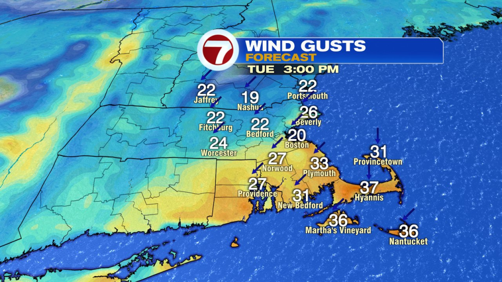
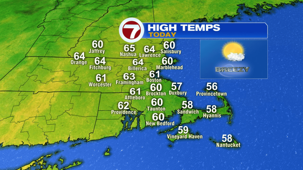
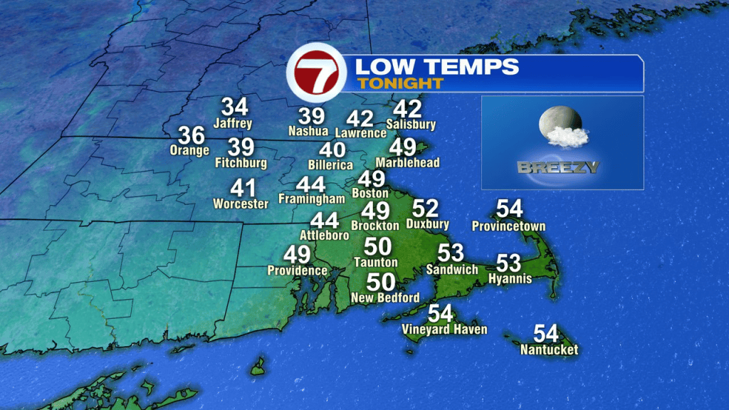
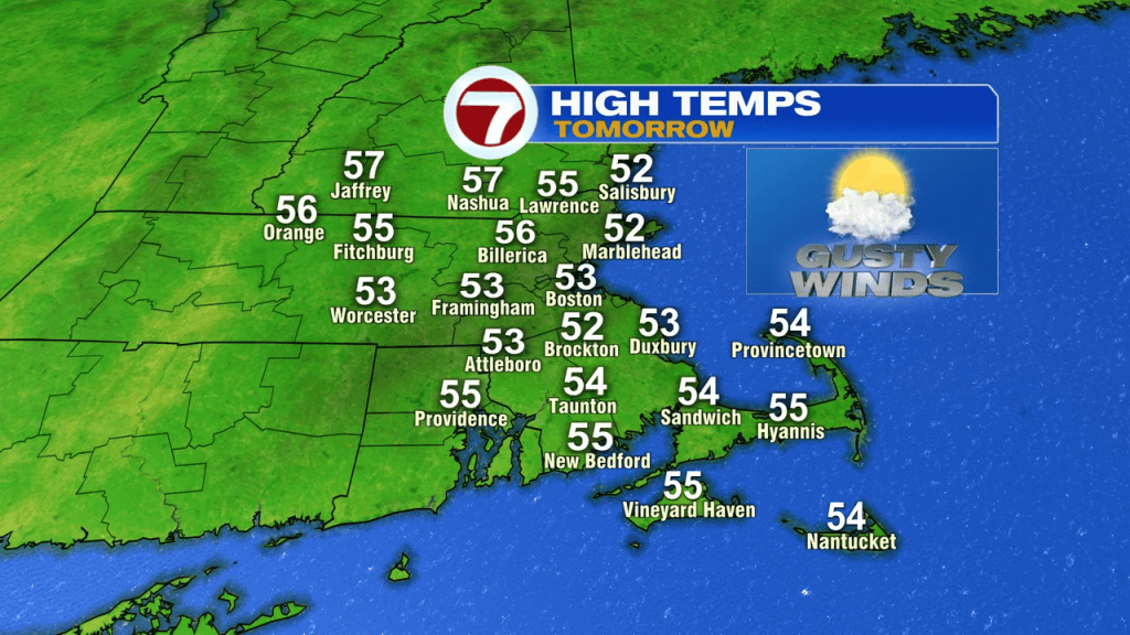
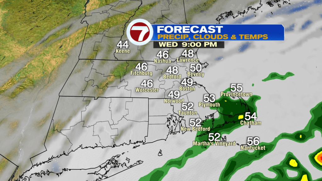
The breeze continues tonight and bumps up more tomorrow. It’ll be a cooler day with more clouds too as winds gusts 35-45mph across Southeast Mass. As the coastal storm makes its closest approach, some showers are possible across far southeastern Mass late tomorrow into tomorrow night. Any Cape and Islands showers early Thursday morning will taper off near sunrise. Tides are astronomically on the lower side, so that’ll help mitigate any coastal flood potential. With that said, big waves and a pounding surf may produce some beach erosion.
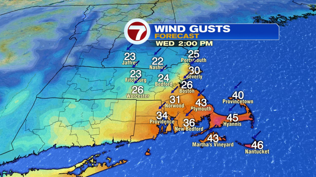
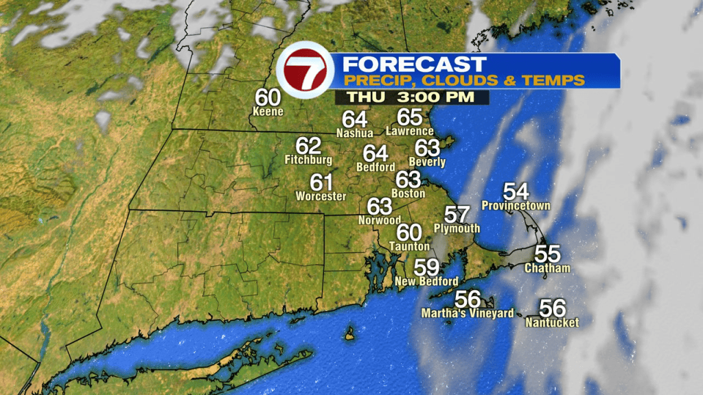
Thursday afternoon is breezy for all of us, however, the wind is from the west/northwest with gusts 20-30mph. We’ll warm back into the low 60s.
Friday is cooler and breezy with perhaps an ocean-effect rain shower across coastal Plymouth county or the Cape in the morning. Temps run only in the low to mid 50s.
The weekend weather looks great for late October. Mid to upper 50s with sunshine and light winds Saturday. Low to mid 60s with light winds and sun on Sunday. 70 degrees anyone? We’re close to it next Monday.