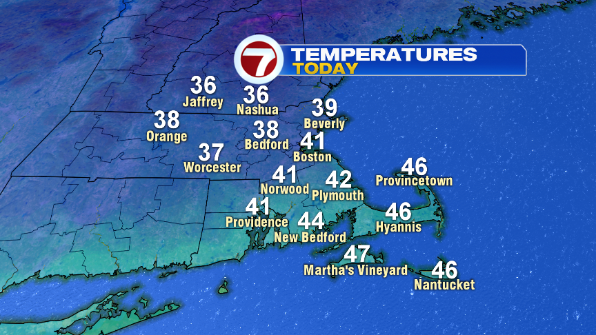
We’re feeling the chill again this morning, however, we’ll see some improvements this afternoon as temps moderate back into the upper 30s and lower 40s. Combine that, and a lighter wind, and it’ll feel like winter’s grip starts to relax. More clouds are in the mix, and even a few evening sprinkles/showers are possible across Buzzards Bay and the Cape and Islands, but much of the time is rain-free.
Tomorrow is breezy, but milder and with a lot of sun!

The air this weekend tracks from the Arctic, down into New England. While the core of the coldest air stays just to our north, it’ll be cold once again. This Arctic sideswipe will knock highs back into the 30s for Saturday and Sunday.

Next week we’ll track an ocean storm off the Carolina/mid-Atlantic coast. If it gets close enough to New England, then it’s fair game for showers and gusty onshore winds at the coast by Monday.