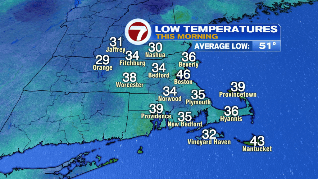
It didn’t take long for temps to tumble last evening as the chilliest air of the season, so far, settled in. We awake to temps in the low to mid 30s for many, allowing for a frosty start for some.
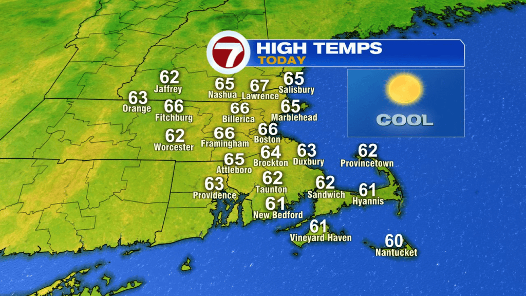
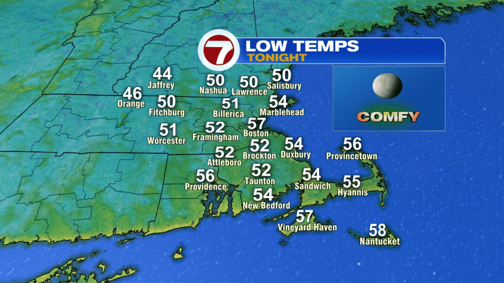
With the sunshine and a breeze kicking in out of the southwest, it won’t take long to warm up today with temps moderating back into the mid 60s this afternoon. Perfectly seasonable for the time of year. Tonight won’t be nearly as chilly as temps stay near 50.
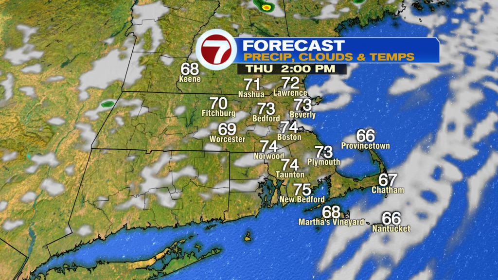
Tomorrow will be mild, low to mid 70s and a bit breezy. A front swings on through, and while a brief, spot shower is possible, drops will be few and far between. The front is more of a breeze/cloud producer than anything else. Winds turn from the southwest to the west/northwest during the day.
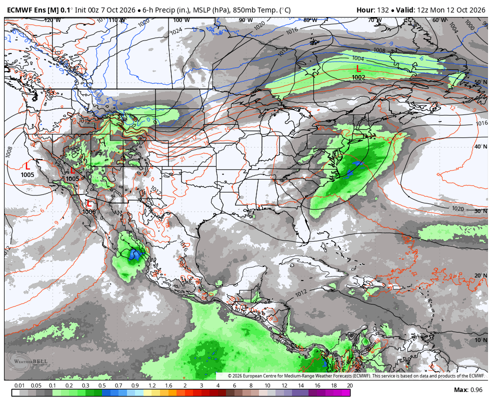
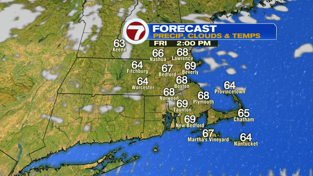
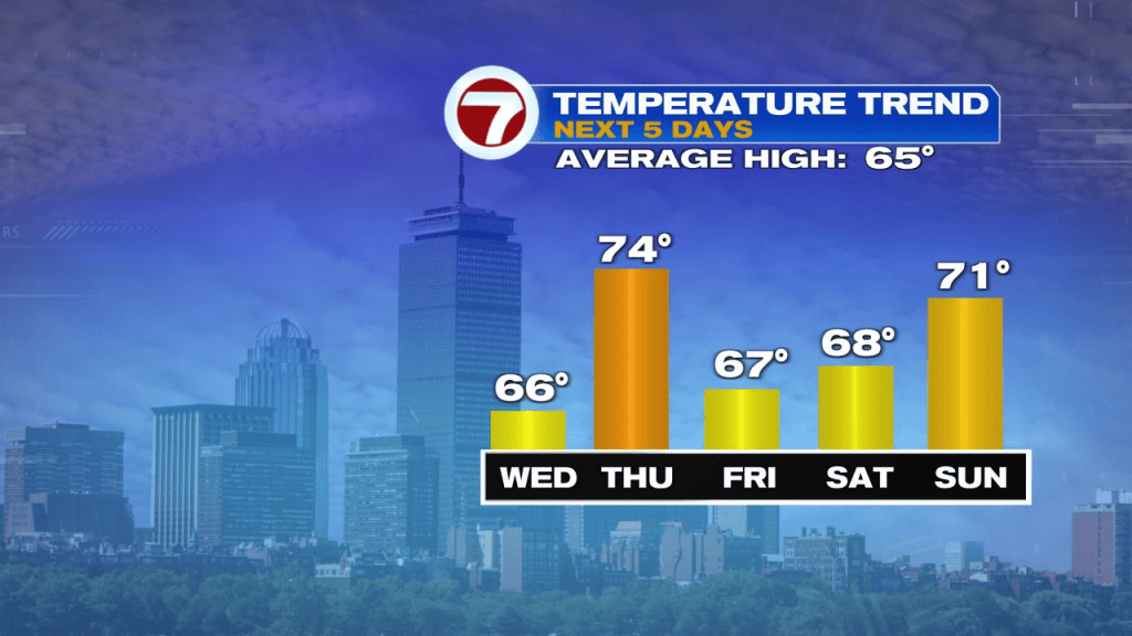
Friday, into the weekend is fairly seasonable and dry with temps running in the 60s to near 70. The best shot of more widespread showers will arrive Sunday night into Monday morning, putting a bit of a damper on the tail end of the long holiday weekend.
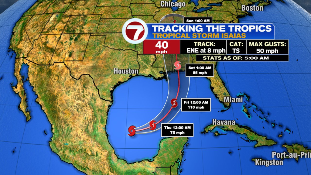
Some of that moisture will come from the tropics as rain from Tropical Storm Isaias moves from the Gulf Coast, up into the Ohio Valley, points northeast. It’ll be a shadow of itself by the time any moisture gets in here and I don’t expect much wind either. However, Isaias is forecasted to become the first Hurricane of the Atlantic Basin’s season and likely to make landfall along the Gulf Coast somewhere between eastern Louisiana and the Panhandle of Florida. If it does become the first hurricane of the season, it’ll mark the latest, first hurricane of the season, crushing the old record of mid September since the satellite era began. Thanks El Nino!

Rain moves in Sunday night into Monday morning… map below shows some of that.