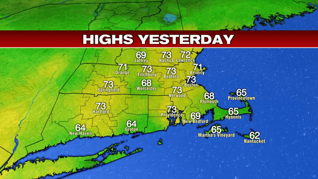
Wow, what a late October day yesterday as the frosty start for some, turned into a mild afternoon as temps took off mid to late morning. With highs running in the upper 60s to lower 70s for many, it was well above average for the time of year.
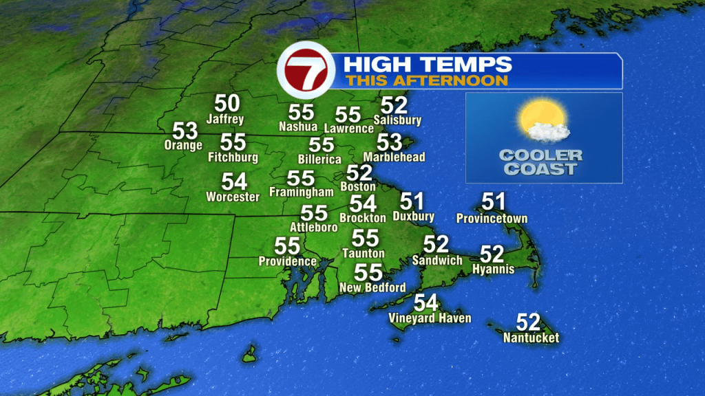
Today, we’re back into a cooler pattern as a front slipped through overnight and chillier air moves back in from the north. Temps this afternoon max out in the lower to middle 50s with dry air prevailing.
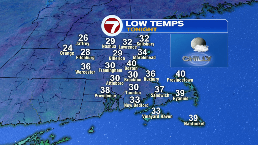
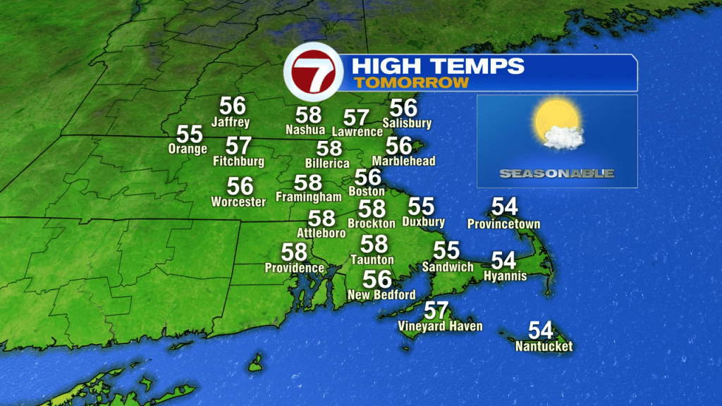
Temps tomorrow start frosty and end in the mid to upper 50s. As a warm front moves closer to us, clouds increase in the afternoon.
Thursday and Friday will be milder again, just shy of 70 Thursday and just above it on Friday. We stay dry.
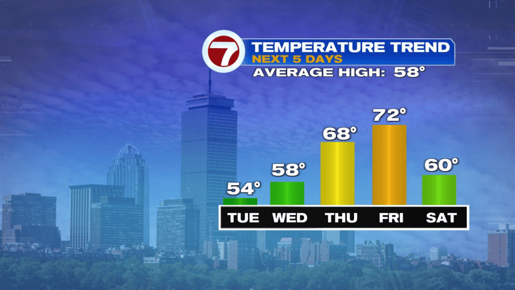
The weekend forecast looks solid overall. A cold front slips through late Friday, so it’ll be more seasonable, but dry.
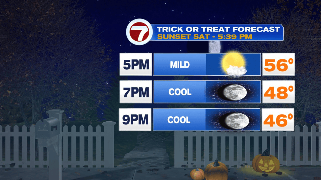
Right now, the Halloween forecast features temps maxing out near 60 in the day and fading back into the mid 50s by sunset and into the 40s for the Trick-or-Treaters. Winds look light too, so that’ll help it feel comfortably cool as the little ghosts and goblins run from house to house.