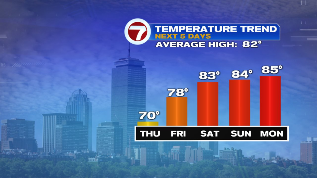
It’s a mild and muggy start to the day with early morning dry hours in the mix.
Showers, with embedded downpours start to move in Worcester County first by 8-9am and closer to Boston, points north around lunch time. We’ll watch for narrow bands of slow moving downpours to drop a quick 1-2″+ at times, producing localized street flooding/poor drainage flooding as well as a rise in small creeks and streams. The rain will be heaviest from late this morning, through this evening.
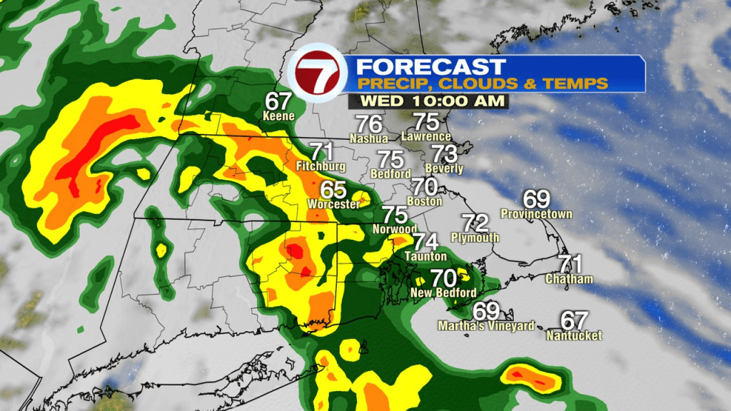
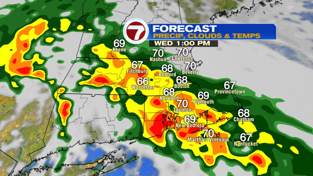
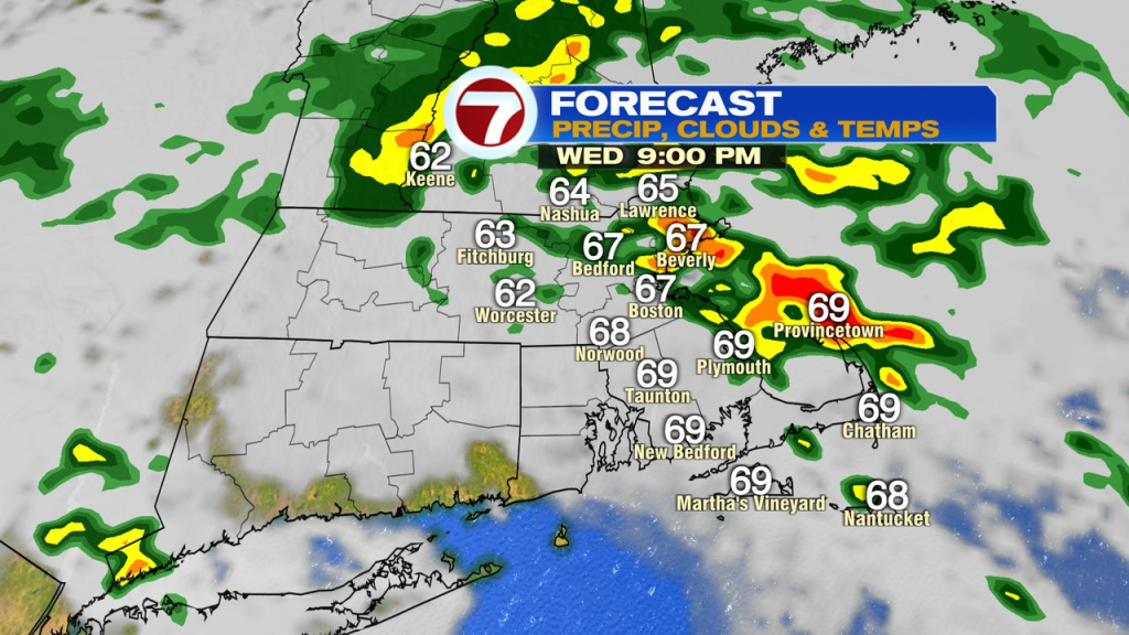
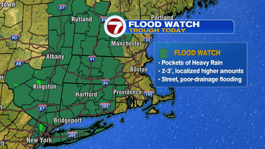
A flood watch is up across the western half of New England, where rain totals push 3-6″, with the highest totals likely across western Mass, western CT and parts of NY state. Across eastern Mass, many spots fall in the 1-3″ range, but any narrow bands of heavy rain that are slow to move, can produce locally more, especially in the Worcester Hills.
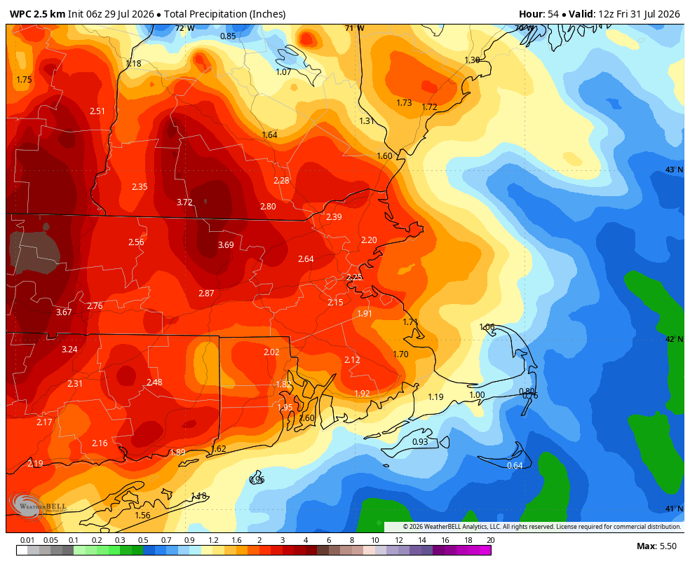
Overnight into tomorrow, it’s cloudy with scattered showers, and that’ll continue through the day Thursday as temps are stuck near or below 70.
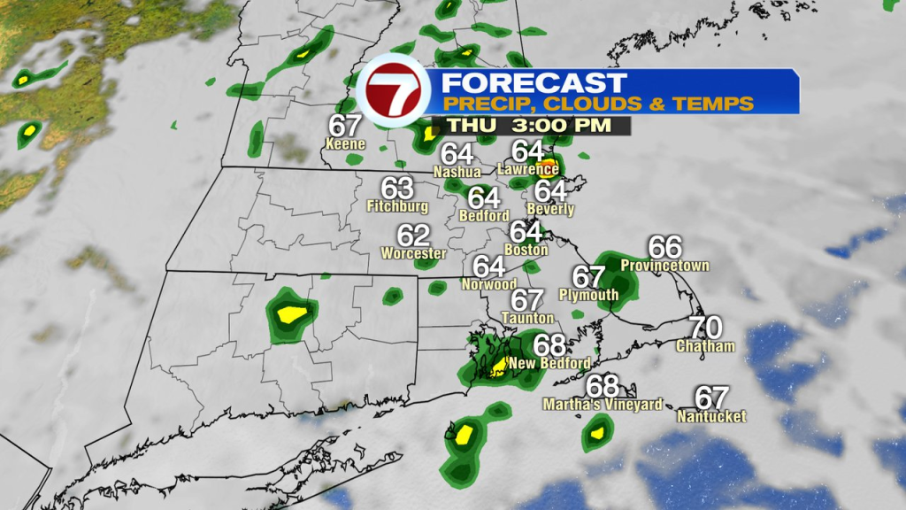
The area of low pressure will lose it’s grip on us on Friday with morning clouds breaking for some sun. Highs head up to near 80 inland, and run 70-75 at the coast. There will be some lingering moisture/instability to the atmosphere, so a pop-up shower or storm can’t be ruled out. About 20% of us pick up on that.
Saturday and Sunday look pretty good overall too with highs in the low to mid 80s and a partly sunny sky. While a few isolated showers can’t be ruled out, most of the time is dry.