

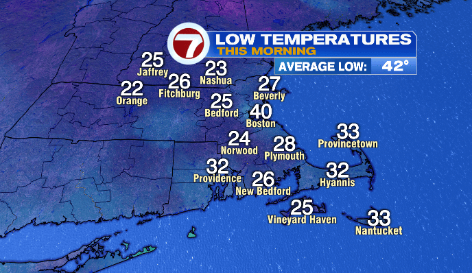
Good morning! Hopefully you had a restful night with that extra hour of sleep– pretty convenient after Halloween festivities. Our sunrise was at 6:17AM, and we’ll see sunset at 4:37PM today. In between now and then, we have a beautiful Sunday on tap!
Expect plenty of sunshine and light winds.
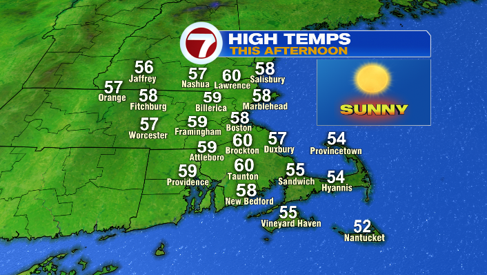
While we started out cold this morning, high temperatures in mid to upper 50s and low 60s– pretty close to average for this time of year.
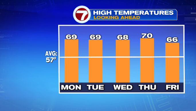
After Sunday, however, we get into a much milder trend during the workweek! We’ll largely be in the mid to upper 60s, and even a few spots around 70 between Monday and Thursday! That’ll be a good 10 degrees above average for some cities– much more of a September feel, rather than a November feel.
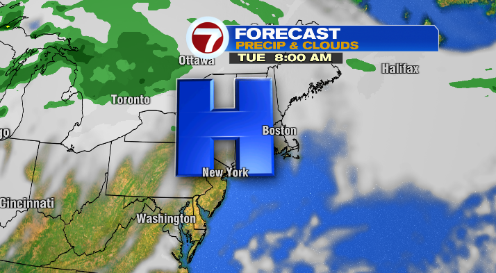
We’ll see continued sunshine Monday, though clouds (mainly high clouds) increase as we head into Tuesday — Election Day!
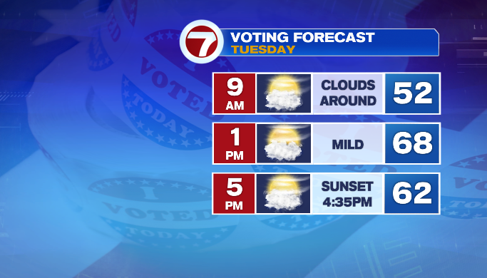
Mother Nature certainly won’t prevent you from heading out to do your civic duty. You’ll likely want a jacket in the morning when the polls open. However, you may wind up in short sleeves in the afternoon considering the temperatures.
We’ll be back to a mix of sun and clouds on Wednesday… but it’s Thursday that I really have my eyes on. Thursday is our next real chance of rain, particularly in the second half of the day.
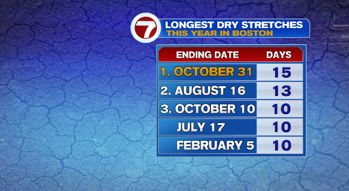
That would end what would be, at that point, a 19-day streak of no measurable rain in Boston. We just put day 15 in the books, but with Sunday-Wednesday staying rain free, I think 19 will be the number.
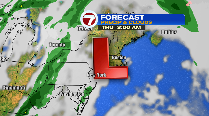
However, Mother Nature wants to balance the scales after such a lengthy dry stretch. So, while it’s not a total wash late this week, Thursday, Friday AND Saturday all look rather unsettled as low pressure gains control of the forecast.
That said, there’s still a bit of discrepancy in modeling late this week, so make sure you’re staying tuned the forecast, and we’ll make sure to keep updating you!