Foggy and groggy… that’s how we roll on this Monday morning as a soupy, summery air mass is back in place. Areas of dense fog will break apart by mid morning and a mix of sun and clouds prevails this afternoon. Temps vary from near 80 at the coast to near 90 inland. While storms won’t be widespread, there will be a few isolated storms that pop up this afternoon and produce a downpour in a few towns. So we’ll keep an eye to the sky for that.

No break from the humidity tonight with lows in the lower 70s and the mugginess continuing. That means the A/C unit will be cranking away tonight too.
We’ll continue to be hot tomorrow, with even Boston taking a run toward 90 degrees as a southwest wind kicks in. In addition, the humidity will be sky high, making it feel tropical outside. Storms tomorrow will be widespread late afternoon/evening (mainly after 5pm) with locally torrential rains as well as gusty winds. The most favored locations for the strongest storms will be northwest of 495. Localized street flooding is possible in towns that pick up a quick 1-2″ of rain.


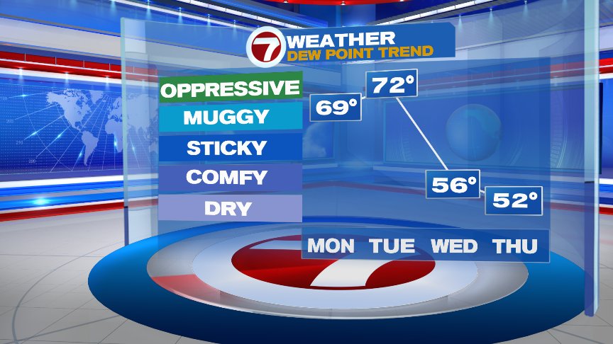

On the other side of that cold front, we enjoy lowering humidity and some sun mid to late-week.
@clamberton7 -twitter