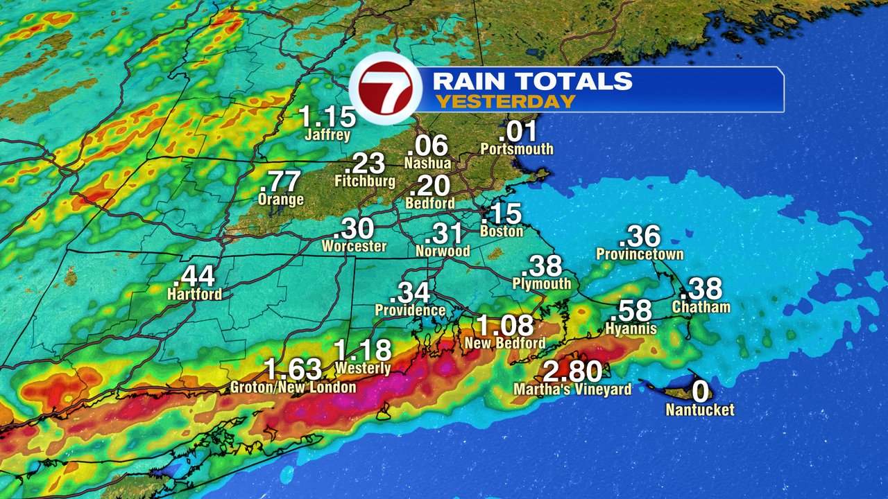
Summer-like storms yesterday were hit or miss, with the heaviest storms, dropping a lot of water in a short amount of time. Some of the highest rain totals were achieved along the south coast. Below are a few of the rain totals.
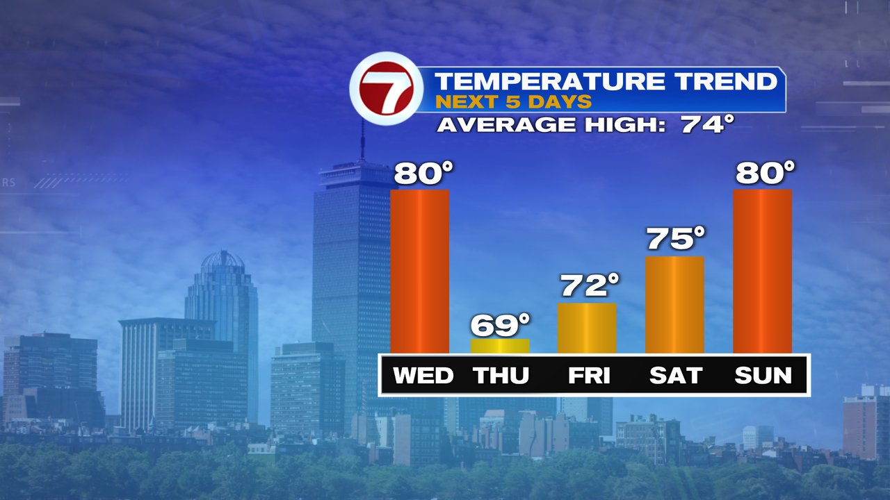
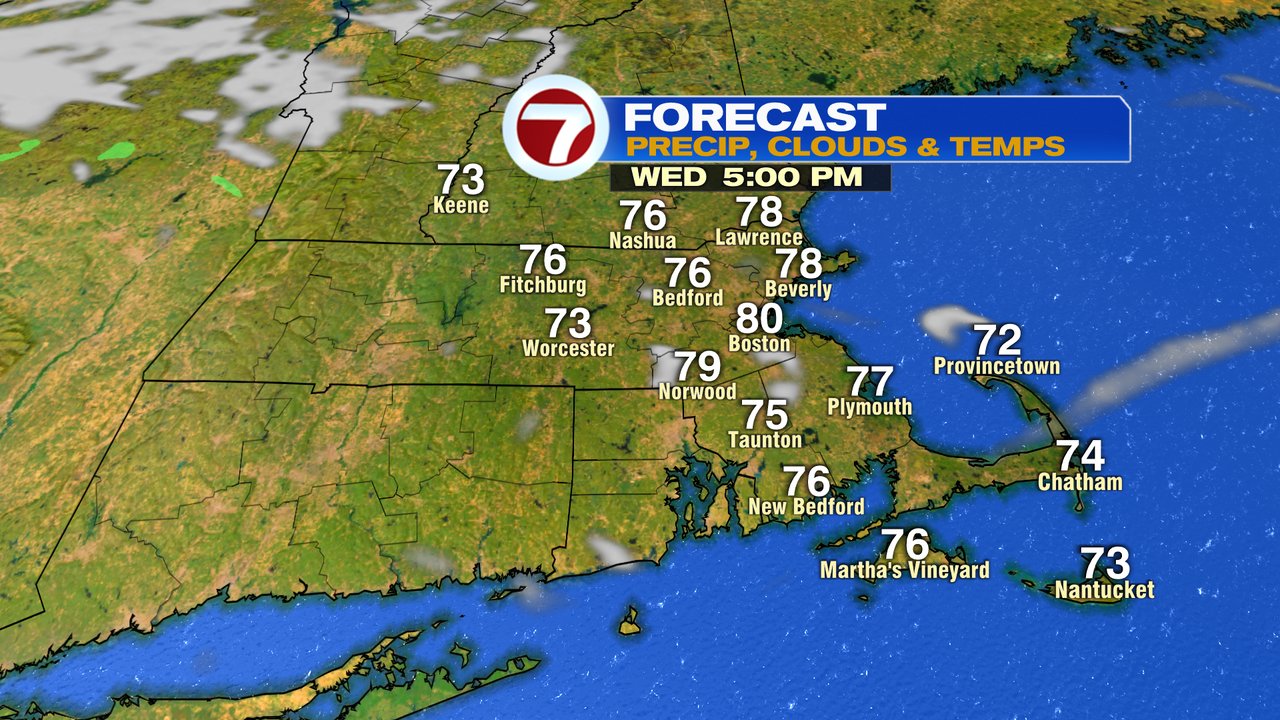
That wet weather and high humidity are long gone this morning as a refreshing breeze starts the day. Northwest winds are helping drop the humidity and provide for a cooler start to the day vs. what we had yesterday morning. Despite it being a bit cooler this morning, it will be a warm afternoon with highs in the mid 70s to lower 80s. The breeze is strongest this morning, gusting 20-30mph and comes down a bit, to 15-20mph this afternoon.

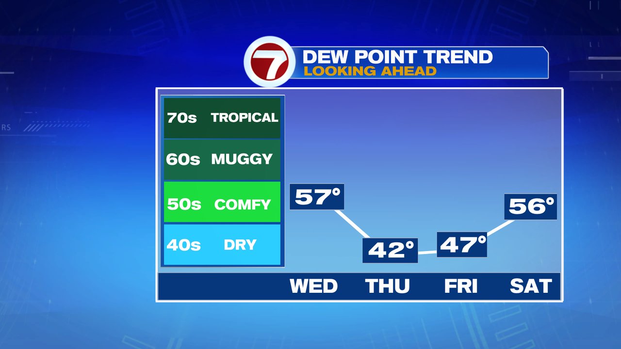
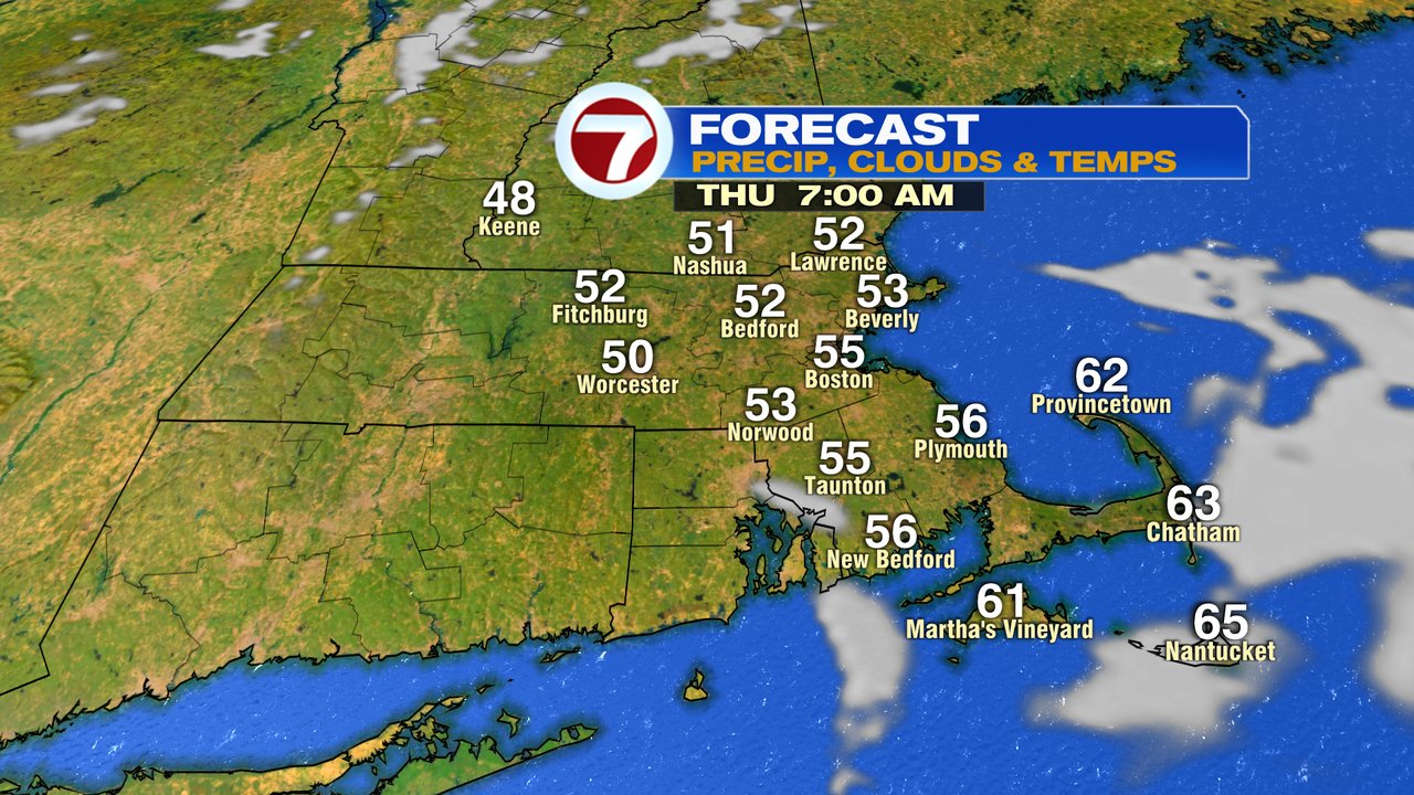
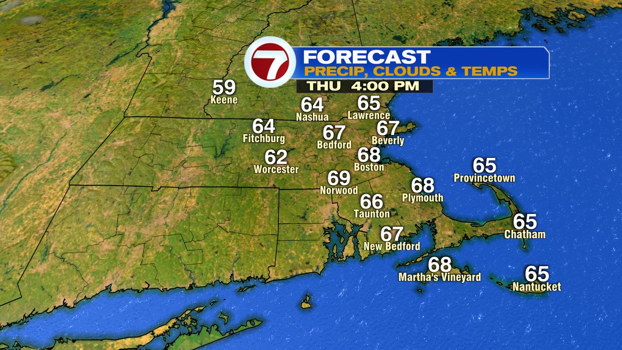
Another cold front slips through late overnight tonight, however, it’ll be starved of moisture. With that in mind, don’t expect any rainfall from that front as it pushes through, but do expect cooler temps behind it. Around sunrise tomorrow, temps fade back into the low to mid 50s and only recover into the mid 60s to near 70 in the afternoon despite abundant sunshine. Additionally, with really low humidity and a busy breeze, that crisp airmass will certainly give a Fall-like feel to the air. The set-up for tomorrow night is also really cool, with temps in the 40s fairly widespread by Friday morning.
Friday’s temps run in the low 70s, rebound into the mid 70s Saturday and then near 80 Sunday. Later Sunday into Monday, there will be a cold front nearby that could possibly trigger a few showers and somewhat cooler weather to start next week.