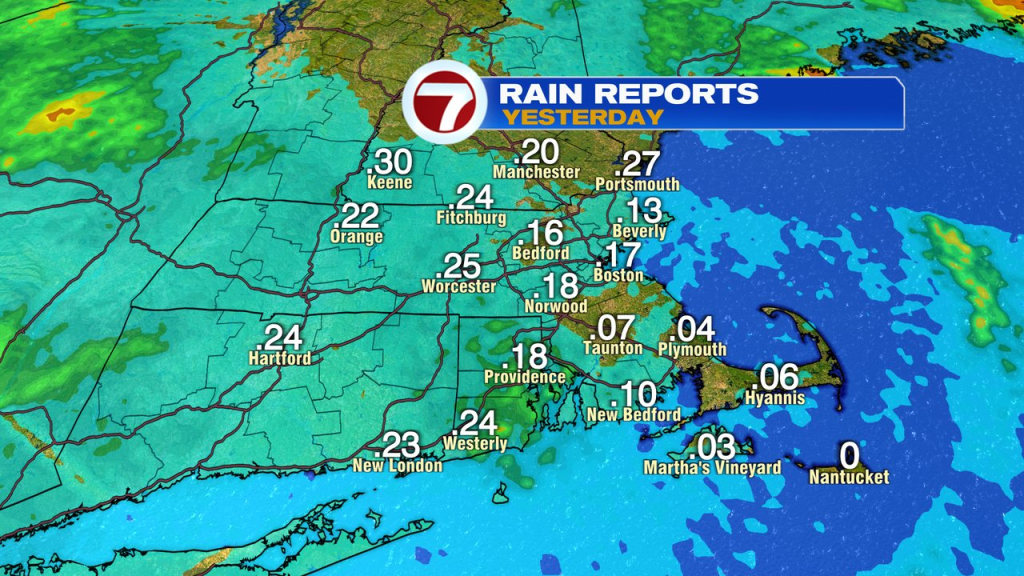
While it wasn’t a big storm, most areas did pick up wet weather yesterday, generally running between a tenth and a quarter inch of rain. That wet weather is now east of us this morning and early morning clouds will break for partly to mostly sunny skies.
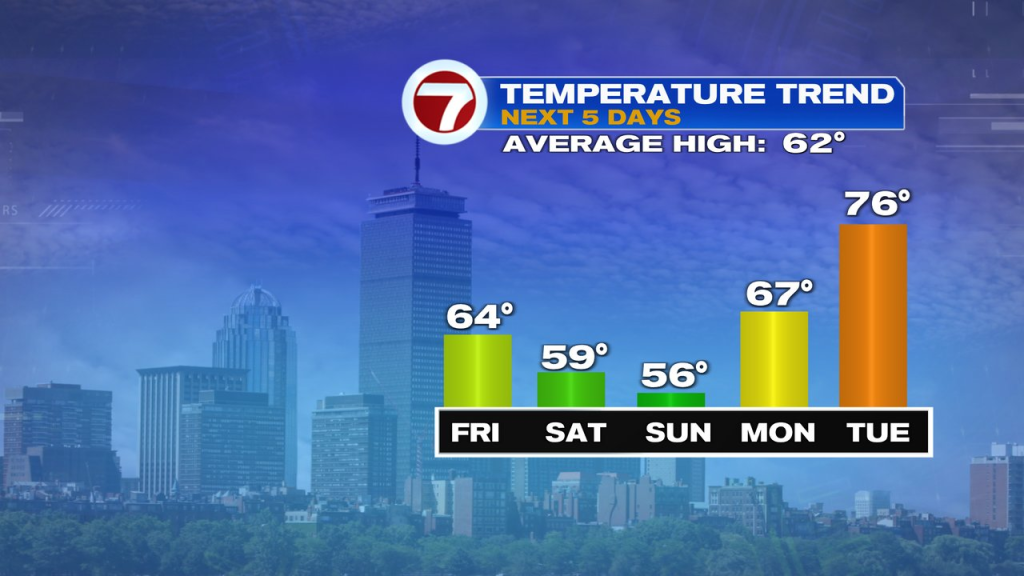
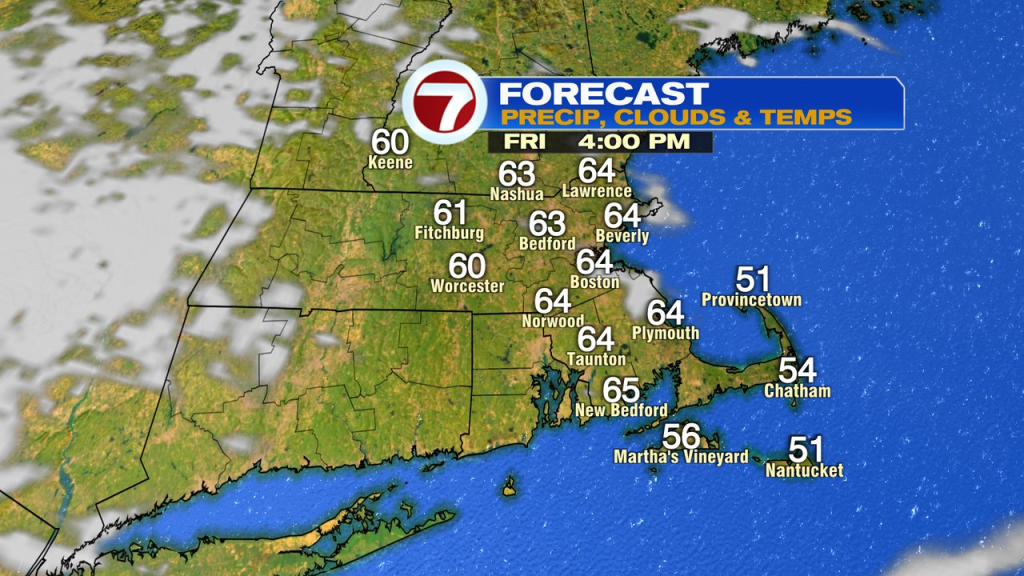
While a bit of a gusty breeze develops out of the west to northwest, it won’t be too strong, but strong enough that no sea breeze kicks in today. That means even near the coast, temps run near or above 60. Overall, a great start to the month of May and close to seasonable levels.
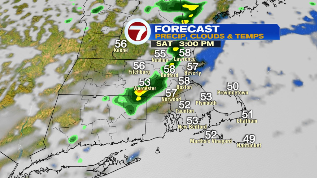
The weekend is not a washout, but we’ll track some wet weather. The first disturbance creates the chance for scattered showers tomorrow. In between the showers, breaks of sun will push temps toward 60 in the afternoon. Showers are hit or miss, so while some spots pick up 0.25″ or so of rain, other towns and cities stay dry.
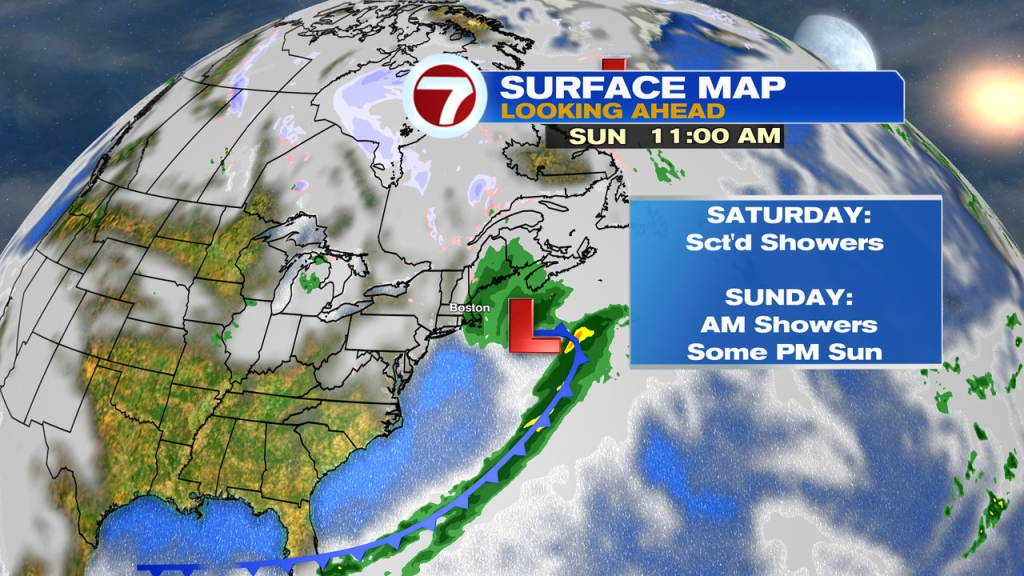
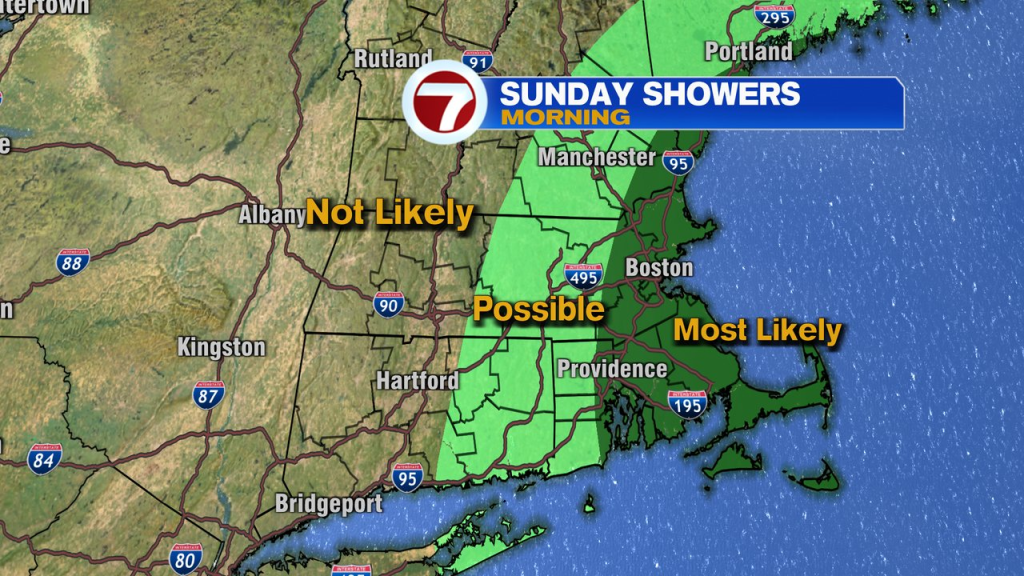
The other system to track is a developing wave of low pressure to our south Saturday night into Sunday morning. It’ll likely throw back a period of rain into Southern New England, with the highest risk of steadiest rain Sunday morning and highest totals, across Southeast Mass. Overall, the farther west you go, the lower chance for rain and the faster it’ll taper off. Even near the coast, the rain tapers off by midday with some breaks of sun in the afternoon.
Early next week we warm up with temps in the 60s Monday and well into the 70s on Tuesday.