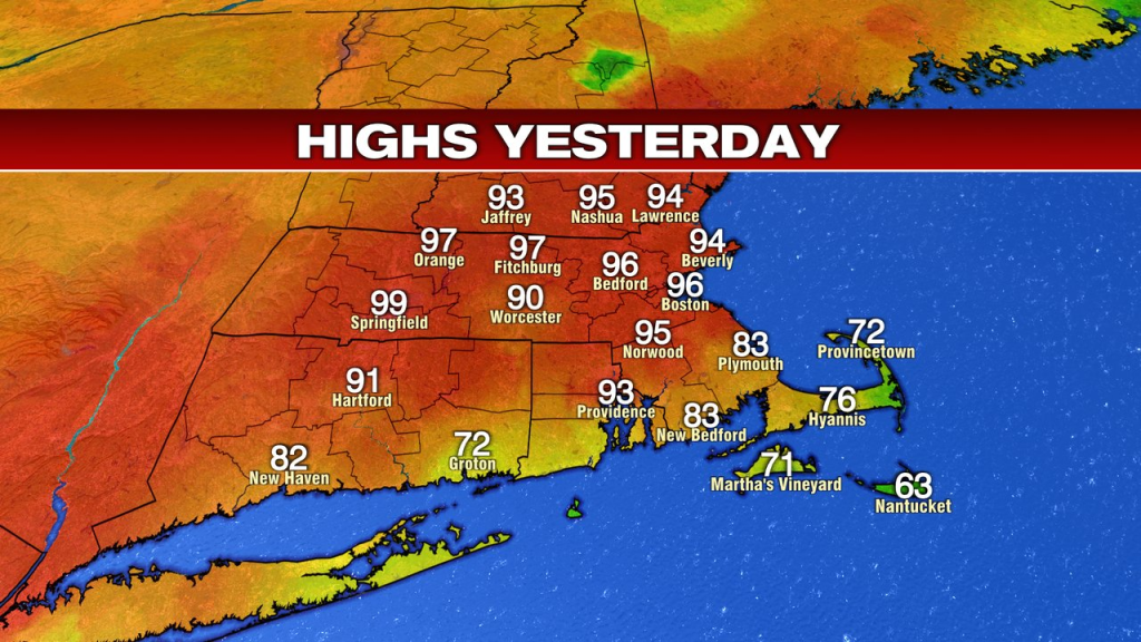
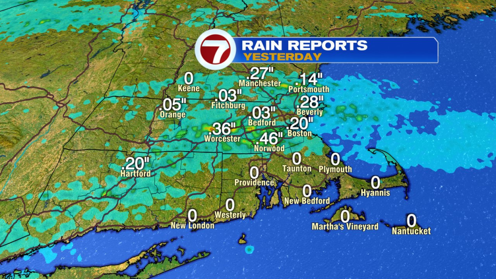
High heat smashed daily records yesterday and challenge all-time monthly May record highs across New England. The 96 in Boston fell just shy of the monthly record of 97, set on May 26th, 1880. We ended the day with storms too, dropping a quick 0.25-0.50″ as well as pockets of damaging wind gusts.
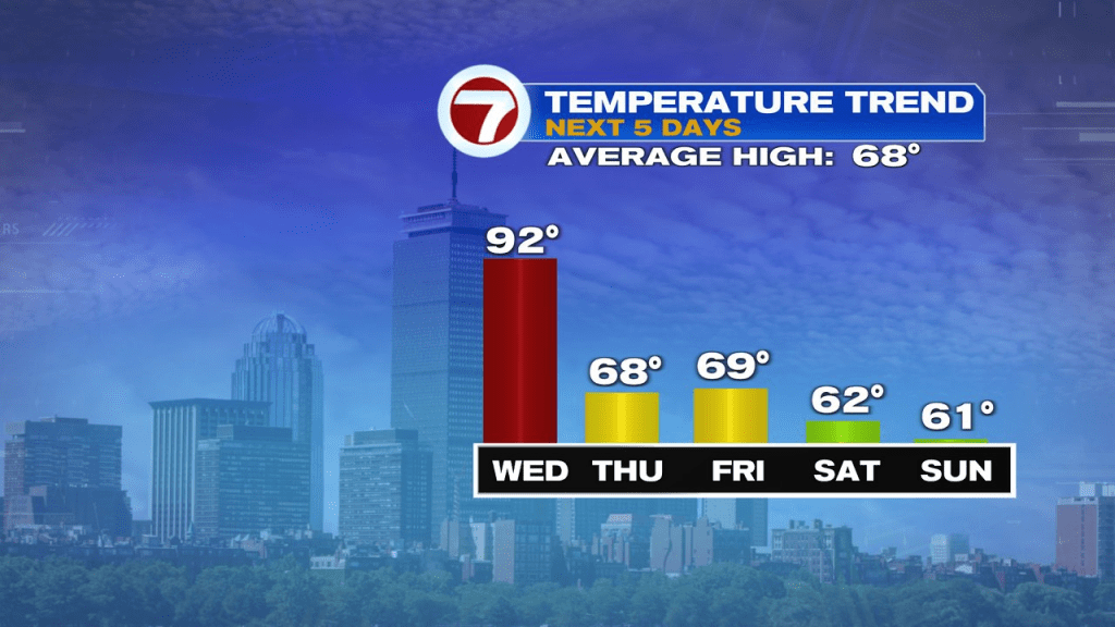
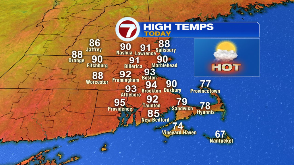
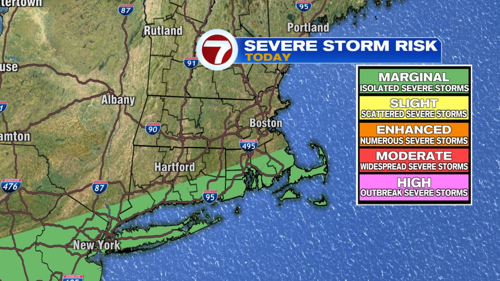
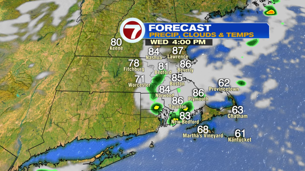
Today, we’ll run it back into the low to mid 90s with a few more scattered storms to fire up. The highest risk for a strong mid to late afternoon storm favors Southeast Mass today. Temps get trimmed back mid to late afternoon as the front slips through with those isolated to scattered showers/storms.
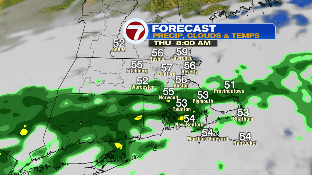
Cooler air slips in tonight, into tomorrow morning. We’ll track some showers too south of the Pike into early tomorrow morning. Some showers linger near the south coast through the morning, before drier air pushes in midday/afternoon. It’ll be a much cooler day as highs max out in the 60s for most.
Friday looks great. Sunshine and crisp air in place.
The weekend weather will be cool. Highs run in the 60s Saturday and mid 50s to low 60s Sunday. Shower chances go up by Sunday as well.