Graduations, the Best Buddies bike ride, we’re getting so many questions about how bad Saturday will be. Well… I don’t bring good news. It looks pretty rough. A potent area of low pressure is going to drop south out of Canada and bring rain, wind and cold temperatures to New England. While a few showers may start as soon as Friday evening, the bulk of the rain will arrive overnight Friday and continue through most of Saturday. But it’s not just a rainy day. It’s a cold, wind-driven rain. Brutal!
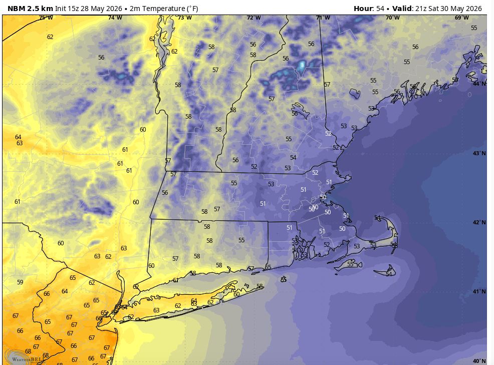
We’ll start with temperatures. Your phone high temperature may be deceiving on Saturday because high temperatures will likely be in the upper 50s, but that’ll be overnight as the rain first arrives and temperatures will progressively get colder through the morning. The snapshot below is more of an afternoon “high temperature” if you will. Yes, only about 50°. But that’s only half of the story.
AFTERNOON TEMPERATURES:
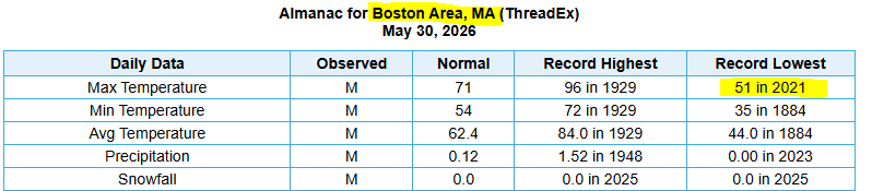
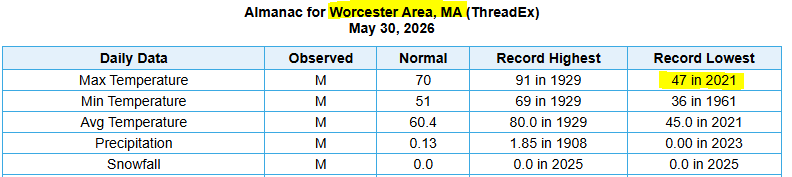
Because of those midnight highs we won’t set any records for the coldest high temperature for this date, but what you feel in the afternoon will be close to those record numbers. Both Boston and Worcester have record cold high temperatures that were set just five years ago in 2021. For Worcester, we didn’t even make it to 50°!
RECORD COLD HIGH TEMPERATURES:
Honestly, I wish this storm was two days later so I could complain about wind chills in June, but instead I have to complain about wind chills in late May. Yes, expect wind chills Saturday that will be stuck in the 40s for most of us in the afternoon.
MIDDAY WIND CHILLS:

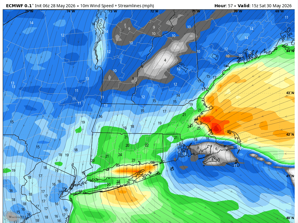
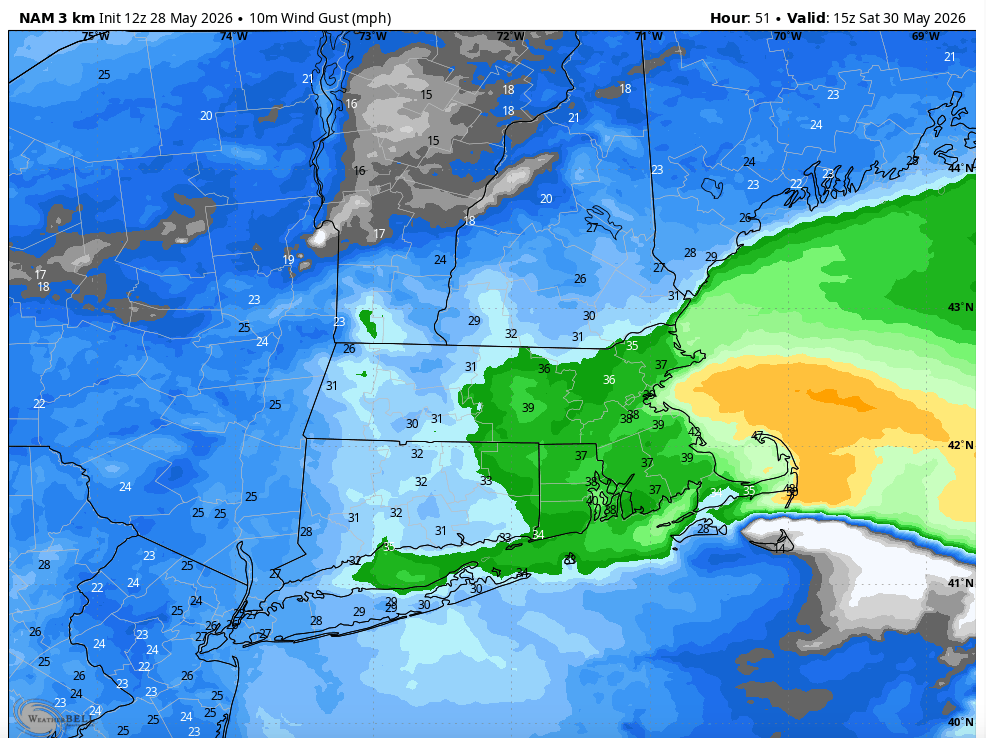
The wind chill of course is in part thanks to the cold temperatures and in part the wind. The wind will be howling on Saturday with sustained winds coming off of the water at 20-30 mph and gusts as high as 40 mph at times.
SUSTAINED WIND:
WIND GUSTS:
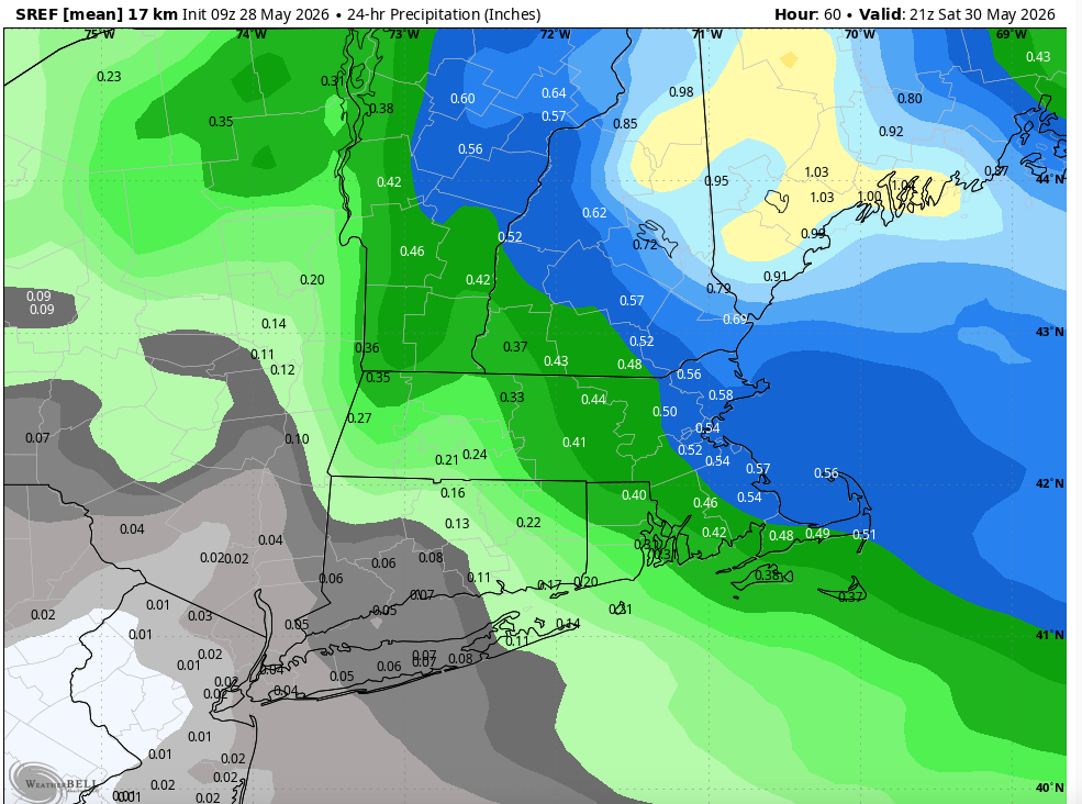
As far as rain, given what we’re dealing with for the overall weather, we don’t get a deluge of rain. We’re likely in line to pick up somewhere around 1/2″ of rain with the heaviest amounts in northeast Massachusetts and the more substantial rain across northern New England. Given that we’re dealing with such a crappy day, it would actually be nice to get a nice deluge of rain and put some water in the ground. It’s been pretty dry, especially across eastern Massachusetts. Central Massachusetts has managed a little bit better this year so far.
RAINFALL AMOUNTS:
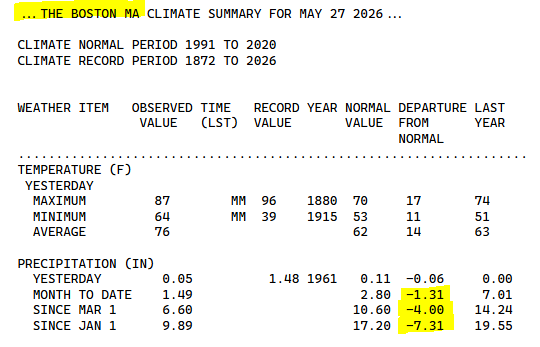
For Boston, we’re running 1.3″ below normal for May, 4″ below normal since March 1st, and over 7″ below normal for the year.
BOSTON PRECIPITATION DEFICIT
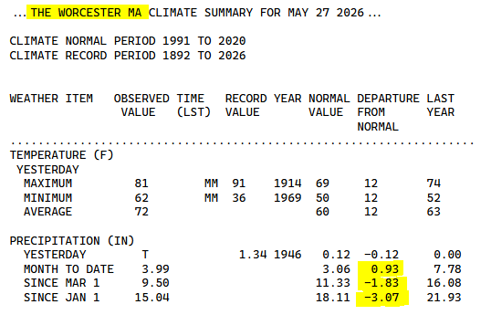
Worcester hasn’t been quite as dry. In fact for May, Worcester has actually seen a surplus of rain compared to average. Rain amounts are still below normal for both meteorological spring (since March 1st) and for the year.
WORCESTER PRECIPITATION DEFICIT