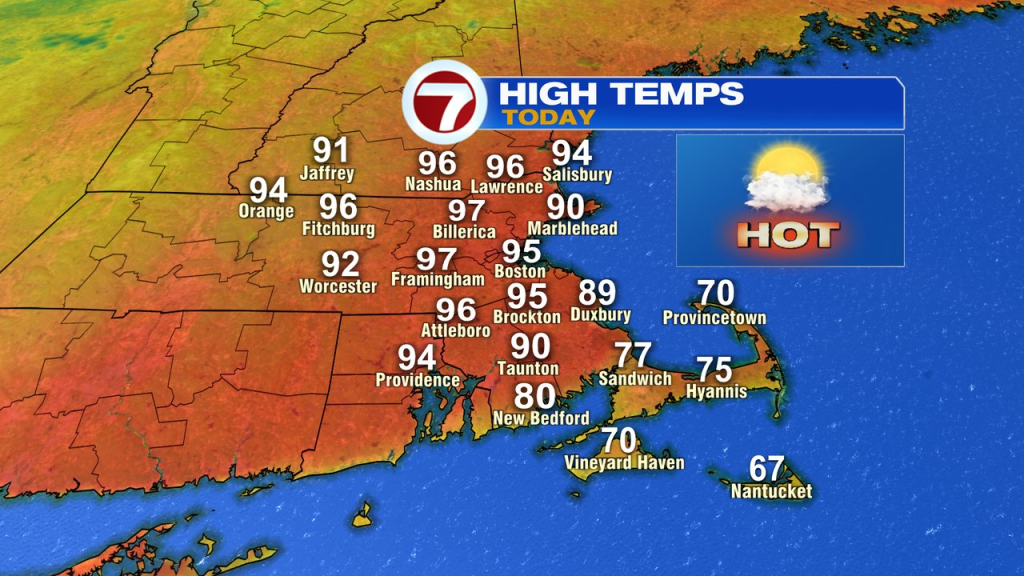
A heat advisory is up for the next couple of days as modest humidity and high heat will combine for a full on summer send. Temps peak today with highs running in the mid to upper 90s. Not only will we crush the record of 90 for the day (May 19th) in Boston, we’ll challenge some of the highest temps May can offer. The monthly record for May is 97 in Boston, set in 1880.


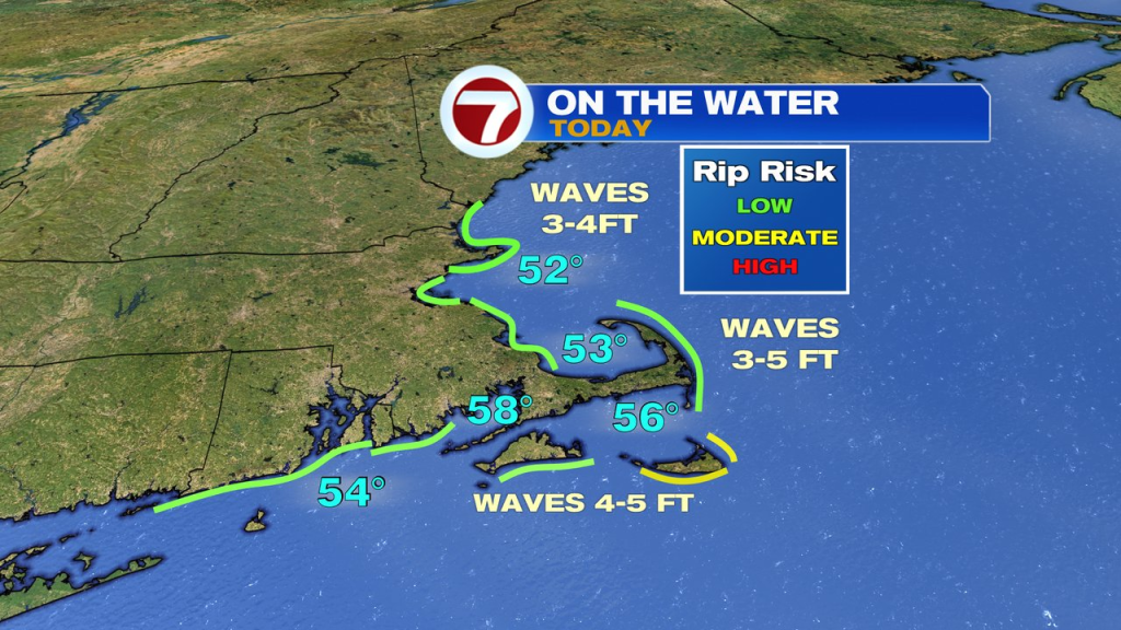
If you’re heading out to the beach, the sand, the sun and the air will be hot, however, that water is still chilly with temps in the 50s! It’ll be dry through mid afternoon, just keep an eye to the sky for some late-day storms. The timeframe for storms today runs in the 4-8pm timeframe. We’ll watch for localized downpours and gusty winds with the storms that do form.

It’ll be hot again tomorrow with highs in the mid 80s to mid 90s, warmest south of the Pike. As winds shift from southwest to west around midday, a few isolated storms get going north of the Pike. South of the Pike, across CT, RI and Southeast Mass, afternoon storms look to be more numerous than north. We’ll watch for strong wind gusts with the storms that do form.
Temps are much cooler behind the front by Thursday with highs back into the 60s.

We’ll stay on the cooler side through the Holiday weekend as the chance for rain comes back by Saturday night into Sunday.