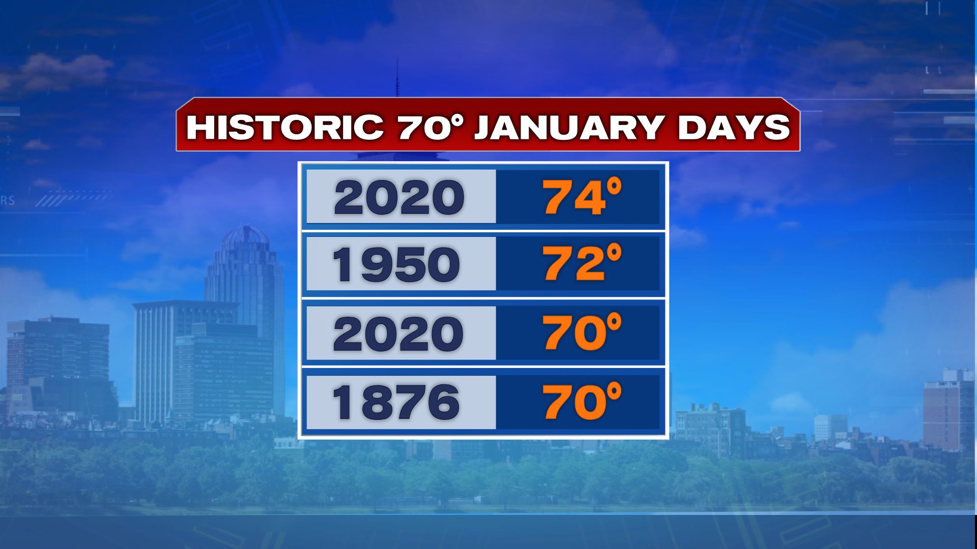
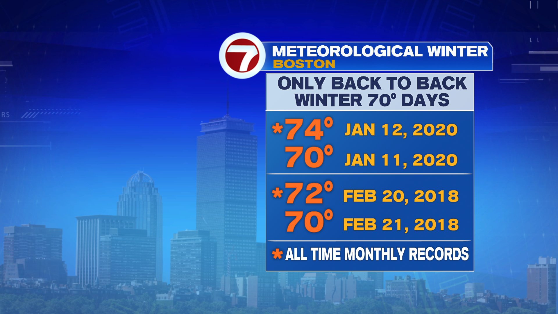
A record breaking weekend is now behind us as the temperature hit 70+ in back to back days. The 74 yesterday afternoon is now the warmest January day on record, and the only other time we’ve hit 70 in back to back days during meteorological winter (Dec-Feb) was just a couple years ago, when we did it in February.
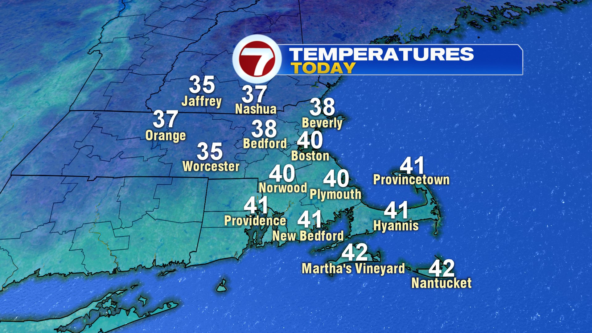
Today, we’re back to the reality of January as clouds prevail and temps hover in the 30s and lower 40s. While the clouds win out, the atmosphere is rather dry, so aside from a few flurries or a patch of drizzle, I don’t expect much precipitation.
Tomorrow starts with some sun, but clouds increase as we go through the afternoon. With the increased cloud cover, comes a few showers in the evening. With just enough cold air in place, some sleet pellets and snow flakes will likely be mixed in across the interior, mainly northwest of 495. Behind this system, we hit 50 with sunshine on Wednesday!

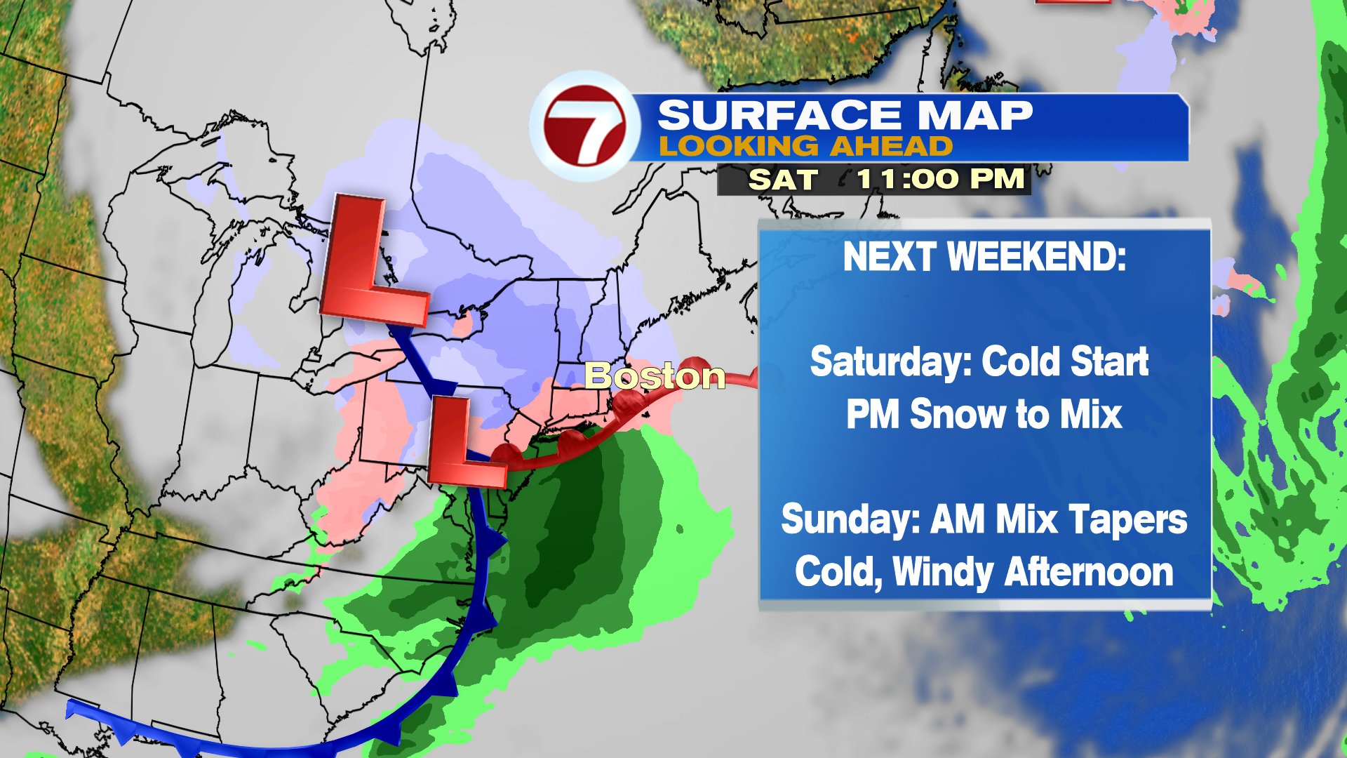
Cold air come barreling in Friday and holds firm Saturday morning. With a deep cold and dry air mass in place, as the next storm system approaches, the initial burst of precipitation will likely be snow Saturday late afternoon/night. That snow may be steady/heavy at the start, before any ice and rain mix in. That mix tapers off early Sunday, with a gusty wind and cold air prevailing Sunday afternoon. Quite the turnaround from this past weekend for sure! Too early for snow amounts, but it’s certainly worth watching and keeping updated on as we get closer to the weekend.