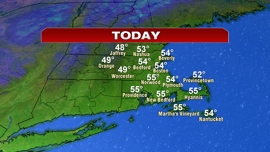
We kick off this Wednesday morning running 5-10 degrees cooler than yesterday morning, however, we also have a lot more sunshine in place and expect no rain this afternoon. In fact, mostly sunny skies prevail as seasonably cool air settles in with highs running in the low to mid 50s.
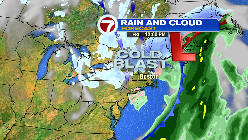
It’ll be another seasonable day tomorrow with increasing clouds and a few showers arriving in northern Worcester County, southern New Hampshire and the Merrimack Valley by 5pm. The rain will overspread the rest of the area through the evening with snow likely across Central and Northern New England.

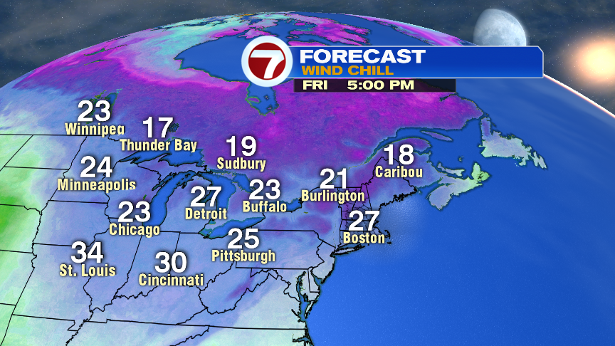
Although this storm is mainly rain for us, if enough moisture lingers past midnight, we’ll likely see some wet snow start to mix in for a couple of hours predawn Friday. It won’t accumulate much and won’t stick to the roads, but will be an indication of the cold blast of air that heading in to end the workweek. Temps Friday afternoon hold in the mid to upper 30s and with a gusty wind, will feel more like the 20s. Rain/snow is long gone by the morning commute, so weather shouldn’t be much of a travel issue on Friday. Saturday is cold before Sunday rebounds into the upper 40s.