

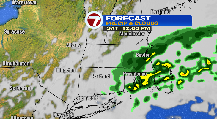
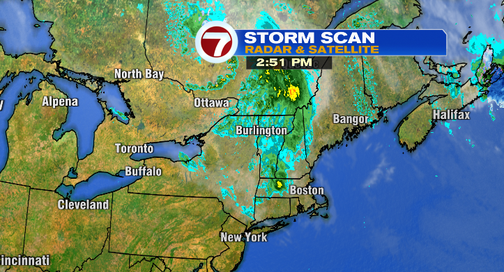
While today started out beautiful and has largely felt seasonable (remember, average high for this time of year is 70 degrees), you’ll notice the differences this afternoon and evening as the wind picks up and clouds become more widespread. This is all a precursor to our next storm, which arrives late tonight and will be most impactful Saturday morning and early afternoon.
We’ll start with a few light showers in the evening, and showers and some spotty, heavy rain tonight after sunset as this storm moves south into New England.
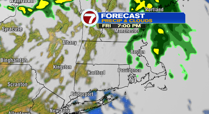
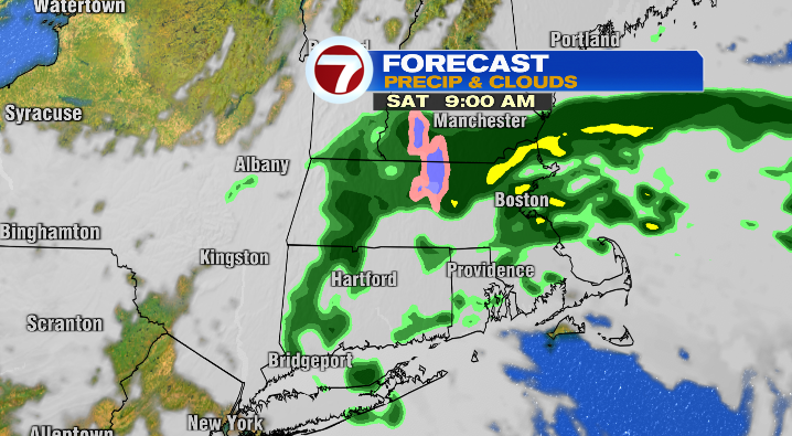
The early morning will be similar, with spottier precipitation. But as this storm continues south, we’ll see steadier and more widespread rain mid-morning to early afternoon.
The rain becomes much less widespread once we hit about 2 PM. While we may still have some mist & drizzle, the true showers will be moving through southeastern Massachusetts by that point.
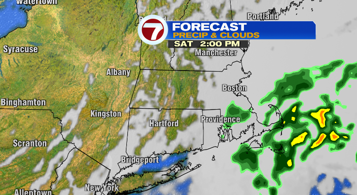
Rain continues to taper off, through the afternoon/early evening, and the clouds even start to break before sunset.
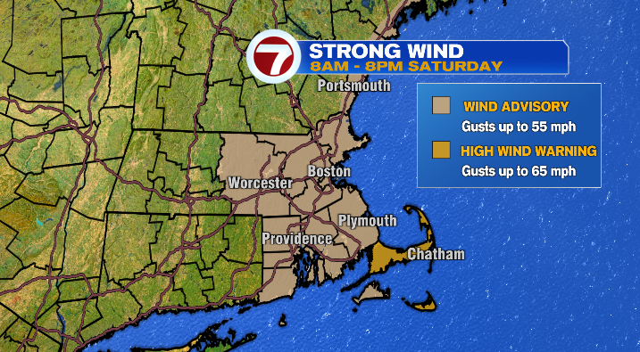
While the end of the day Saturday will be slightly more manageable as the rain tapers, unfortunately, it’s not just the rain we’ll be dealing with. It’ll also be a very windy day with widespread gusts exceeding 30mph. Gusts along the coast could be considerably stronger. For that reason, we have a Wind Advisory for most of the coastline for gusts up to 55mph, while the Cape & Nantucket have a High Wind Warning for gusts up to 65mph. With gusts this high, be mindful that a few power outages wouldn’t be a surprise.
On top of the rain and the wind, it’ll also be cold. Think mid-March. Temperatures will fall from the upper 50s just after midnight to the mid 40s by mid-morning. We’ll bounce between the mid to upper 40s and about 50 degrees in the afternoon.
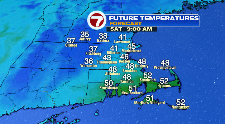
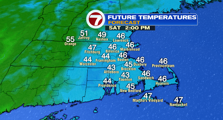
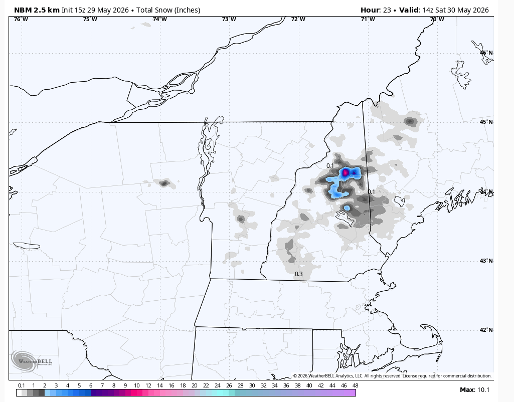
Higher elevations could even see temperatures in the 30s, and with that a few mushy snowflakes mixing with the rain are possible.
On that note, this storm will bring snow to parts of northern New England– particularly the White Mountains! It may be the end of May, but shoulder season in the Whites can be particularly fickle… as demonstrated by this storm!
Okay. Now that we’ve gone through the rough stuff, let’s talk about the bright side of this weekend forecast– Sunday looks much nicer than Saturday for those looking to spend time outdoors (not that the bar is set very high)! For starters, temperatures will be back to average, with highs in the upper 60s and low 70s. We’ll also start the day with sunshine, though clouds increase as we head into the evening. Most of the day stays totally dry, but we are keeping an eye out for a few evening showers ahead of our next storm, which will bring more clouds and showers for Monday.
With that, we’re also looking at another drop in temperature, though not as extreme as Saturday. Monday’s highs will be in the low to mid 60s.
While temperatures stay in the 60s through Wednesday, a completely dry day is tough to come by thanks to a pattern we refer to as an “omega block”. With low pressure west and east, and high pressure stuck in the middle, the pattern on a map resembles the Greek letter “omega”.
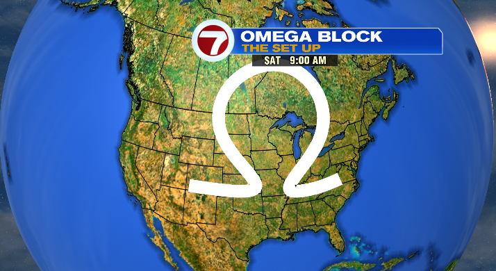
That pattern is actually starting to set up across the US as you read this, but because of its nature, the tendency is for it to create a meteorological log jam, with the same areas getting the same pattern of weather until that log jam can break up. For us, the pattern is showery and largely below-average, temperature wise.
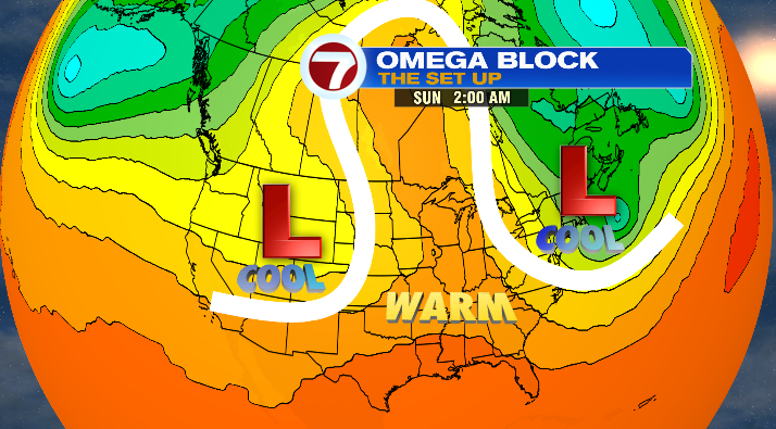
So, yes, Tuesday, we’ll keep a few showers around, and even a spotty shower on Wednesday as well. Right now, it looks like we’ll finally break out of this blockage by Thursday, at which point we’ll get into a warmer, sunnier stretch!!!