
What a weekend! What a day! We have more sunny days ahead this week thanks to a stagnant pattern. Last week, I spent several days explaining the reason for the day after day after day doldrum weather and it was basically a typical spring pattern. Last week we were under the influence of a slow moving Low Pressure system and this week it will be a slow moving High Pressure system! During spring, it’s common to find these High & Low pressure system moving slow. During the winter, these weather systems are still present but move faster due to a faster jet stream. In springtime, the winter jet stream begins to weaken (slow down) and retreat into Canada. The result is those weather systems move slow. Hence, a lot of sunshine this week!

Even tho we’ll have mostly sunny skies tomorrow, it will be cooler, especially along the coast. The reason is that cool front quietly moving through southern New England tonight (no rain). That front will drag down some cooler air from Canada which means reaching the 70s will be a tall order.
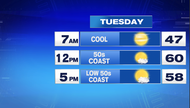

Despite the cooler temps, still a great spring day on tap! More sunshine for midweek with warmer temps set to return!

We’ll also be dry for several days with only Friday offering a slight chance of an afternoon shower/t-storm. The chance is so low that I’ve opted not to advertise it on our 7-day forecast. As of now, Mother’s Day looking very nice!
Ciao for now!
~JR