While it was a nice break from the mugginess and rain yesterday afternoon, some humidity and showers and storms do return today. That shower and thunderstorm threat increases late today and continues tonight. Highs run near 80 degrees as dew points jump into the mid 60s.
While a few brief pop-up showers are possible this morning, into the mid afternoon, the most widespread action holds off until after 4pm.

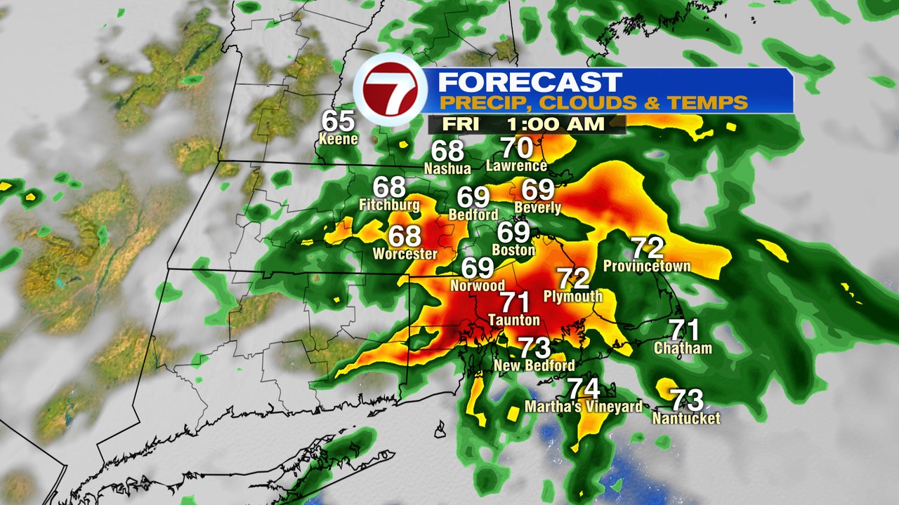
Showers and storms are widespread this evening and overnight tonight as a warm front approaches the area. The main risk for many locations will be localized downpours. Just south of the warm front, SE Mass, RI and CT, a few strong to severe storms are possible. Typically the atmosphere can be conducive to rotating storms just south of these warm fronts, so although the chance for a tornado is low, it’s not zero, so we’ll keep an eye on these storms in CT, RI and SE Mass.

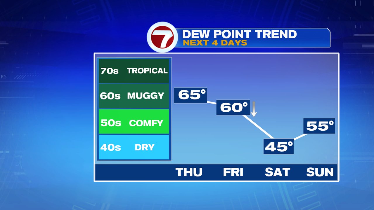
Behind the storms tonight, we’ll dry out early tomorrow. First goes the rain, then the humidity. Dew points drop tomorrow afternoon and crash by Saturday morning. We’ll have low humidity this weekend and a touch of September on Saturday morning with lows in the 40s in some of the cooler suburbs. Temps do recover to about 75 in the afternoon and near 80 Sunday. Sunday will see increasing clouds and the chance for some afternoon showers, especially late-day inland.