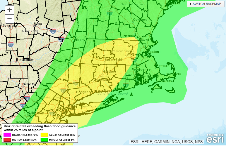
Out the door this morning you’ll most definitely notice the thick humidity that’s in place. That tropical humidity will lead to tropical downpours and a few thunderstorms on and off through the day today. The storms and downpours will favor areas north and west of Boston, but you’ll see a few south and east as well. You can see that risk highlighted here. This product is the risk of excessive rainfall (or risk of a flash flood) today from the National Weather Service. While the heavy rain is possible everywhere, it’s more likely and more persistent in the yellow contour from Nashua to New York City, including all of Worcester County.
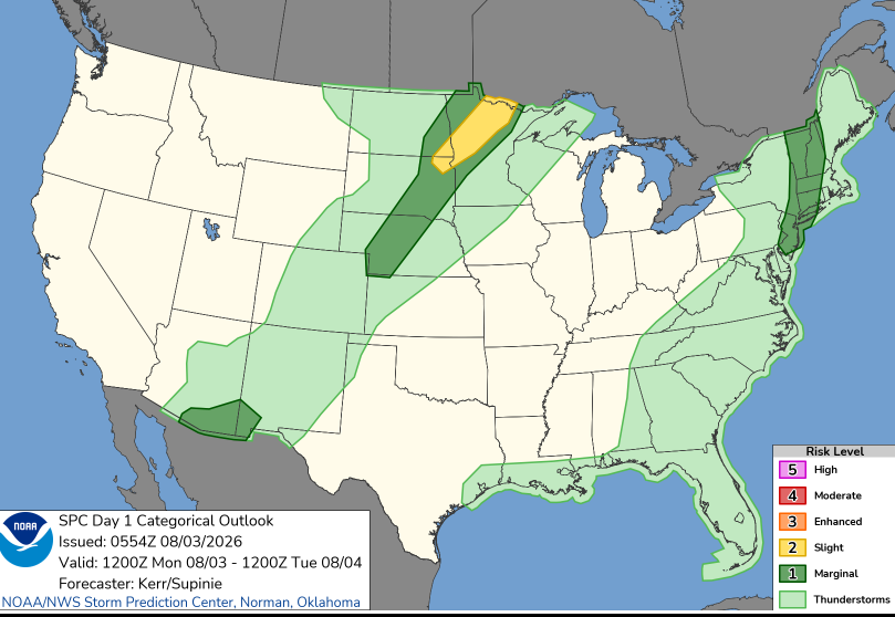
In some of the thunderstorms that develop, there’s a very low, but non zero risk that one of those storm could be on the stronger side. Again, this is not widespread severe weather, it’s more for the potential of a rogue strong/severe storm. If that would occur, the most likely threat would be damaging wind gusts. Much like the risk for heavy rain, this threat is also more likely west of Boston. The lighter green contour is a general risk of thunderstorms with the darker green a level 1 of 5 on the severe weather scale. So it’s about as low as it can be without being zero.
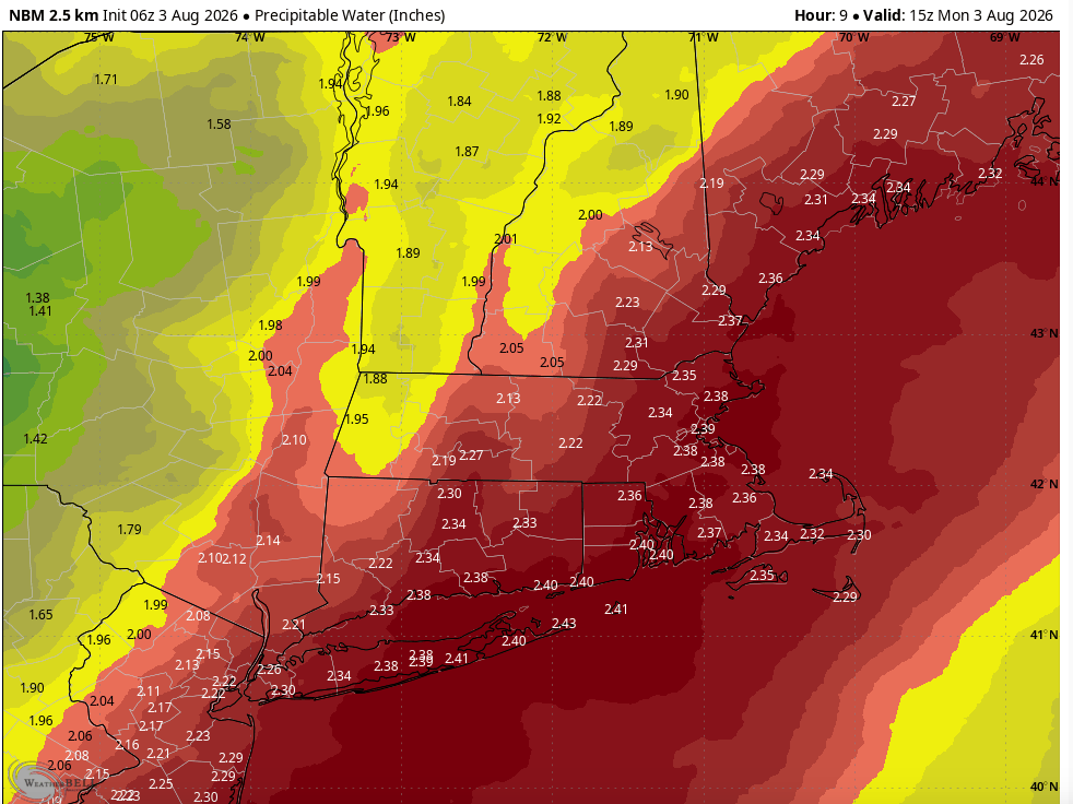
There’s a ton of water locked up in the atmosphere right now which is why the humidity is so high today, why we have the risk of tropical downpours, and why a rogue storm could even be strong. The humidity is one of many ingredients that aid in the development of stronger storms. This product is called “precipitable water”. What the precipitable water is, is the amount of water in a column of air over a given point at a given time.
In simpler terms, at a single snapshot in time today, if you took all of the water in the atmosphere above your head and removed it, you’d get over 2″ of water. That’s a lot of moisture!
This is the water you *see* when it rains, and the humidity is the water you *feel*. Dew points today are wicked high, well into the tropical category (70+), and they’ll stay here all day long today.
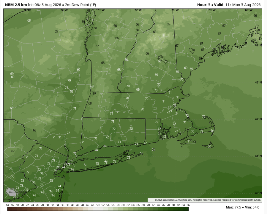
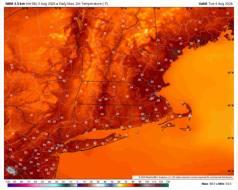
Temperatures aren’t overly warm today, we’ll probably stay in the 70s all afternoon, but it’s going to feel very soupy with that tropical air. We’ll see relief tomorrow.
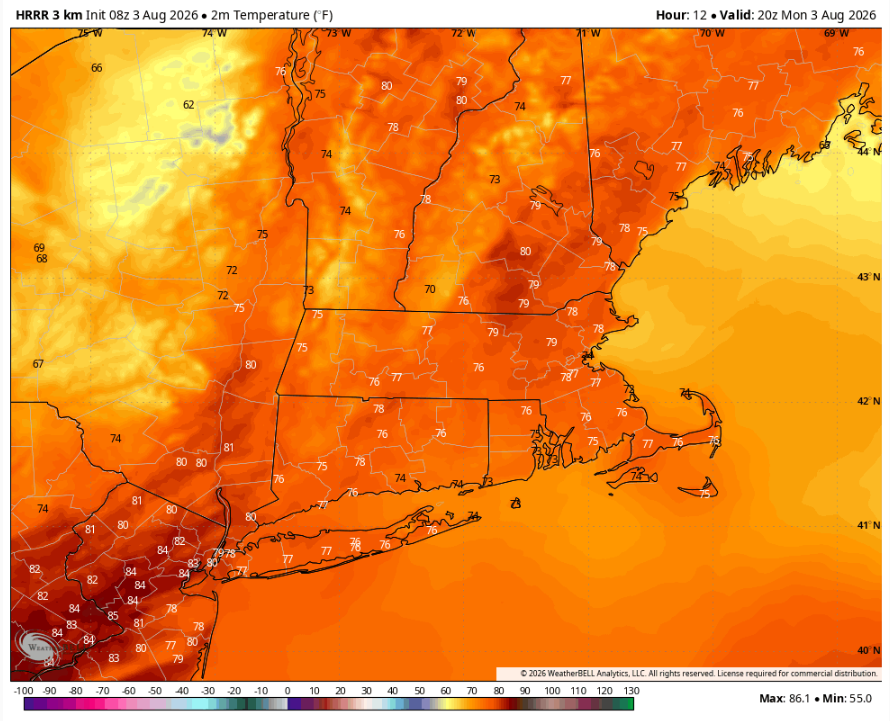
From the 70s today to the 60s tomorrow — the humidity will drop off tomorrow. Now it’s not a super dry air mass, but it’s definitely better than today. Dew points tomorrow afternoon will be closer to 60° than the 70s.
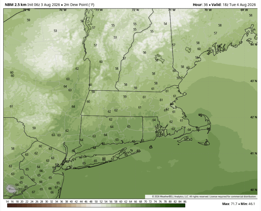
Drier air not only means less humidity, but as we bring in the drier air we’ll also bring in more sunshine. Tomorrow we’ll have less humid air, temperatures that return to the 80s and plenty of sunshine to fill the sky!