Snow, freezing and rain kicks off this abbreviated work week as an unsettled pattern holds on through tomorrow. Heading out the door this morning watch for some slick spots on untreated surfaces near and northwest of 495. Inside 495, it’s mainly wet roads that are the issue.
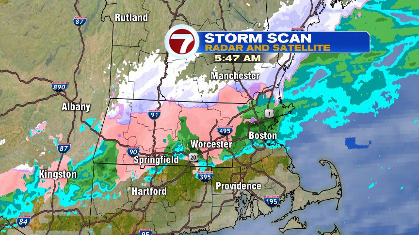
Showers taper off this afternoon as we catch a patch of dry weather from early afternoon to early evening.

Our break of dry air is brief as more rain and snow fill back in tonight. The rain and snow become steady by tomorrow morning with most of the accumulating snow north and west of Boston.


Even in the city though, we will likely end as some wet snow in the early afternoon with some slushy coatings possible in Boston and around eastern Mass. Near and just outside of 495, including Worcester, it’s 1-3″ of snow. Northern Worcester County and through much of southern and central New Hampshire picks up 3-5″ of snow with locally high totals in the higher terrain.
Near and just northwest of 495, there will likely be a big difference over a short distance of how much snow falls town to town, so stay tuned for updates to the snow map below.

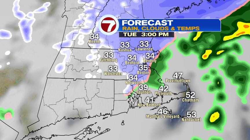
Wednesday looks quiet and cold with highs in the 30s before an Arctic front comes blasting in here Wednesday evening. There may be a few snow squalls to watch for with that front, but that action should be short lived. Behind the front, brutally cold air comes pouring air. Near record cold for this time of year.

For all those High School Football games… 9-10am wind chills run near or below 0. Brutal stuff! Stay warm.

@clamberton7 – twitter