

Editor’s Note: Today’s blog is written by 7Weather intern Owen Vetree ~JR
Hello, I hope everyone has had an enjoyable Tuesday. It was a fairly active day across; this activity is expected to continue for the next couple of days.
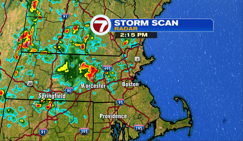
Above is the radar at 2:15 today. This time is roughly when the largest portion of our area was experiencing rain. You can see a fairly large cluster of storms and showers centered in Worcester County. Everywhere east of Boston has been dry throughout the day, while most, not all, spots west of the city have seen some of rain. A few isolated spots have already seen totals exceed two inches.
We will get a brief break tonight before a more widespread area of rain takes over the area.
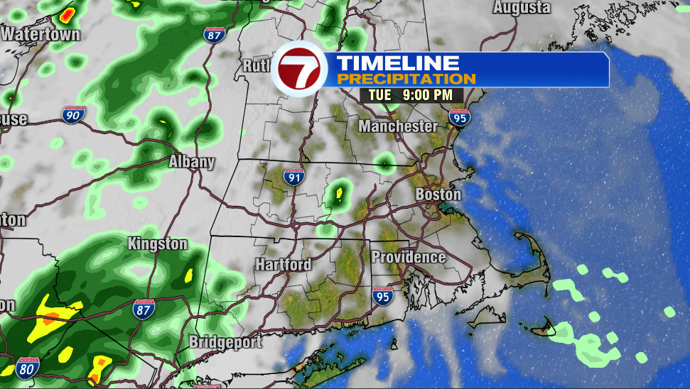
At 9pm there may be a few showers around but the vast majority of locations will be dry. The conditions will remain largely unchanged overnight.
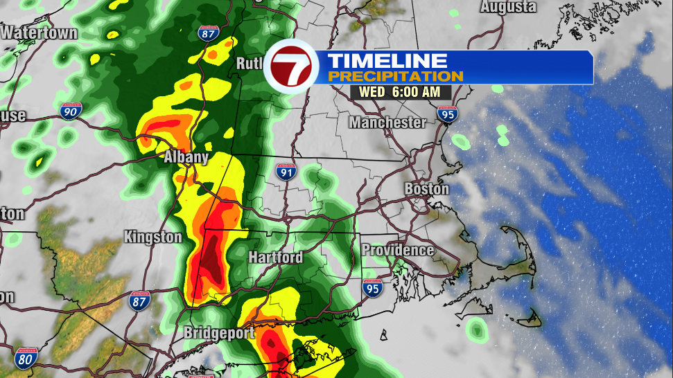
Here at 6am tomorrow we will be watching a narrow strip of very heavy rain approaching from the west. Flooding is likely at this time across eastern New York, western Massachusetts and Connecticut. This band of heavy rain is expected to progress eastward at a very slow clip late tonight and into tomorrow morning. This is what is producing a flood risk.
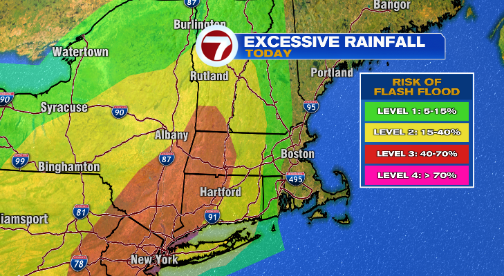
Overnight tonight the bulk of the flood risk stays away from our area, but is still possible.
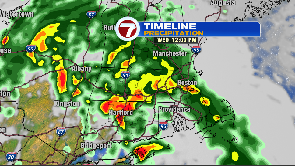
By noon, rain is expected to spread across the entirety of southern New England. It is expected to begin around 8 or 9 Wednesday morning in Worcester and approximately three hours later for Boston around 11am.
The rain will continue into the night and last into Thursday as well. It appears that we may not be fully done with the rain until Thursday. However, you can expect the intensity of the rain to fall off as it goes on. The heaviest rain will be Wednesday.
As the rain overspreads our area, the bullseye for the flooding shifts with it.
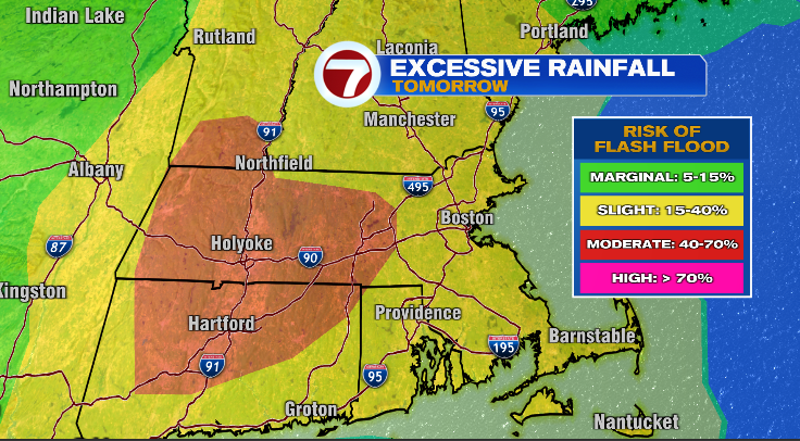
There is a noticeable flood risk outside of I-495, for tomorrow. It is not just isolated to this place though, as flooding is in the cards across nearly all of New England with the only exception being northern Maine.
Generally, about 2 to 4 inches of rainfall are expected with the highest amounts being west. Some locations could see isolated amounts of 6+ inches, between now and the end of the day Thursday.
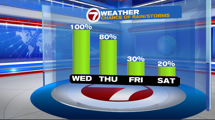
Once we get through all this rain, Friday through the weekend looks solid with highs in the 80s and slight rain chances.
Stay dry.
- Owen