That’s more like it! Classic early October weather returned over the weekend with a sparkling Saturday as temps ran up into the 60s to near 70. While more clouds rolled in Sunday and a few spotty afternoon showers dropped across Southeast Mass, overall, it was still much better than the hand we were dealt last weekend. Nice to get in a lot of those kids sports or tee times.
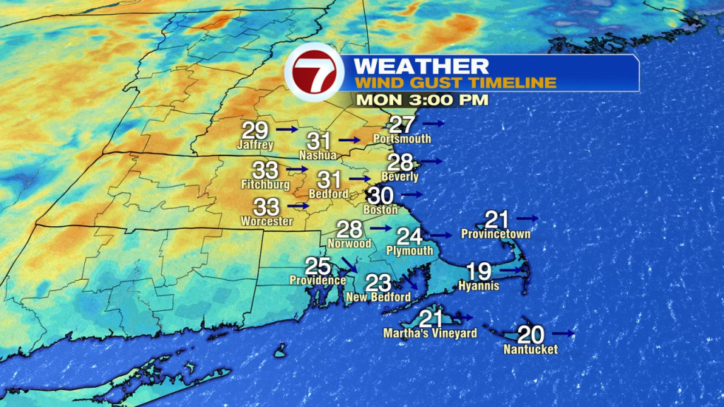
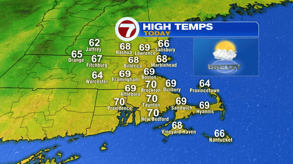
The pattern ahead overall is a dry one with limited rain chances this week. A cold front sweeps through this afternoon without much fanfare as moisture is very limited. Aside from a spot sprinkle or very brief, isolated shower across the interior, it’s a dry day. Temps rebound to the mid 60s to 70. The one thing the front will produce, that’s widespread, is a gusty breeze. Winds out of the west push 25-35mph this afternoon.
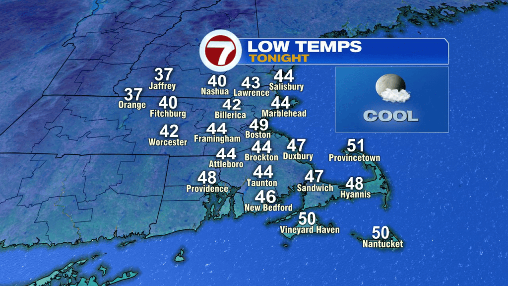
The west to northwest wind ushers in chillier air tonight with lows back into the 40s.
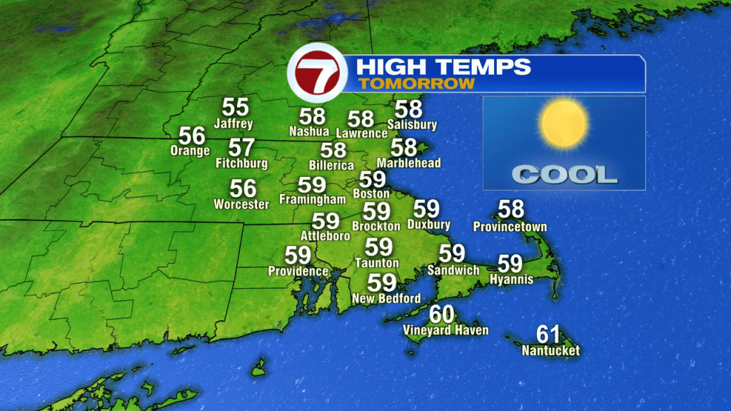
Despite the abundant sunshine tomorrow, highs only reach the upper 50s to 60. With a diminishing wind and clear skies, temps tumble tomorrow night. Mid to upper 30s will be widespread in the typically chilly spots with some patchy frost possible early Wednesday morning.
By Wednesday afternoon, we’re back into the mid to upper 60s.
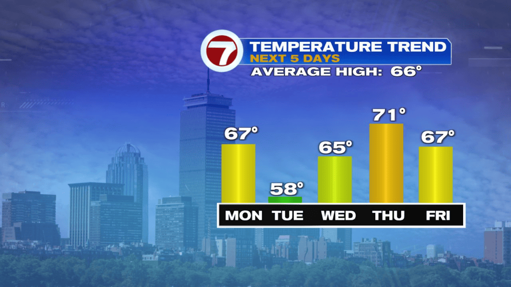
Low 70s return Thursday.
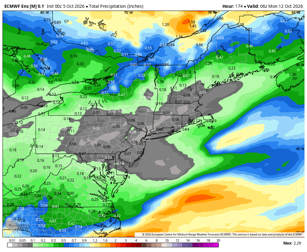
Next weekend looks seasonable and mainly dry Saturday and Sunday. Next chance of showers rolls in sometime around Columbus Day, and even that is just a possibility and not a lock. below is a look at accumulated rain totals through Sunday… pretty paltry for sure!