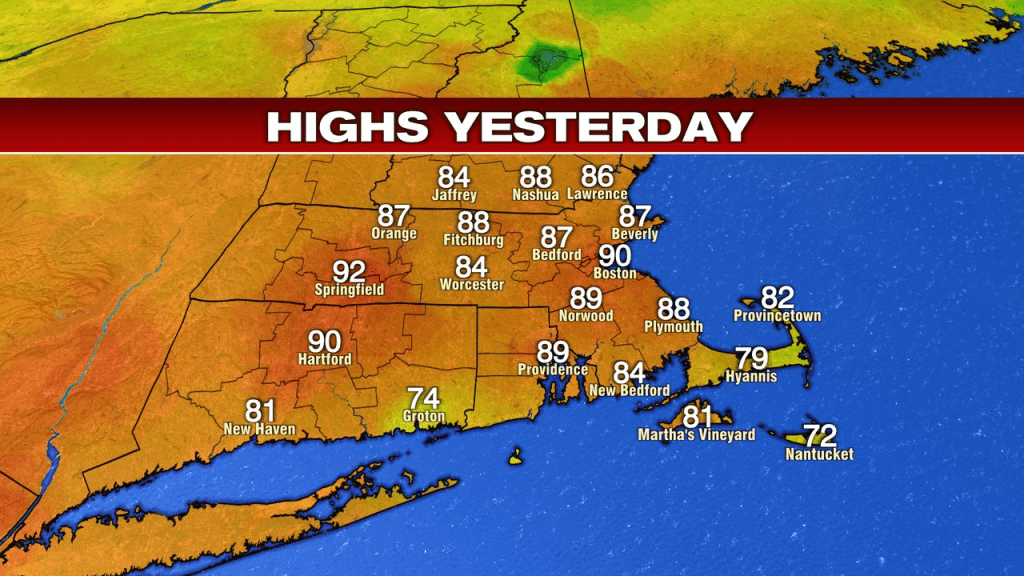
What a summery weekend we had for ourselves. Highs ran 75-80 Saturday and 85-90 on Sunday. While it was hot yesterday with the first 90 of the season in Boston, it was a dry heat as dew points dropped into the upper 40s and a breeze helped it feel comfortable outside.
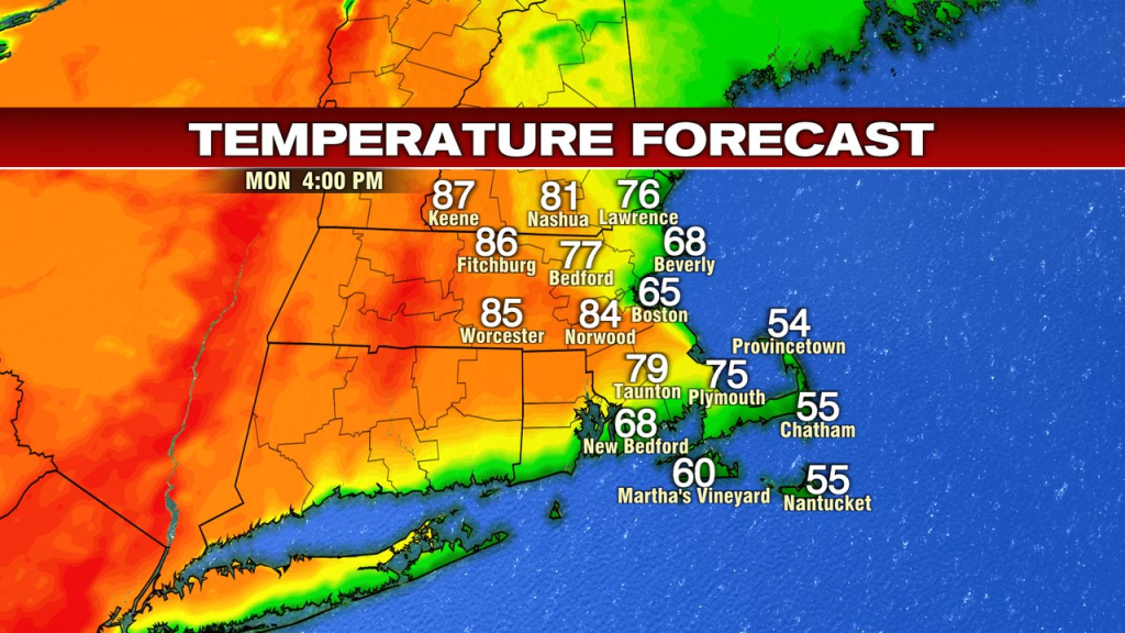
Today, the temps take a bit of a step back inland and a giant step back at the coast. Temps run 60s to near 70 near the coast and push mid 70s to mid 80s inland. Warmest temps will be near and west to southwest of 495. The map below shows the general idea. We’ll stay dry from start to finish.
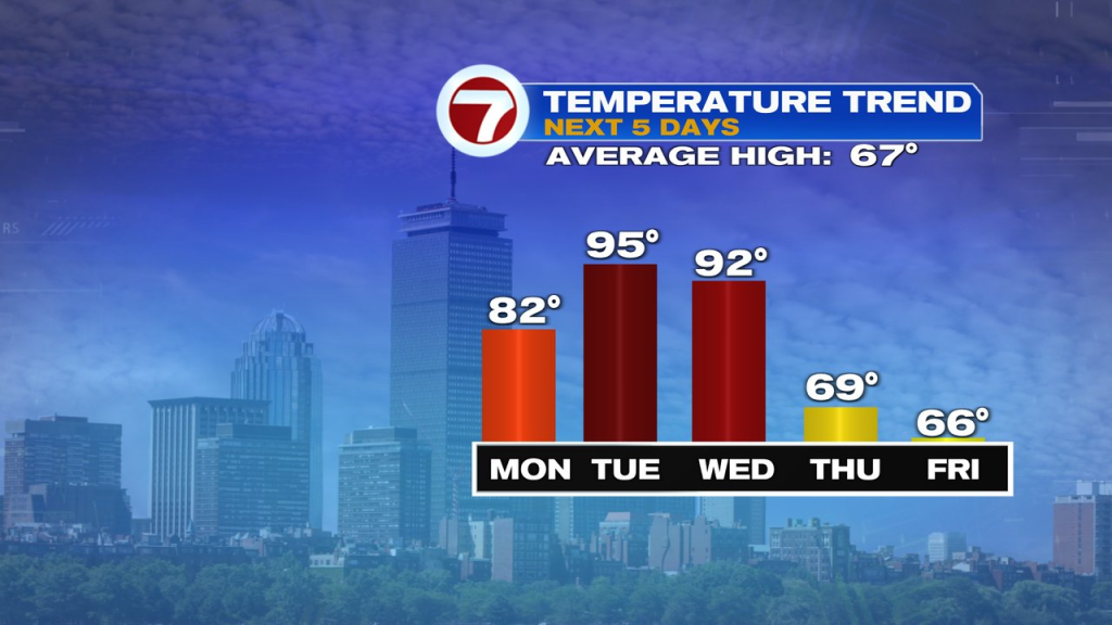
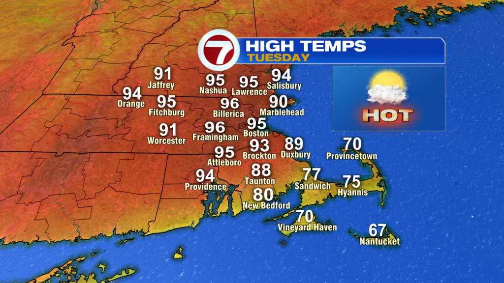
Winds kick back to the southwest tomorrow and the high heat builds in. Temps soar into the low to mid 90s, cruising by the record of 90 in Boston. While a few late afternoon storms rumble through, much of the day is dry. Dew points jump into the mid 60s too, so it’ll also feel humid to go along with the hot.
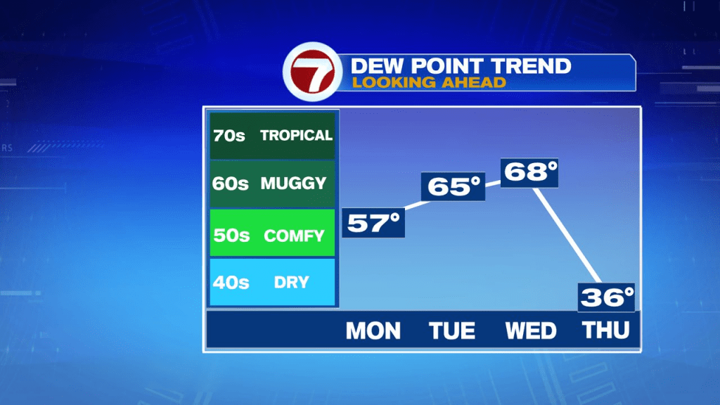

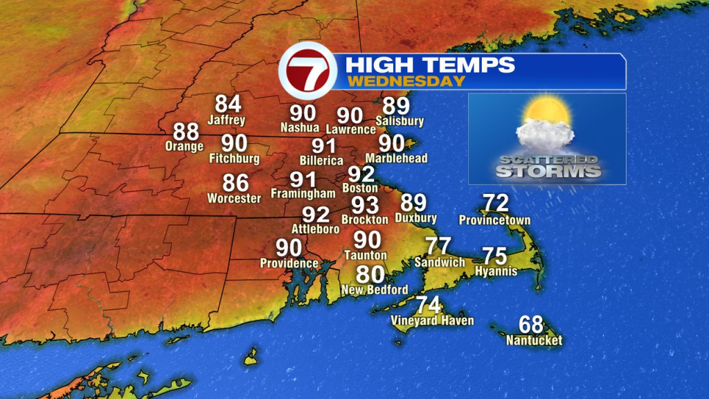
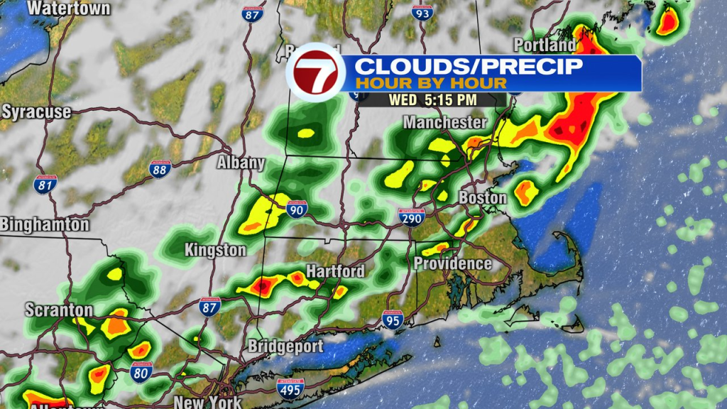
It’s another hot and humid day Wednesday as highs head for the low 90s again. Storms run through mid to late afternoon, putting an end to that high heat. Storms Wednesday afternoon will be earlier than Tuesday’s, and more widespread. We’ll watch for a few of these storms to be locally strong/severe with damaging wind gusts.
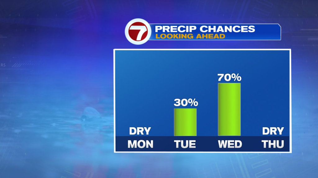
It’ll turn much cooler behind the front with a nice air mass in place Thursday. The cooler air lingers into the weekend, although rain chances start to go up by then too.