What a day we had for ourselves yesterday as sunshine, light winds and temps in the lower to mid 50s won out. Unfortunately, it wasn’t a pattern we could extend for a few days… at least not yet.
Overnight, temps slipped back into the 20s for most, refreezing the snowmelt many of us had. Clouds thicken this morning, and we await another winter’s mess that’ll be heading on in. A winter weather advisory is up from Boston to Providence, points north and west from 5pm today until noon tomorrow.
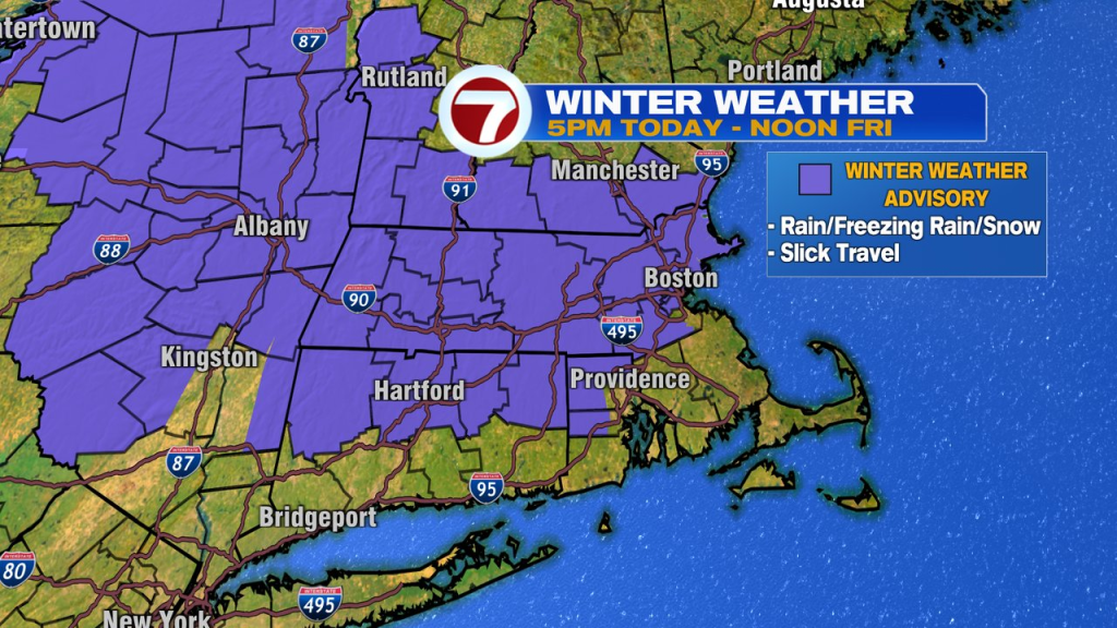
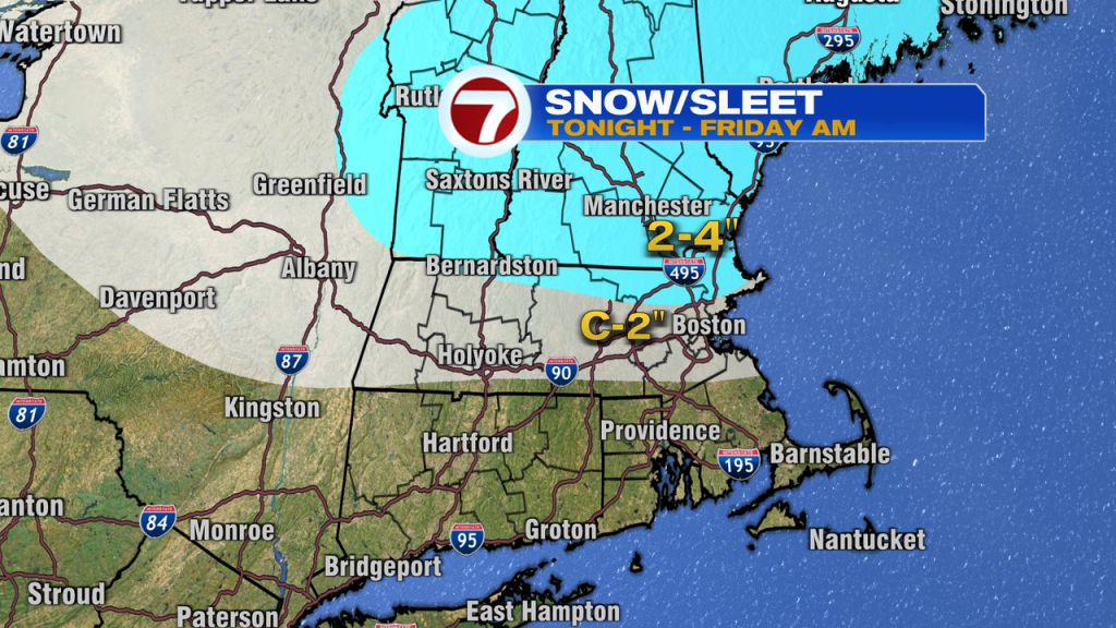
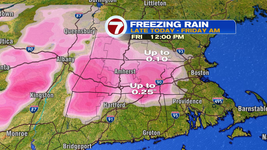
Light rain and freezing rain break out late today with precipitation becoming steadier tonight. As it becomes steadier, colder air drains in, changing the freezing rain to sleet and snow across northern Mass and the rain to an icy mix across the interior near and south of the Mass Pike. Even in Boston, some snow/sleet will mix in tonight. Across Southeast Mass, it’s mainly rain, and about an inch of it. Expect slick travel to develop this evening and continue into tomorrow morning, especially northwest of Boston.
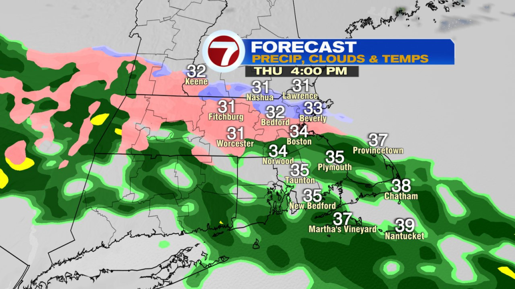
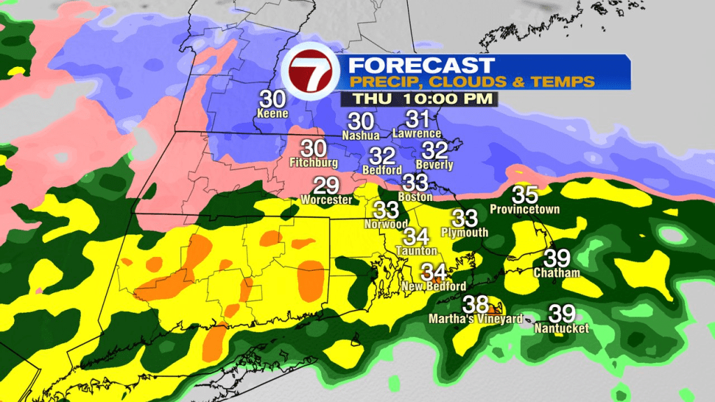
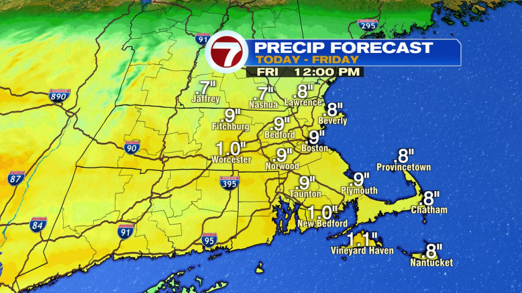
Snow/sleet totals run 2-4″ across northern MA and NH with lower amounts near the Pike. Freezing rain will push toward 0.25″ accretion in southern Worcester County.
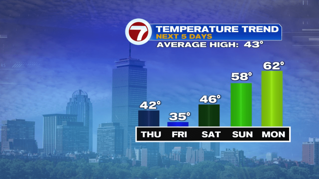
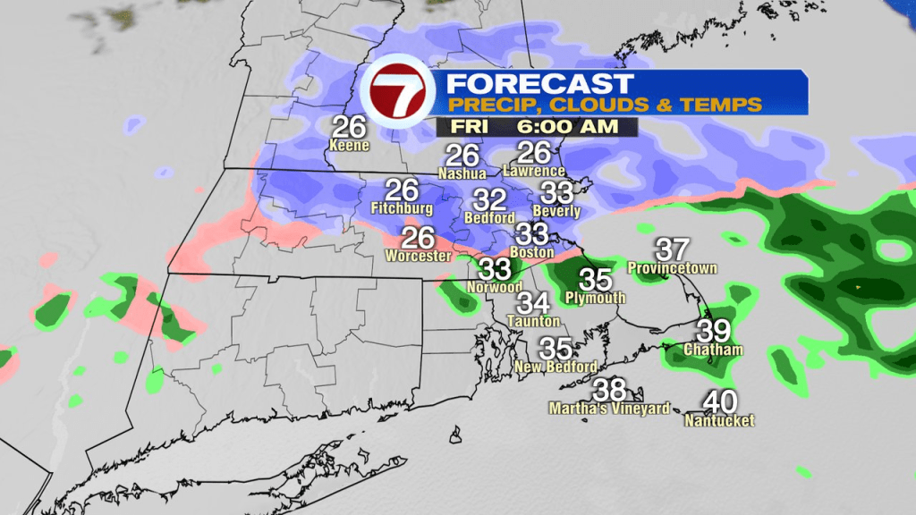
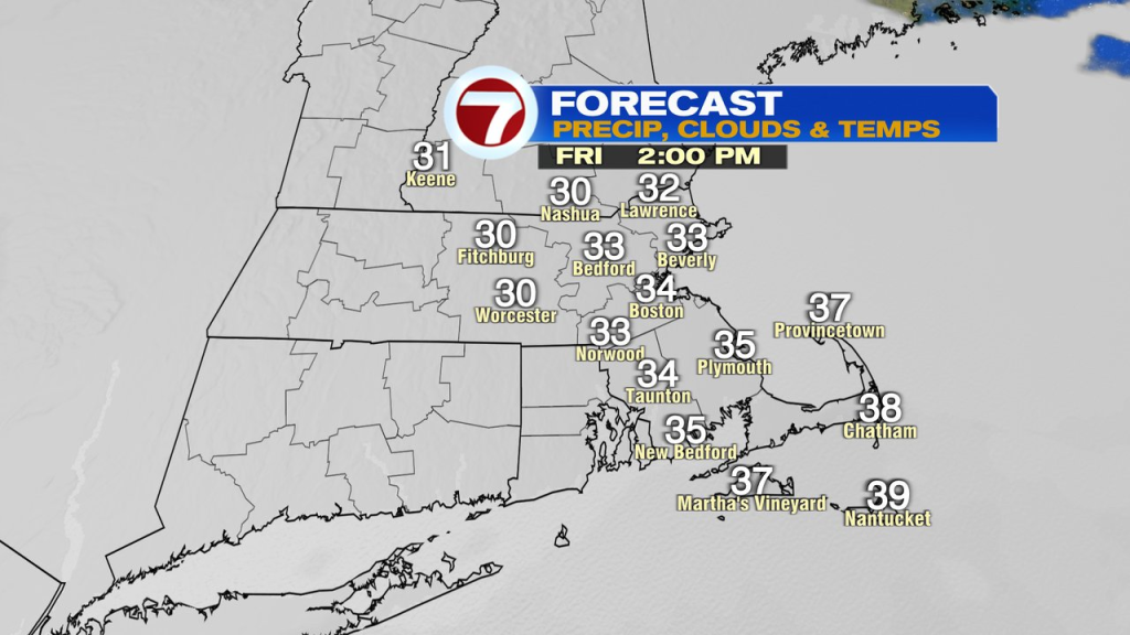
Slick conditions with some snow, ice and rain linger into tomorrow morning, tapering off by midday. It’ll be a cool and raw afternoon with temps stuck in the low to mid 30s.
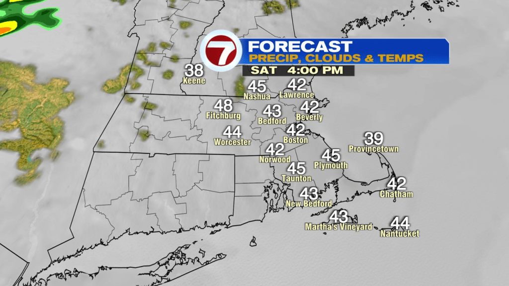
Saturday is mostly cloudy with temps in the 40s. A front comes through with a few showers Saturday night, then on the other side of it, we’ll be milder and a bit brighter on Sunday with highs well into the 50s.
Full on meltdown mode kicks in Monday – Wednesday as temps head near 60 Monday and push well into the 60s Tuesday and Wednesday. By the time we wake up next Thursday, much of the snowpack in place now, will be gone. That’s aside from where there are big piles now, and some leftovers in heavily shaded spots.