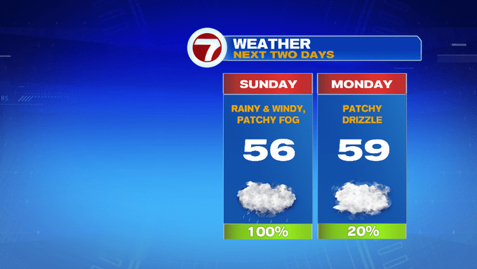
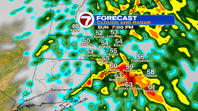
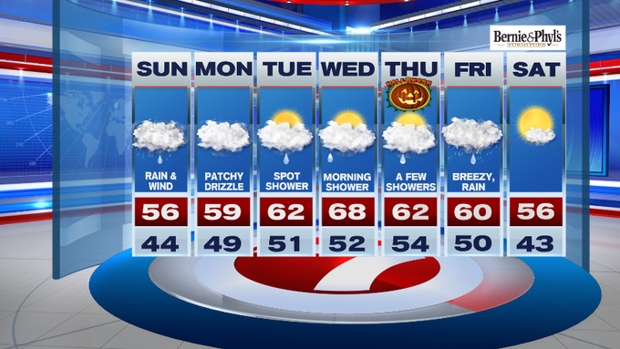
The system that brought a soaking rain to college football games yesterday in the Midwest is continuing to work it’s way into southern New England. This will bring rain, with embedded downpours through the rest of our Sunday, along with gusty winds.
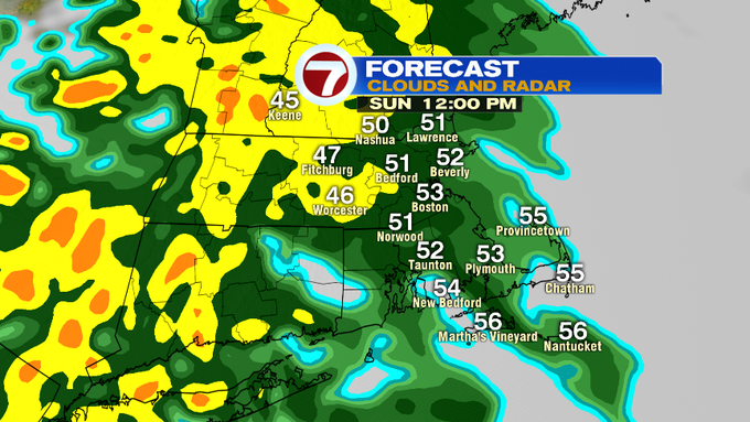
The heaviest rain likely between 3pm – 7pm. As the rain exits the area later tonight, rainfall totals could be between an inch to an inch and half with the higher rainfall totals likely along the South Coast and SE MA.
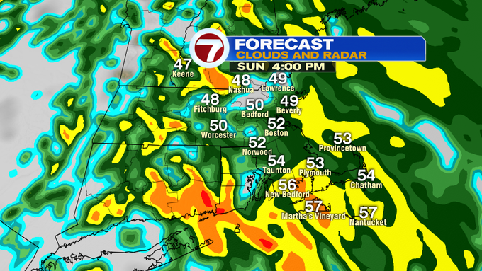
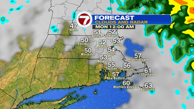
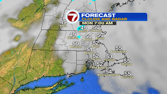
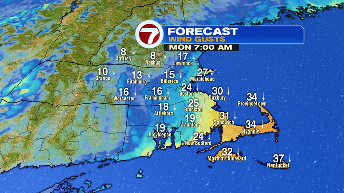
The rain clears out by 11pm tonight, but it will still be windy into early Monday morning.
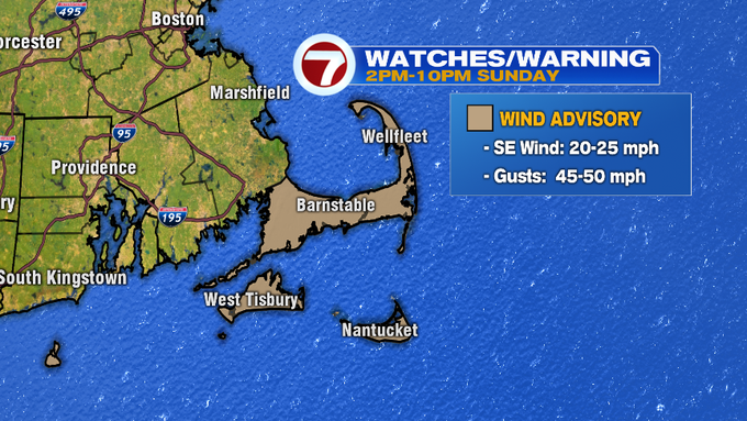
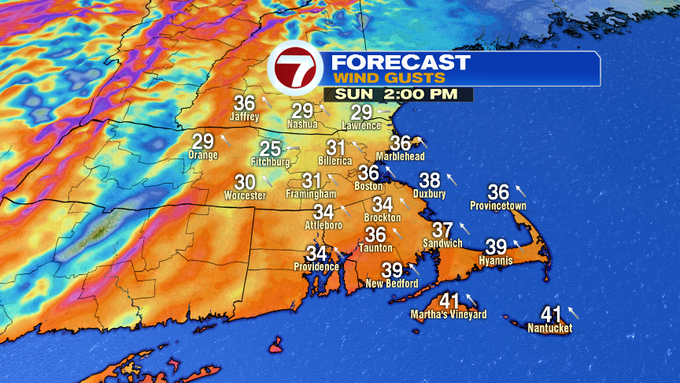
A Wind Advisory has been issued from 2pm to 10pm for the Cape and the Islands where gusts could reach up to 50 MPH. Inland, gusts are expected to top out between 25 to 35 mph this afternoon.
The clouds stick around for Monday. With an onshore flow, the coast will likely see some patchy drizzle at times, otherwise drier conditions will prevail inland with highs into the 50s.
Tuesday features a spot shower, with highs reaching into the low 60s under mainly cloudy skies. The warm-up continues into Wednesday with highs into the mid to upper 60s, with some morning showers likely.
Halloween highs are still in the low 60s, with a chance for a few showers…it does not look like a complete washout at this point for trick-or-treaters.
However, Friday looks to be a washout, with breezy conditions and steady rain. Highs for the first day of November will be near 60.
With such a cloudy and damp work week, there is light at the end of the [7-day] tunnel…next Saturday brings the return of sunshine and seasonable high temperatures…a nice way to kick off the first weekend of November.
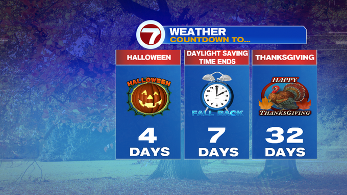
Also, don’t forget, next weekend we “fall back” one hour for Daylight Saving Time into early Sunday morning. Just a heads up!